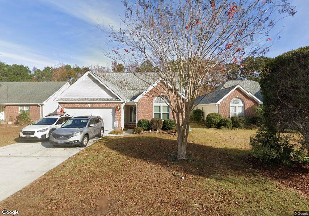
5122 Long Pointe Rd Wilmington, NC 28409
Estimated Value: $386,000 - $396,000
3
Beds
2
Baths
1,586
Sq Ft
$246/Sq Ft
Est. Value
About This Home
This home is located at 5122 Long Pointe Rd, Wilmington, NC 28409 and is currently estimated at $390,667, approximately $246 per square foot. 5122 Long Pointe Rd is a home located in New Hanover County with nearby schools including Pine Valley Elementary School, Myrtle Grove Middle School, and Eugene Ashley High School.
Ownership History
Date
Name
Owned For
Owner Type
Purchase Details
Closed on
Oct 13, 2016
Sold by
Moran Ruth M and Moran Daniel J
Bought by
Moran Daniel J and Moran Ruth M
Current Estimated Value
Home Financials for this Owner
Home Financials are based on the most recent Mortgage that was taken out on this home.
Original Mortgage
$150,000
Outstanding Balance
$120,253
Interest Rate
3.46%
Mortgage Type
New Conventional
Estimated Equity
$270,414
Purchase Details
Closed on
Dec 15, 1998
Sold by
Baker Precythe Development Co
Bought by
Moran Ruth M
Purchase Details
Closed on
May 22, 1998
Sold by
B & D Development Corp
Bought by
Baker Precythe Development Co
Create a Home Valuation Report for This Property
The Home Valuation Report is an in-depth analysis detailing your home's value as well as a comparison with similar homes in the area
Home Values in the Area
Average Home Value in this Area
Purchase History
| Date | Buyer | Sale Price | Title Company |
|---|---|---|---|
| Moran Daniel J | -- | Ravenswood Title Company Llc | |
| Moran Ruth M | $137,000 | -- | |
| Baker Precythe Development Co | -- | -- |
Source: Public Records
Mortgage History
| Date | Status | Borrower | Loan Amount |
|---|---|---|---|
| Open | Moran Daniel J | $150,000 |
Source: Public Records
Tax History
| Year | Tax Paid | Tax Assessment Tax Assessment Total Assessment is a certain percentage of the fair market value that is determined by local assessors to be the total taxable value of land and additions on the property. | Land | Improvement |
|---|---|---|---|---|
| 2025 | $1,620 | $408,500 | $108,900 | $299,600 |
| 2023 | $1,335 | $242,500 | $59,900 | $182,600 |
| 2022 | $1,347 | $242,500 | $59,900 | $182,600 |
| 2021 | $1,340 | $242,500 | $59,900 | $182,600 |
| 2020 | $1,157 | $182,900 | $44,000 | $138,900 |
| 2019 | $1,157 | $182,900 | $44,000 | $138,900 |
| 2018 | $1,157 | $182,900 | $44,000 | $138,900 |
| 2017 | $1,184 | $182,900 | $44,000 | $138,900 |
| 2016 | $1,147 | $165,500 | $44,000 | $121,500 |
| 2015 | $1,066 | $165,500 | $44,000 | $121,500 |
| 2014 | $1,048 | $165,500 | $44,000 | $121,500 |
Source: Public Records
Map
Nearby Homes
- 5235 Crosswinds Dr
- 5117 Chalice Ln
- 4641 Masonboro Loop Rd
- 134 Cherokee Trail
- 110 Cherokee Trail
- 4953 Coronado Dr
- 4511 Masonboro Loop Rd
- 273 Foxwood Ln
- 4921 Crosswinds Dr
- 5225 Leisure Cir
- 301 Foxwood Ln
- 4809 W Grove Dr
- 4244 Moorland Ln
- 4800 Wedgefield Dr
- 5014 Helms Port Ave
- 5353 Leisure Cir
- 5333 Leisure Cir
- 218 Southwold Dr
- 141 Southwold Dr
- 5623 Woodridge Rd
- 5124 Long Pointe Rd
- 5120 Long Pointe Rd
- 5126 Long Pointe Rd
- 5118 Long Pointe Rd
- 5116 Long Pointe Rd
- 5128 Long Pointe Rd
- 5228 Crosswinds Dr
- 5232 Crosswinds Dr
- 5224 Crosswinds Dr
- 5125 Long Pointe Rd
- 5123 Long Pointe Rd
- 5127 Long Pointe Rd
- 5130 Long Pointe Rd
- 5114 Long Pointe Rd
- 5121 Long Pointe Rd
- 5236 Crosswinds Dr
- 5220 Crosswinds Dr
- 5129 Long Pointe Rd
- 5119 Long Pointe Rd
- 5112 Long Pointe Rd