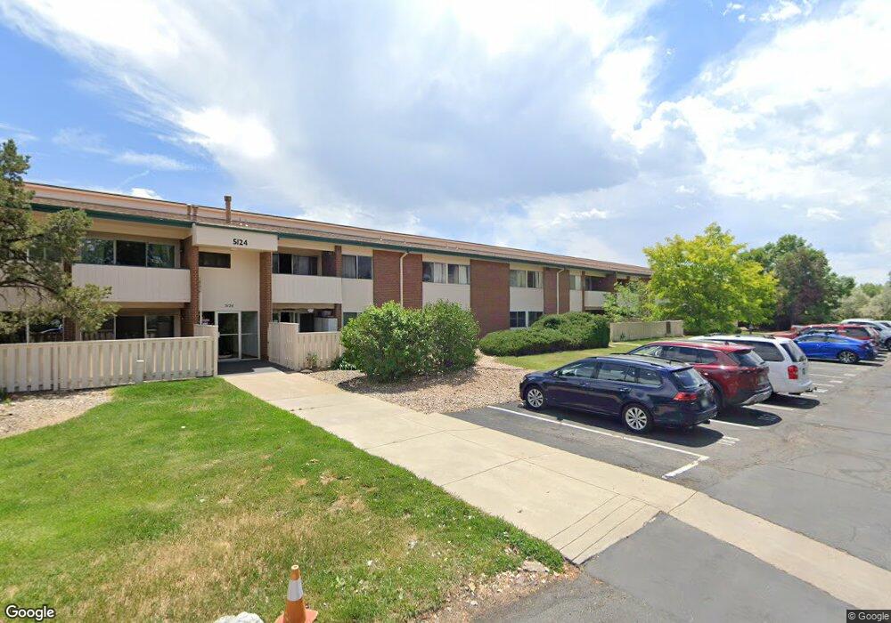
5124 Williams Fork Trail Unit 108 Boulder, CO 80301
Gunbarrel NeighborhoodEstimated Value: $286,285 - $331,000
3
Beds
2
Baths
1,256
Sq Ft
$249/Sq Ft
Est. Value
About This Home
This home is located at 5124 Williams Fork Trail Unit 108, Boulder, CO 80301 and is currently estimated at $312,821, approximately $249 per square foot. 5124 Williams Fork Trail Unit 108 is a home located in Boulder County with nearby schools including Heatherwood Elementary School, Nevin Platt Middle School, and Boulder High School.
Ownership History
Date
Name
Owned For
Owner Type
Purchase Details
Closed on
May 30, 1996
Sold by
Ray Frank E and Ray Pat M
Bought by
Boggs Kent D and Boggs Frances M
Current Estimated Value
Home Financials for this Owner
Home Financials are based on the most recent Mortgage that was taken out on this home.
Original Mortgage
$101,800
Interest Rate
7.93%
Purchase Details
Closed on
Jul 1, 1993
Bought by
Boggs Kent D and Boggs Frances M
Purchase Details
Closed on
Jul 14, 1987
Bought by
Boggs Kent D and Boggs Frances M
Purchase Details
Closed on
Sep 19, 1986
Bought by
Boggs Kent D and Boggs Frances M
Create a Home Valuation Report for This Property
The Home Valuation Report is an in-depth analysis detailing your home's value as well as a comparison with similar homes in the area
Home Values in the Area
Average Home Value in this Area
Purchase History
| Date | Buyer | Sale Price | Title Company |
|---|---|---|---|
| Boggs Kent D | $105,000 | Title Services Inc | |
| Boggs Kent D | $63,500 | -- | |
| Boggs Kent D | -- | -- | |
| Boggs Kent D | $50,000 | -- |
Source: Public Records
Mortgage History
| Date | Status | Borrower | Loan Amount |
|---|---|---|---|
| Previous Owner | Boggs Kent D | $101,800 |
Source: Public Records
Tax History
| Year | Tax Paid | Tax Assessment Tax Assessment Total Assessment is a certain percentage of the fair market value that is determined by local assessors to be the total taxable value of land and additions on the property. | Land | Improvement |
|---|---|---|---|---|
| 2025 | $1,305 | $22,894 | -- | $22,894 |
| 2024 | $1,305 | $22,894 | -- | $22,894 |
| 2023 | $1,284 | $20,531 | -- | $24,216 |
| 2022 | $1,306 | $20,079 | $0 | $20,079 |
| 2021 | $1,246 | $20,656 | $0 | $20,656 |
| 2020 | $1,134 | $19,276 | $0 | $19,276 |
| 2019 | $1,115 | $19,276 | $0 | $19,276 |
| 2018 | $861 | $16,387 | $0 | $16,387 |
| 2017 | $836 | $18,117 | $0 | $18,117 |
| 2016 | $535 | $11,168 | $0 | $11,168 |
| 2015 | $510 | $8,772 | $0 | $8,772 |
| 2014 | $407 | $8,772 | $0 | $8,772 |
Source: Public Records
Map
Nearby Homes
- 5120 Williams Fork Trail Unit 206
- 4945 Twin Lakes Rd Unit 39
- 5012 Carter Ct
- 4870 Twin Lakes Rd Unit 1
- 6844 Roaring Fork Trail
- 4690 Portside Way
- 0 Cottonwood Dr
- 6495 Barnacle Ct
- 6838 Harvest Rd
- 6239 Willow Ln Unit 6239
- 4872 Country Club Way
- 6170 Habitat Dr Unit 6170
- 6201 Willow Ln Unit 6201
- 6972 Roaring Fork Trail
- 4559 Beachcomber Ct
- 6923 Hunter Place
- 5531 High Country Ct
- 6146 Willow Ln
- 4887 White Rock Cir Unit F
- 6112 Habitat Dr Unit 2
- 5124 Williams Fork Trail Unit 210
- 5124 Williams Fork Trail Unit 209
- 5124 Williams Fork Trail Unit 208
- 5124 Williams Fork Trail Unit 207
- 5124 Williams Fork Trail Unit 206
- 5124 Williams Fork Trail Unit 205
- 5124 Williams Fork Trail Unit 203
- 5124 Williams Fork Trail Unit 202
- 5124 Williams Fork Trail Unit 201
- 5124 Williams Fork Trail Unit 110
- 5124 Williams Fork Trail Unit 109
- 5124 Williams Fork Trail Unit 107
- 5124 Williams Fork Trail Unit 106
- 5124 Williams Fork Trail Unit 105
- 5124 Williams Fork Trail Unit 104
- 5124 Williams Fork Trail Unit 103
- 5124 Williams Fork Trail Unit 102
- 5124 Williams Fork Trail Unit 101
- 5124 Williams Fork Trail Unit 6201
- 5122 Williams Fork Trail Unit 210
Your Personal Tour Guide
Ask me questions while you tour the home.