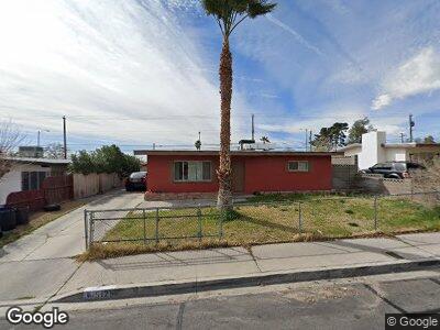
5125 Cannon Blvd Las Vegas, NV 89108
Michael Way NeighborhoodEstimated Value: $283,620 - $334,000
3
Beds
1
Bath
1,000
Sq Ft
$303/Sq Ft
Est. Value
About This Home
This home is located at 5125 Cannon Blvd, Las Vegas, NV 89108 and is currently estimated at $302,655, approximately $302 per square foot. 5125 Cannon Blvd is a home located in Clark County with nearby schools including J.T. McWlliams Elementary School, Robert O Gibson Middle School, and Western High School.
Ownership History
Date
Name
Owned For
Owner Type
Purchase Details
Closed on
Mar 2, 2001
Sold by
Franklin Laurie Rose
Bought by
Franklin Laurie R Bialac and The Lrbf Trust
Current Estimated Value
Purchase Details
Closed on
Dec 1, 1993
Sold by
Franklin Jerry and Franklin Laurie
Bought by
Franklin Jerry W and Franklin Laurie Rose
Home Financials for this Owner
Home Financials are based on the most recent Mortgage that was taken out on this home.
Original Mortgage
$37,739
Interest Rate
6.74%
Mortgage Type
VA
Create a Home Valuation Report for This Property
The Home Valuation Report is an in-depth analysis detailing your home's value as well as a comparison with similar homes in the area
Home Values in the Area
Average Home Value in this Area
Purchase History
| Date | Buyer | Sale Price | Title Company |
|---|---|---|---|
| Franklin Laurie R Bialac | -- | -- | |
| Franklin Jerry W | -- | Land Title |
Source: Public Records
Mortgage History
| Date | Status | Borrower | Loan Amount |
|---|---|---|---|
| Closed | Franklin Jerry W | $37,739 |
Source: Public Records
Tax History Compared to Growth
Tax History
| Year | Tax Paid | Tax Assessment Tax Assessment Total Assessment is a certain percentage of the fair market value that is determined by local assessors to be the total taxable value of land and additions on the property. | Land | Improvement |
|---|---|---|---|---|
| 2025 | $770 | $39,834 | $25,900 | $13,934 |
| 2024 | $713 | $39,834 | $25,900 | $13,934 |
| 2023 | $713 | $42,690 | $30,100 | $12,590 |
| 2022 | $661 | $34,757 | $23,450 | $11,307 |
| 2021 | $612 | $32,540 | $22,050 | $10,490 |
| 2020 | $565 | $29,457 | $19,250 | $10,207 |
| 2019 | $530 | $25,602 | $15,750 | $9,852 |
| 2018 | $506 | $23,589 | $14,350 | $9,239 |
| 2017 | $748 | $22,806 | $13,650 | $9,156 |
| 2016 | $475 | $17,624 | $8,750 | $8,874 |
| 2015 | $472 | $14,909 | $6,300 | $8,609 |
| 2014 | $458 | $13,546 | $5,250 | $8,296 |
Source: Public Records
Map
Nearby Homes
- 1020 Nassau Dr
- 5208 Overland Ave
- 617 Stanford St
- 604 N Minnesota St
- 608 Mc Dermit St
- 1001 Fay Blvd
- 5013 Vermont Ave
- 516 Donner St
- 701 Harvard St
- 424 Stanford St
- 600 Sarajane Ln
- 5129 Sugarfoot Ave
- 5109 Sugarfoot Ave
- 4804 Apawana Ln
- 5201 Glen Eagles Ln
- 5608 Ridgeline Ave
- 600 Woodmount Dr
- 5128 Forrest Hills Ln
- 5612 Pearldrop Ave
- 5701 Pearldrop Ave
- 5125 Cannon Blvd
- 5121 Cannon Blvd
- 5129 Cannon Blvd
- 5117 Cannon Blvd
- 5133 Cannon Blvd
- 5124 Cannon Blvd
- 5124 Cannon Blvd
- 5120 Cannon Blvd
- 5113 Cannon Blvd
- 5201 Cannon Blvd
- 5128 Cannon Blvd
- 5116 Cannon Blvd
- 5116 Cannon Blvd Unit 1
- 5116 Overland Ave
- 5120 Overland Ave
- 5112 Cannon Blvd
- 5109 Cannon Blvd
- 5205 Cannon Blvd
- 1004 Nassau Dr
- 5200 Cannon Blvd