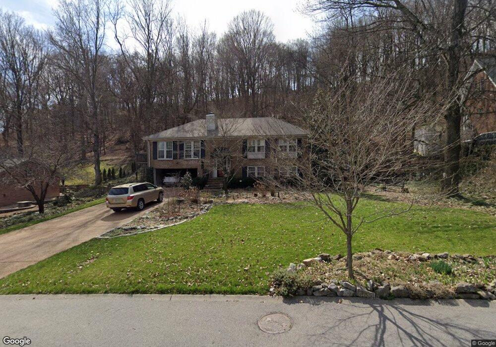
5125 Prince Phillip Cove Brentwood, TN 37027
Estimated Value: $717,000 - $1,023,000
--
Bed
3
Baths
1,556
Sq Ft
$512/Sq Ft
Est. Value
About This Home
This home is located at 5125 Prince Phillip Cove, Brentwood, TN 37027 and is currently estimated at $796,384, approximately $511 per square foot. 5125 Prince Phillip Cove is a home located in Williamson County with nearby schools including Scales Elementary School, Brentwood Middle School, and Brentwood High School.
Ownership History
Date
Name
Owned For
Owner Type
Purchase Details
Closed on
Apr 27, 1999
Sold by
Bridges Susan L Etvir Bruce D
Bought by
Vogel Jerry Ray and Vogel Janie M
Current Estimated Value
Home Financials for this Owner
Home Financials are based on the most recent Mortgage that was taken out on this home.
Original Mortgage
$187,450
Outstanding Balance
$51,274
Interest Rate
8%
Estimated Equity
$745,110
Purchase Details
Closed on
Jul 31, 1995
Sold by
Mangelsdorf Richard C
Bought by
Mangelsdorf Richard C
Create a Home Valuation Report for This Property
The Home Valuation Report is an in-depth analysis detailing your home's value as well as a comparison with similar homes in the area
Home Values in the Area
Average Home Value in this Area
Purchase History
| Date | Buyer | Sale Price | Title Company |
|---|---|---|---|
| Vogel Jerry Ray | $187,450 | -- | |
| Mangelsdorf Richard C | $170,000 | -- |
Source: Public Records
Mortgage History
| Date | Status | Borrower | Loan Amount |
|---|---|---|---|
| Open | Vogel Jerry Ray | $187,450 |
Source: Public Records
Tax History Compared to Growth
Tax History
| Year | Tax Paid | Tax Assessment Tax Assessment Total Assessment is a certain percentage of the fair market value that is determined by local assessors to be the total taxable value of land and additions on the property. | Land | Improvement |
|---|---|---|---|---|
| 2025 | $2,768 | $193,000 | $70,000 | $123,000 |
| 2024 | $2,768 | $127,550 | $43,750 | $83,800 |
| 2023 | $2,768 | $127,550 | $43,750 | $83,800 |
| 2022 | $2,768 | $127,550 | $43,750 | $83,800 |
| 2021 | $2,768 | $127,550 | $43,750 | $83,800 |
| 2020 | $2,557 | $99,100 | $33,750 | $65,350 |
| 2019 | $2,557 | $99,100 | $33,750 | $65,350 |
| 2018 | $2,488 | $99,100 | $33,750 | $65,350 |
| 2017 | $2,468 | $99,100 | $33,750 | $65,350 |
| 2016 | $2,438 | $99,100 | $33,750 | $65,350 |
| 2015 | -- | $78,950 | $28,750 | $50,200 |
| 2014 | $347 | $78,950 | $28,750 | $50,200 |
Source: Public Records
Map
Nearby Homes
- 1426 Robert e Lee Ln
- 1305 Robert e Lee Ln
- 1326 Holly Tree Gap Rd
- 1400 Franklin Rd
- 6004 Eastmans Way
- 1213 Brentwood Ln
- 1204 Brentwood Ln
- 6006 Eastmans Way
- 1215 Brentwood Ln
- 1349 Holly Tree Gap Rd
- 7018 Willowick Dr
- 5113 W Concord Rd
- 7017 Boone Trail Cir
- 6033 Frazier Park Ln
- 6032 Frazier Park Ln
- 6035 Frazier Park Ln
- 6034 Frazier Park Ln
- 1112 Franklin Rd
- 1535 Franklin Rd
- 5014 Mountview Place
- 5123 Prince Phillip Cove
- 5127 Prince Phillip Cove
- 5120 Prince Phillip Cove
- 5121 Albert Dr
- 5129 Prince Phillip Cove
- 5124 Prince Phillip Cove
- 5118 Prince Phillip Cove
- 5119 Albert Dr
- 5115 Prince Phillip Cove
- 5126 Prince Phillip Cove
- 5116 Prince Phillip Cove
- 1420 Robert e Lee Ln
- 5128 Prince Phillip Cove
- 5117 Albert Dr
- 1417 Robert e Lee Ln
- 1415 Robert e Lee Ln
- 5113 Prince Phillip Cove
- 1421 Robert e Lee Ln
- 5114 Albert Dr
- 5114 Prince Phillip Cove