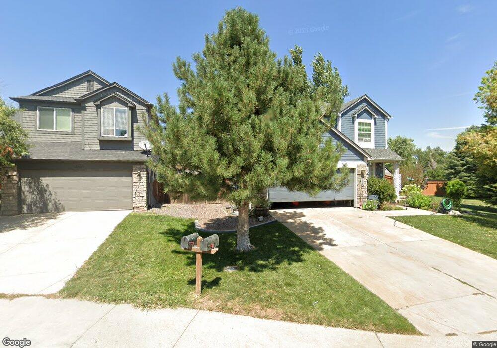
5127 E Hamilton Ave Castle Rock, CO 80104
Founders Village NeighborhoodEstimated Value: $523,000 - $545,000
4
Beds
4
Baths
2,107
Sq Ft
$251/Sq Ft
Est. Value
About This Home
This home is located at 5127 E Hamilton Ave, Castle Rock, CO 80104 and is currently estimated at $529,691, approximately $251 per square foot. 5127 E Hamilton Ave is a home located in Douglas County with nearby schools including Rock Ridge Elementary School, Mesa Middle School, and Douglas County High School.
Ownership History
Date
Name
Owned For
Owner Type
Purchase Details
Closed on
Apr 22, 2014
Sold by
Macrory James and Macrory Cashel
Bought by
Lawrence Roberta
Current Estimated Value
Purchase Details
Closed on
Mar 12, 2012
Sold by
Dejay Timothy J
Bought by
Macrory James and Macrory Cashel
Home Financials for this Owner
Home Financials are based on the most recent Mortgage that was taken out on this home.
Original Mortgage
$180,310
Interest Rate
3.87%
Mortgage Type
FHA
Purchase Details
Closed on
Feb 27, 2012
Sold by
Lay Timothy J De and Henson Shana
Bought by
Lay Timothy J De
Home Financials for this Owner
Home Financials are based on the most recent Mortgage that was taken out on this home.
Original Mortgage
$180,310
Interest Rate
3.87%
Mortgage Type
FHA
Purchase Details
Closed on
Oct 12, 2011
Sold by
Delay Timothy and Henson Shana
Bought by
Delay Timothy
Purchase Details
Closed on
Oct 11, 2011
Sold by
Dedelay Timothy De and Henson Shana
Bought by
Delay Timothy
Purchase Details
Closed on
Mar 4, 2010
Sold by
Delay Timothy J
Bought by
Delay Timothy J and Henson Shana R
Purchase Details
Closed on
May 21, 2004
Sold by
Delay Timothy J and Delay Megan E
Bought by
Delay Timothy J
Purchase Details
Closed on
Dec 23, 2002
Sold by
Citifinancial Mtg Company
Bought by
Delay Timothy J and Delay Megan E
Home Financials for this Owner
Home Financials are based on the most recent Mortgage that was taken out on this home.
Original Mortgage
$140,000
Interest Rate
5.96%
Purchase Details
Closed on
Sep 18, 2002
Sold by
Pervin Dawn L
Bought by
Citifinancial Mtg Company Inc
Purchase Details
Closed on
Oct 30, 1997
Sold by
Lear John T and Lear Wendy C
Bought by
Pervin Dawn L
Home Financials for this Owner
Home Financials are based on the most recent Mortgage that was taken out on this home.
Original Mortgage
$117,178
Interest Rate
7.27%
Mortgage Type
FHA
Purchase Details
Closed on
Feb 28, 1994
Sold by
Pulte Home Corp
Bought by
Lear John T and Lear Wendy C
Home Financials for this Owner
Home Financials are based on the most recent Mortgage that was taken out on this home.
Original Mortgage
$95,400
Interest Rate
7%
Create a Home Valuation Report for This Property
The Home Valuation Report is an in-depth analysis detailing your home's value as well as a comparison with similar homes in the area
Home Values in the Area
Average Home Value in this Area
Purchase History
| Date | Buyer | Sale Price | Title Company |
|---|---|---|---|
| Lawrence Roberta | $242,000 | Land Title Guarantee Company | |
| Macrory James | $185,000 | Cwt | |
| Lay Timothy J De | -- | -- | |
| Delay Timothy | -- | None Available | |
| Delay Timothy | -- | -- | |
| Delay Timothy J | -- | None Available | |
| Delay Timothy J | -- | -- | |
| Delay Timothy J | $175,000 | Heritage Title | |
| Citifinancial Mtg Company Inc | -- | -- | |
| Pervin Dawn L | $129,500 | -- | |
| Lear John T | $106,025 | Land Title |
Source: Public Records
Mortgage History
| Date | Status | Borrower | Loan Amount |
|---|---|---|---|
| Previous Owner | Macrory James | $180,310 | |
| Previous Owner | Delay Timothy J | $140,000 | |
| Previous Owner | Pervin Dawn L | $117,178 | |
| Previous Owner | Lear John T | $95,400 |
Source: Public Records
Tax History Compared to Growth
Tax History
| Year | Tax Paid | Tax Assessment Tax Assessment Total Assessment is a certain percentage of the fair market value that is determined by local assessors to be the total taxable value of land and additions on the property. | Land | Improvement |
|---|---|---|---|---|
| 2024 | $5,313 | $36,020 | $8,210 | $27,810 |
| 2023 | $5,344 | $36,020 | $8,210 | $27,810 |
| 2022 | $3,968 | $25,060 | $6,100 | $18,960 |
| 2021 | $4,043 | $25,060 | $6,100 | $18,960 |
| 2020 | $3,812 | $24,330 | $5,010 | $19,320 |
| 2019 | $3,814 | $24,330 | $5,010 | $19,320 |
| 2018 | $3,257 | $20,620 | $3,890 | $16,730 |
| 2017 | $3,135 | $20,620 | $3,890 | $16,730 |
| 2016 | $2,598 | $17,840 | $3,810 | $14,030 |
| 2015 | $2,631 | $17,840 | $3,810 | $14,030 |
| 2014 | $2,226 | $14,490 | $3,420 | $11,070 |
Source: Public Records
Map
Nearby Homes
- 1025 S Lindsey St
- 596 S Lindsey St
- 576 S Lindsey St
- 5133 E Essex Ave
- 4947 Stoneham Ave
- 510 Fairhaven St
- 1005 Parsons Ave
- 4937 Parsons Way
- 5181 Devon Ave
- 5428 Suffolk Ave
- 5282 Devon Ave
- NA Ridge Rd
- 475 Hampstead Ave
- 1243 Parsons Ave
- 1037 Rosedale Ct
- 359 S Cherry St
- 378 Benton St
- 321 Lockwood St
- 4590 Wakefield Ave
- 5258 Lost Meadow Trail
- 5107 E Hamilton Ave
- 845 S Lindsey St
- 864 S Lindsey St
- 5146 E Hamilton Ave
- 855 S Lindsey St
- 5166 E Hamilton Ave
- 5186 E Hamilton Ave
- 865 S Lindsey St
- 874 S Lindsey St
- 5206 E Hamilton Ave
- 875 S Lindsey St
- 5173 E Kensington Ave
- 5237 E Hamilton Ave
- 5185 E Kensington Ave
- 5140 E Hanover Place
- 5120 E Hanover Place
- 884 S Lindsey St
- 5160 E Hanover Place
- 5197 E Kensington Ave
- 5216 E Hamilton Ave