5129 Solar Heights Dr Unit LOT Eugene, OR 97405
Crest Drive NeighborhoodEstimated Value: $1,094,000 - $1,223,000
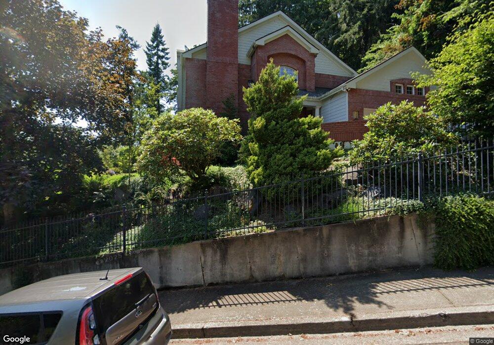
About This Home
This home is located at 5129 Solar Heights Dr Unit LOT, Eugene, OR 97405 and is currently estimated at $1,137,379, approximately $326 per square foot. 5129 Solar Heights Dr Unit LOT is a home located in Lane County with nearby schools including Edgewood Community Elementary School, Spencer Butte Middle School, and South Eugene High School.
Ownership History
We collect this data history from publicly available records. To have your information removed, we recommend requesting removal directly through your county’s website.
Purchase Details
Home Financials for this Owner
Home Financials are based on the most recent Mortgage that was taken out on this home.Purchase Details
Home Financials for this Owner
Home Financials are based on the most recent Mortgage that was taken out on this home.Purchase Details
Home Values in the Area
Average Home Value in this Area
Purchase History
We collect this data history from publicly available records. To have your information removed, we recommend requesting removal directly through your county’s website.
| Date | Buyer | Sale Price | Title Company |
|---|---|---|---|
| $759,000 | Cascade Title Co | ||
| $705,000 | Fidelity National Title Insu | ||
| -- | -- |
Mortgage History
We collect this data history from publicly available records. To have your information removed, we recommend requesting removal directly through your county’s website.
| Date | Status | Borrower | Loan Amount |
|---|---|---|---|
| Open | $484,350 | ||
| Previous Owner | $350,000 |
Tax History
We collect this data history from publicly available records. To have your information removed, we recommend requesting removal directly through your county’s website.
| Year | Tax Paid | Tax Assessment Tax Assessment Total Assessment is a certain percentage of the fair market value that is determined by local assessors to be the total taxable value of land and additions on the property. | Land | Improvement |
|---|---|---|---|---|
| 2025 | $16,273 | $854,884 | -- | -- |
| 2024 | $16,449 | $829,985 | -- | -- |
| 2023 | $16,449 | $805,811 | -- | -- |
| 2022 | $15,015 | $782,341 | $0 | $0 |
| 2021 | $13,641 | $759,555 | $0 | $0 |
| 2020 | $13,258 | $737,433 | $0 | $0 |
| 2019 | $13,016 | $715,955 | $0 | $0 |
| 2018 | $11,182 | $603,841 | $0 | $0 |
| 2017 | $10,561 | $603,841 | $0 | $0 |
| 2016 | $9,947 | $586,253 | $0 | $0 |
| 2015 | $9,691 | $569,178 | $0 | $0 |
| 2014 | $9,436 | $552,600 | $0 | $0 |
Map
- 5171 Solar Heights Dr
- 223 Trailside Loop Unit 223
- 417 Stonewood Dr
- 213 Trailside Loop
- 645 Startouch Dr
- 149 Treehill Loop Unit 149
- 151 Treehill Loop Unit 151
- 152 Treehill Loop Unit 152
- 143 Treehill Loop Unit 143
- 667 Kamapheema Place
- 217 Rockridge Loop
- 278 Rockridge Ct
- 79 Rockridge Dr
- 0 Rockridge Loop Unit 339703397
- 0 Rockridge Loop Unit 1513157 Lp
- 0 Rockridge Loop Unit 13
- 784 Brookside Dr
- 151 Rockridge Loop
- 70 Coachman Dr
- 0 Pine View Ct Unit 758820410
- 5129 Solar Heights Dr
- 5134 Solar Heights Dr
- 5125 Solar Heights Dr
- 5128 Solar Heights Dr
- 0 Solar Heights Dr Unit 24449075
- 0 Solar Heights Dr Unit 3827
- 0 Solar Heights Dr Unit 24462163
- 0 Solar Heights Dr Unit 21395790
- 0 Solar Heights Dr Unit 38 20176152
- 0 Solar Heights Dr Unit 20524677
- 0 Solar Heights Dr Unit LOT 19276643
- 0 Solar Heights Dr Unit 18642488
- 0 Solar Heights Dr Unit 18603415
- 0 Solar Heights Dr Unit 1 18253493
- 0 Solar Heights Dr Unit 1600
- 5138 Solar Heights Dr
- 147 W 52nd Ave
- 5127 Solar Heights Dr
- 5123 Solar Heights Dr
- 5142 Solar Heights Dr
Ask me questions while you tour the home.