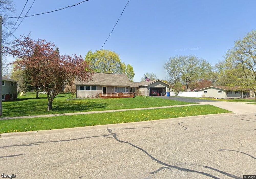
513 Bush St Linden, MI 48451
Estimated Value: $279,860 - $312,000
4
Beds
2
Baths
1,778
Sq Ft
$164/Sq Ft
Est. Value
About This Home
This home is located at 513 Bush St, Linden, MI 48451 and is currently estimated at $290,715, approximately $163 per square foot. 513 Bush St is a home located in Genesee County with nearby schools including Linden Elementary School, Linden Middle School, and Linden High School.
Ownership History
Date
Name
Owned For
Owner Type
Purchase Details
Closed on
Oct 24, 2024
Sold by
Rodgers Patricia A
Bought by
Rodgers Patricia A and Patricia A Rodgers Trust
Current Estimated Value
Purchase Details
Closed on
Jan 24, 2022
Sold by
Marie Stockero Rebecca
Bought by
Rodgers Patricia A
Purchase Details
Closed on
Jan 30, 2020
Sold by
Stockero Rebecca Marie
Bought by
Stockero Rebecca Marie and Rodgers Patricia A
Purchase Details
Closed on
Aug 5, 2019
Sold by
Rodgers Patricia A
Bought by
Stockero Rebecca Marie
Create a Home Valuation Report for This Property
The Home Valuation Report is an in-depth analysis detailing your home's value as well as a comparison with similar homes in the area
Home Values in the Area
Average Home Value in this Area
Purchase History
| Date | Buyer | Sale Price | Title Company |
|---|---|---|---|
| Rodgers Patricia A | -- | Land Title | |
| Rodgers Patricia A | -- | Land Title | |
| Rodgers Patricia A | -- | None Listed On Document | |
| Stockero Rebecca Marie | -- | None Available | |
| Stockero Rebecca Marie | -- | None Available |
Source: Public Records
Tax History
| Year | Tax Paid | Tax Assessment Tax Assessment Total Assessment is a certain percentage of the fair market value that is determined by local assessors to be the total taxable value of land and additions on the property. | Land | Improvement |
|---|---|---|---|---|
| 2025 | $2,728 | $132,500 | $0 | $0 |
| 2024 | $2,610 | $123,500 | $0 | $0 |
| 2023 | $1,651 | $111,500 | $0 | $0 |
| 2022 | $2,493 | $93,300 | $0 | $0 |
| 2021 | $3,058 | $85,900 | $0 | $0 |
| 2020 | $3,097 | $79,700 | $0 | $0 |
| 2019 | $2,104 | $76,900 | $0 | $0 |
| 2018 | $2,641 | $76,900 | $0 | $0 |
| 2017 | $2,606 | $73,200 | $0 | $0 |
| 2016 | $2,643 | $67,600 | $0 | $0 |
| 2015 | $2,646 | $59,600 | $0 | $0 |
| 2012 | -- | $45,194 | $45,194 | $0 |
Source: Public Records
Map
Nearby Homes
- 214 Willow Ln
- 331 Andrea Ave Unit 63
- 220 Laura Ln
- 231 Kathy Cir Unit 43
- 5220 Amelia Earhart Dr
- 5202 Amelia Earhart Dr
- 5194 Amelia Earhart Dr
- 15051 Poberezny Ct
- 4468 Edison Blvd Unit 50
- 4453 Ford Ave
- 4437 Edison Blvd
- 4448 Ford Ave
- 513 W Broad St
- The Oxford Plan at Liberty Shores
- The Bloomington Plan at Liberty Shores
- The Hampton Plan at Liberty Shores
- The Princeton Plan at Liberty Shores
- The Columbia Plan at Liberty Shores
- The Berkeley Plan at Liberty Shores
- The Austin Plan at Liberty Shores