Estimated Value: $1,084,000 - $1,266,000
4
Beds
4
Baths
3,376
Sq Ft
$346/Sq Ft
Est. Value
About This Home
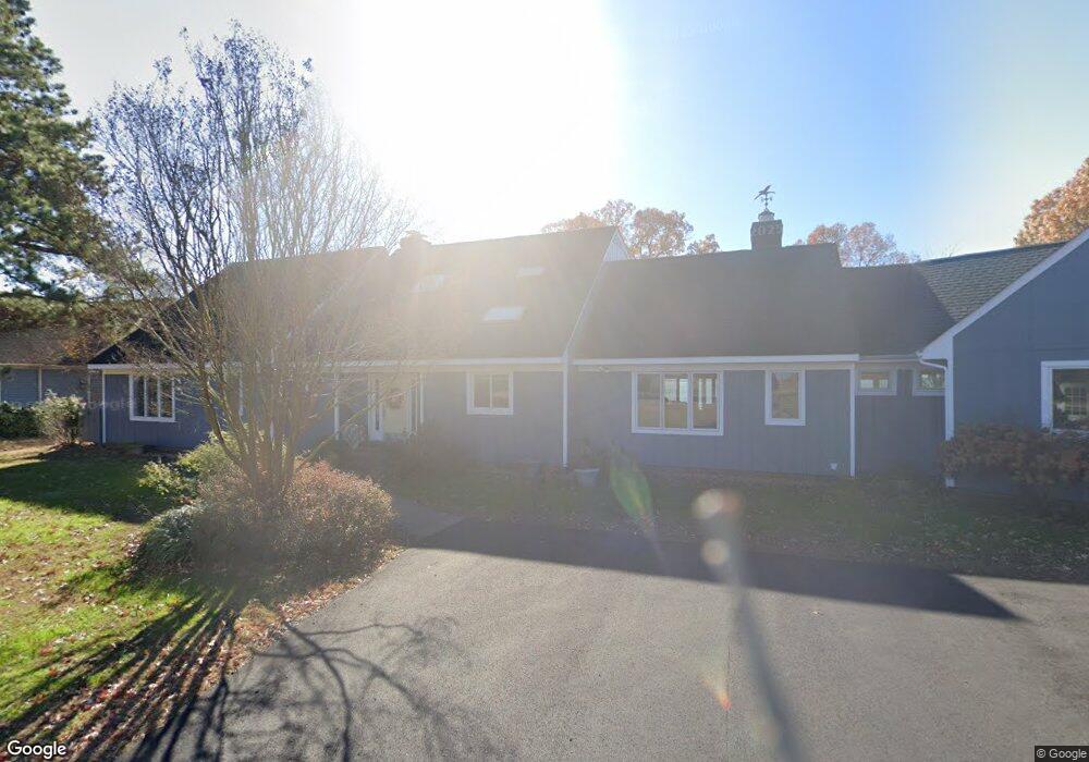
This home is located at 513 Cedar Pointe Dr, Weems, VA 22576 and is currently estimated at $1,167,883, approximately $345 per square foot. 513 Cedar Pointe Dr is a home located in Lancaster County with nearby schools including Lancaster Primary School, Lancaster Middle School, and Lancaster High School.
Ownership History
Date
Name
Owned For
Owner Type
Purchase Details
Closed on
Mar 29, 2010
Sold by
Hopkins Francis P
Bought by
Lofton Tr James Hilton and James H Donna B Lofton Fam Tru
Current Estimated Value
Home Financials for this Owner
Home Financials are based on the most recent Mortgage that was taken out on this home.
Original Mortgage
$644,250
Outstanding Balance
$424,488
Interest Rate
5.02%
Mortgage Type
New Conventional
Estimated Equity
$743,395
Create a Home Valuation Report for This Property
The Home Valuation Report is an in-depth analysis detailing your home's value as well as a comparison with similar homes in the area
Purchase History
| Date | Buyer | Sale Price | Title Company |
|---|---|---|---|
| Lofton Tr James Hilton | $859,000 | -- |
Source: Public Records
Mortgage History
| Date | Status | Borrower | Loan Amount |
|---|---|---|---|
| Open | Lofton Tr James Hilton | $644,250 |
Source: Public Records
Tax History
| Year | Tax Paid | Tax Assessment Tax Assessment Total Assessment is a certain percentage of the fair market value that is determined by local assessors to be the total taxable value of land and additions on the property. | Land | Improvement |
|---|---|---|---|---|
| 2025 | $5,763 | $1,047,900 | $312,400 | $735,500 |
| 2024 | $5,763 | $1,047,900 | $312,400 | $735,500 |
| 2023 | $4,370 | $693,600 | $237,400 | $456,200 |
| 2022 | $4,370 | $693,600 | $237,400 | $456,200 |
| 2021 | $4,370 | $693,600 | $237,400 | $456,200 |
| 2020 | $4,370 | $693,600 | $237,400 | $456,200 |
| 2019 | $4,370 | $693,600 | $237,400 | $456,200 |
| 2018 | $4,306 | $729,900 | $303,800 | $426,100 |
| 2017 | $4,306 | $729,900 | $303,800 | $426,100 |
| 2016 | -- | $729,900 | $303,800 | $426,100 |
| 2014 | -- | $0 | $0 | $0 |
| 2013 | -- | $0 | $0 | $0 |
Source: Public Records
Map
Nearby Homes
- 602 Cedar Pointe Dr
- 411 Cedar Pointe Dr
- Lot 16 Cedar Pointe Dr
- 12 Benson Rd
- 19 Wharton Grove Ln
- Map 3324C Sunset Dr
- 72 James Ln
- 176 King Carter Ln
- 2012 Millenbeck Rd
- 212 Gordon Dr
- 1020 Queenstown Rd
- 1678 Weems Rd
- #27-35 Berkeley Forest Rd
- 90 Deep Harbor Ln
- 67 Lewis Ln
- 783 King Carter Dr
- 76 Otter Dr
- 31 Moccasin Trail
- Lot 27_35a Taylor's Creek Rd
- 102B Beechwood Dr
- 481 Cedar Pointe Dr
- 589 Cedar Pointe Dr
- 467 Cedar Pointe Dr
- 617 Cedar Pointe Dr
- 417 Cedar Pointe Dr
- 621 Cedar Pointe Dr
- 379 Cedar Pointe Dr
- 628 Cedar Pointe Dr
- 627 Cedar Pointe Dr
- 373 Cedar Pointe Dr
- 365 Cedar Pointe Dr
- Lot 6 Cedar Pointe Dr
- Lot 22 Cedar Pointe Dr
- 15 Cedar Pointe Dr
- Lot 21 Cedar Pointe Dr
- 6 Cedar Pointe Dr
- TBD Cedar Pointe Dr
- 305 Cedar Pointe Dr
- 420 Benson Rd
- 255 Cedar Pointe Dr