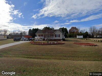
513 Lazy Branch Dr Benson, NC 27504
Pleasant Grove NeighborhoodEstimated Value: $294,000 - $299,050
3
Beds
2
Baths
1,305
Sq Ft
$228/Sq Ft
Est. Value
About This Home
This home is located at 513 Lazy Branch Dr, Benson, NC 27504 and is currently estimated at $297,013, approximately $227 per square foot. 513 Lazy Branch Dr is a home located in Johnston County with nearby schools including McGee's Crossroads Elementary School, McGee's Crossroads Middle School, and West Johnston High School.
Ownership History
Date
Name
Owned For
Owner Type
Purchase Details
Closed on
Nov 8, 2006
Sold by
Nicholson Jamie T
Bought by
Britt Edward and Britt Connie
Current Estimated Value
Home Financials for this Owner
Home Financials are based on the most recent Mortgage that was taken out on this home.
Original Mortgage
$124,900
Outstanding Balance
$91,812
Interest Rate
10.13%
Mortgage Type
Purchase Money Mortgage
Estimated Equity
$207,320
Purchase Details
Closed on
Sep 30, 2003
Sold by
Nicholson Jamie T
Bought by
Locklear William Mitchell
Create a Home Valuation Report for This Property
The Home Valuation Report is an in-depth analysis detailing your home's value as well as a comparison with similar homes in the area
Home Values in the Area
Average Home Value in this Area
Purchase History
| Date | Buyer | Sale Price | Title Company |
|---|---|---|---|
| Britt Edward | $125,000 | None Available | |
| Locklear William Mitchell | $109,500 | -- |
Source: Public Records
Mortgage History
| Date | Status | Borrower | Loan Amount |
|---|---|---|---|
| Open | Britt Edward | $35,000 | |
| Open | Britt Edward | $124,900 |
Source: Public Records
Tax History Compared to Growth
Tax History
| Year | Tax Paid | Tax Assessment Tax Assessment Total Assessment is a certain percentage of the fair market value that is determined by local assessors to be the total taxable value of land and additions on the property. | Land | Improvement |
|---|---|---|---|---|
| 2024 | $1,396 | $172,330 | $44,000 | $128,330 |
| 2023 | $1,353 | $172,330 | $44,000 | $128,330 |
| 2022 | $1,396 | $172,330 | $44,000 | $128,330 |
| 2021 | $1,396 | $172,330 | $44,000 | $128,330 |
| 2020 | $1,448 | $172,330 | $44,000 | $128,330 |
| 2019 | $1,413 | $172,330 | $44,000 | $128,330 |
| 2018 | $952 | $113,290 | $27,500 | $85,790 |
| 2017 | $952 | $113,290 | $27,500 | $85,790 |
| 2016 | $952 | $113,290 | $27,500 | $85,790 |
| 2015 | $952 | $113,290 | $27,500 | $85,790 |
| 2014 | $952 | $113,290 | $27,500 | $85,790 |
Source: Public Records
Map
Nearby Homes
- 104 Eddy Ct
- 133 Creekstone Dr
- 123 Sanders Rd
- 20 Sanders Rd
- 105 Mable Ct Unit 10p
- 317 William Dr
- 234 Crystal Springs Way
- 216 Parrish Farm Ln
- 14 Cricket Hill
- 687 W Watson Rd
- 34 Stuart Dr
- 358 Coats Ridge Dr
- 253 Busterfield Ct
- 308 Busterfield Ct
- 322 Busterfield Ct
- 208 Hunting Lodge Rd
- 38 Winter Red Way
- 311 Ocean Dr
- 120 Keith Ct
- 143 George Wilton Dr
- 513 Lazy Branch Dr
- 509 Lazy Branch Dr
- 101 Eddy Ct
- 100 White Falls Cir
- 716 Slippery Bank Ct
- 720 Slippery Bank Ct
- 505 Lazy Branch Dr
- 105 Eddy Ct
- 710 Slippery Bank Ct
- 104 White Falls Cir
- 600 Meander Way
- 109 Eddy Ct
- 106 White Falls Cir
- 719 Slippery Bank Ct
- 610 Meander Way
- 601 Lazy Branch Dr
- 108 White Falls Cir
- 704 Slippery Bank Ct
- 113 Eddy Ct
- 717 Slippery Bank Ct