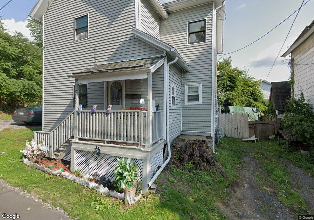
513 Schultz Ct Scranton, PA 18510
Hill Section NeighborhoodEstimated Value: $105,000 - $233,000
4
Beds
2
Baths
1,000
Sq Ft
$148/Sq Ft
Est. Value
About This Home
This home is located at 513 Schultz Ct, Scranton, PA 18510 and is currently estimated at $147,712, approximately $147 per square foot. 513 Schultz Ct is a home located in Lackawanna County with nearby schools including William Prescott School, Northeast Scranton Intermediate School, and Scranton High School.
Ownership History
Date
Name
Owned For
Owner Type
Purchase Details
Closed on
Mar 6, 2020
Sold by
Enterpriese Inc
Bought by
Harris Timothy N
Current Estimated Value
Home Financials for this Owner
Home Financials are based on the most recent Mortgage that was taken out on this home.
Original Mortgage
$78,255
Outstanding Balance
$70,435
Interest Rate
4.4%
Mortgage Type
FHA
Estimated Equity
$77,277
Create a Home Valuation Report for This Property
The Home Valuation Report is an in-depth analysis detailing your home's value as well as a comparison with similar homes in the area
Home Values in the Area
Average Home Value in this Area
Purchase History
| Date | Buyer | Sale Price | Title Company |
|---|---|---|---|
| Harris Timothy N | $79,700 | Djs Abstract &Amp |
Source: Public Records
Mortgage History
| Date | Status | Borrower | Loan Amount |
|---|---|---|---|
| Open | Harris Timothy N | $78,255 |
Source: Public Records
Tax History
| Year | Tax Paid | Tax Assessment Tax Assessment Total Assessment is a certain percentage of the fair market value that is determined by local assessors to be the total taxable value of land and additions on the property. | Land | Improvement |
|---|---|---|---|---|
| 2025 | $1,173 | $3,700 | $500 | $3,200 |
| 2024 | $1,071 | $3,700 | $500 | $3,200 |
| 2023 | $1,071 | $3,700 | $500 | $3,200 |
| 2022 | $1,047 | $3,700 | $500 | $3,200 |
| 2021 | $1,047 | $3,700 | $500 | $3,200 |
| 2020 | $1,027 | $3,700 | $500 | $3,200 |
| 2019 | $966 | $3,700 | $500 | $3,200 |
| 2018 | $966 | $3,700 | $500 | $3,200 |
| 2017 | $948 | $3,700 | $500 | $3,200 |
| 2016 | $278 | $3,700 | $500 | $3,200 |
| 2015 | $709 | $3,700 | $500 | $3,200 |
| 2014 | -- | $3,700 | $500 | $3,200 |
Source: Public Records
Map
Nearby Homes
- 1513 1515 Vine St
- 516 Harrison Ave
- 616-618 Harrison Ave
- 7 Oakwood Place
- 342 Harrison Ave
- 432 Taylor Ave
- 0 Colfax Ave
- 529 Taylor Ave
- 1318 Pine St
- 615 Arthur Ave
- 617 Arthur Ave
- 619 Arthur Ave
- 550 Clay Ave Unit 8c
- 810 Wheeler Ave
- 0 Colfax and Gibson Ave Unit GSBSC255175
- 917 Taylor Ave
- 102 S Irving Ave
- 1406 Ash St
- 825 827 Quincy Ave Unit 825-827
- 217 Crown Ave
- 1513 1515 Vine St Unit 1
- 1513-1515 1515 Vine St
- 1513 Vine St Unit 2
- 1513-1515 Vine St Unit 11
- 1513-1515 Vine St Unit 1
- 1513-1515 Vine St
- 1513 Vine St
- 1515 Vine St Unit 2- STUDIO
- 1515 Vine St Unit 8 - SECOND FLOOR
- 1515 Vine St Unit 1
- 1515 Vine St Unit 8- SECOND FLOOR
- 1515 Vine St Unit 7 - SECOND FLOOR
- 1515 Vine St Unit 7- SECOND FLOOR
- 1515 Vine St Unit 2 STUDIO
- 1515 Vine St Unit 3- FIRST FLOOR
- 1515 Vine St Unit 4- FIRST FLOOR
- 1515 Vine St Unit 1 BDRM 1 BTH
- 1515 Vine St
- 1515 Vine St Unit 6
- 1515 Vine St Unit 7
Your Personal Tour Guide
Ask me questions while you tour the home.