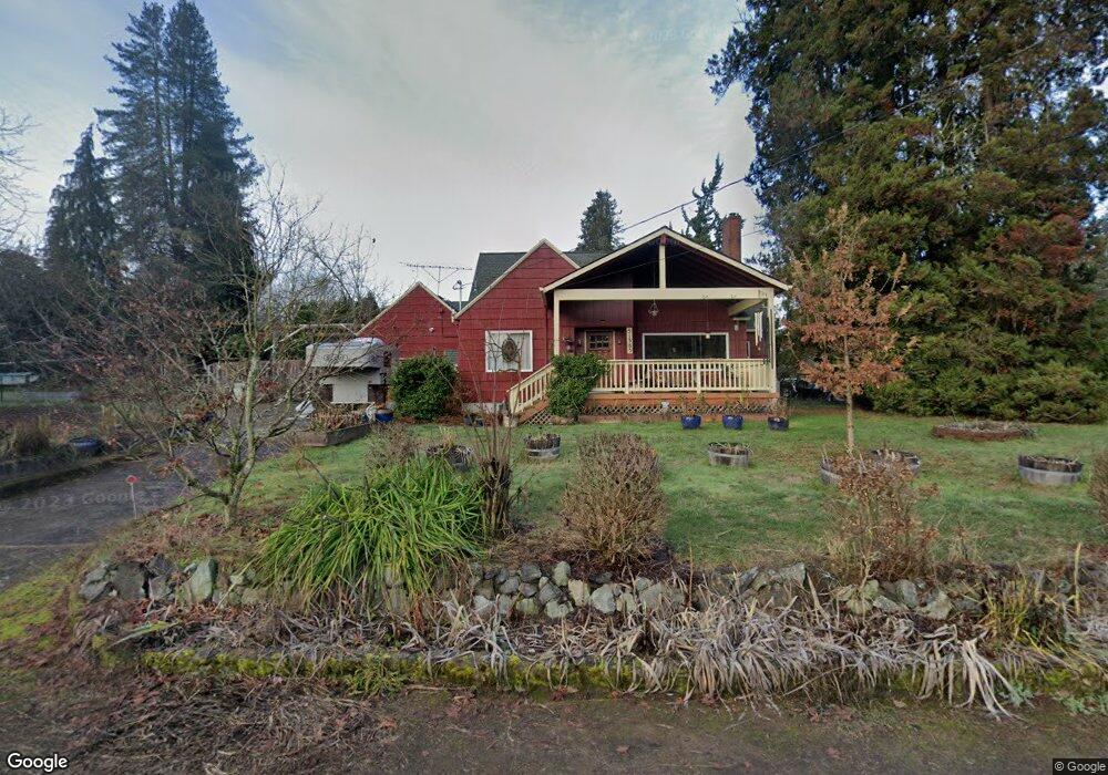
51385 SW Haven Ln Scappoose, OR 97056
Estimated Value: $611,225 - $615,000
3
Beds
2
Baths
2,984
Sq Ft
$205/Sq Ft
Est. Value
About This Home
This home is located at 51385 SW Haven Ln, Scappoose, OR 97056 and is currently estimated at $613,113, approximately $205 per square foot. 51385 SW Haven Ln is a home located in Columbia County with nearby schools including Scappoose High School and Scappoose Adventist School.
Ownership History
Date
Name
Owned For
Owner Type
Purchase Details
Closed on
Oct 20, 2015
Sold by
Gonrowski Brent and Gonrowski Vanessa
Bought by
Rathbun Michael W and Rathbun Kimberly A
Current Estimated Value
Home Financials for this Owner
Home Financials are based on the most recent Mortgage that was taken out on this home.
Original Mortgage
$247,500
Outstanding Balance
$193,996
Interest Rate
3.85%
Mortgage Type
New Conventional
Estimated Equity
$419,117
Purchase Details
Closed on
May 25, 2006
Sold by
Guarnero Richard F
Bought by
Gonrowski Brent and Gonrowski Vanessa
Create a Home Valuation Report for This Property
The Home Valuation Report is an in-depth analysis detailing your home's value as well as a comparison with similar homes in the area
Home Values in the Area
Average Home Value in this Area
Purchase History
| Date | Buyer | Sale Price | Title Company |
|---|---|---|---|
| Rathbun Michael W | $330,000 | Ticor Title | |
| Gonrowski Brent | $347,400 | Ticor Title |
Source: Public Records
Mortgage History
| Date | Status | Borrower | Loan Amount |
|---|---|---|---|
| Open | Rathbun Michael W | $247,500 |
Source: Public Records
Tax History Compared to Growth
Tax History
| Year | Tax Paid | Tax Assessment Tax Assessment Total Assessment is a certain percentage of the fair market value that is determined by local assessors to be the total taxable value of land and additions on the property. | Land | Improvement |
|---|---|---|---|---|
| 2025 | $4,982 | $376,320 | $140,130 | $236,190 |
| 2024 | $4,845 | $365,360 | $136,050 | $229,310 |
| 2023 | $4,823 | $354,720 | $127,100 | $227,620 |
| 2022 | $4,605 | $344,390 | $122,500 | $221,890 |
| 2021 | $4,474 | $334,360 | $120,980 | $213,380 |
| 2020 | $4,103 | $324,630 | $98,510 | $226,120 |
| 2019 | $3,999 | $315,180 | $94,600 | $220,580 |
| 2018 | $3,890 | $306,000 | $127,210 | $178,790 |
| 2017 | $3,832 | $297,090 | $123,510 | $173,580 |
| 2016 | $3,799 | $288,440 | $119,910 | $168,530 |
| 2015 | $3,225 | $260,040 | $96,340 | $163,700 |
| 2014 | $2,938 | $235,500 | $91,520 | $143,980 |
Source: Public Records
Map
Nearby Homes
- 51350 SW Randstad St
- 33279 SW Havlik Dr
- 33298 SW Meadowbrook Dr
- 33410 Meadowbrook Dr
- 51557 SW Em Watts Rd
- Hillsdale Plan at Dutch Canyon
- Aubrey Plan at Dutch Canyon
- Carmichael Plan at Dutch Canyon
- Carlton Plan at Dutch Canyon
- 33340 SW Rokin Way
- 33362 SW Rokin Way
- 51096 SW Klompen St
- 51096 SW Klompen St Unit H138
- 33366 SW Rokin Way
- 51086 SW Klompen St
- 51082 SW Klompen St
- 32922 Coal Creek Rd
- 51692 SE 3rd St
- 33370 SW Rokin Way
- 33344 SW Rokin Way
- 51386 SW Haven Ln
- 33177 SW Dutch Canyon Rd
- 33094 SW Dutch Canyon Rd
- 33094 SW Dutch Canyon Rd
- 51400 SW Randstad St
- 51390 SW Randstad St
- 33153 SW Dutch Canyon Rd
- 33117 SW Dutch Canyon Rd
- 51370 SW Randstad St
- 51380 SW Randstad St
- 51340 SW Randstad St
- 33117 SW Dutch Cy
- 33258 Havlik Dr
- 33258 SW Havlik Dr
- 33278 SW Havlik Dr
- 33240 SW Havlik Dr Unit lot61
- 33268 SW Havlik Dr
- 33272 SW Havlik Dr
- 33236 SW Havlik Dr
- 33236 SW Havlik Dr Unit lot62