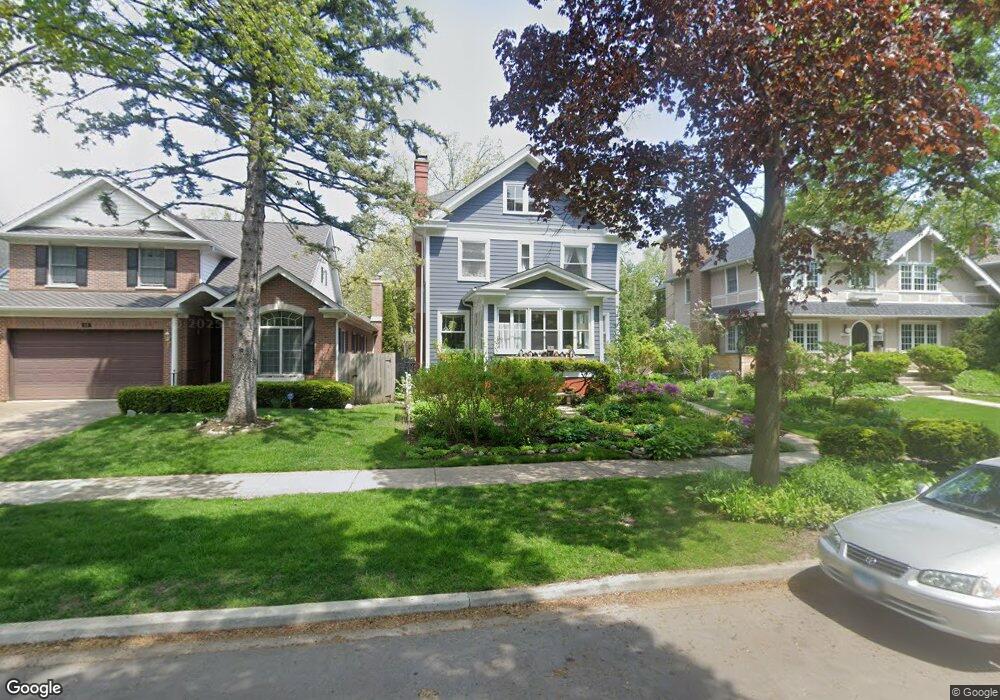
514 Maple Ave Wilmette, IL 60091
Estimated Value: $1,372,000 - $1,779,000
5
Beds
3
Baths
2,993
Sq Ft
$510/Sq Ft
Est. Value
About This Home
This home is located at 514 Maple Ave, Wilmette, IL 60091 and is currently estimated at $1,527,303, approximately $510 per square foot. 514 Maple Ave is a home located in Cook County with nearby schools including Central Elementary School, Highcrest Middle School, and Wilmette Junior High School.
Ownership History
Date
Name
Owned For
Owner Type
Purchase Details
Closed on
Jul 29, 1997
Sold by
Sherck Timothy C
Bought by
Nelson Peter C and Nelson Melissa
Current Estimated Value
Home Financials for this Owner
Home Financials are based on the most recent Mortgage that was taken out on this home.
Original Mortgage
$350,000
Outstanding Balance
$51,127
Interest Rate
7.25%
Estimated Equity
$1,476,176
Purchase Details
Closed on
Jun 13, 1994
Sold by
Ila Karyn and Sherck Karen Ila
Bought by
Sherck Timothy C
Create a Home Valuation Report for This Property
The Home Valuation Report is an in-depth analysis detailing your home's value as well as a comparison with similar homes in the area
Home Values in the Area
Average Home Value in this Area
Purchase History
| Date | Buyer | Sale Price | Title Company |
|---|---|---|---|
| Nelson Peter C | $465,000 | Chicago Title Insurance Co | |
| Sherck Timothy C | $126,500 | -- |
Source: Public Records
Mortgage History
| Date | Status | Borrower | Loan Amount |
|---|---|---|---|
| Open | Nelson Peter C | $350,000 |
Source: Public Records
Tax History Compared to Growth
Tax History
| Year | Tax Paid | Tax Assessment Tax Assessment Total Assessment is a certain percentage of the fair market value that is determined by local assessors to be the total taxable value of land and additions on the property. | Land | Improvement |
|---|---|---|---|---|
| 2024 | $23,528 | $107,000 | $24,750 | $82,250 |
| 2023 | $22,246 | $107,000 | $24,750 | $82,250 |
| 2022 | $22,246 | $107,000 | $24,750 | $82,250 |
| 2021 | $27,878 | $110,640 | $19,800 | $90,840 |
| 2020 | $27,481 | $110,640 | $19,800 | $90,840 |
| 2019 | $26,651 | $120,261 | $19,800 | $100,461 |
| 2018 | $23,191 | $100,914 | $17,100 | $83,814 |
| 2017 | $22,563 | $100,914 | $17,100 | $83,814 |
| 2016 | $21,392 | $100,914 | $17,100 | $83,814 |
| 2015 | $21,482 | $89,156 | $14,175 | $74,981 |
| 2014 | $21,153 | $89,156 | $14,175 | $74,981 |
| 2013 | $20,187 | $89,156 | $14,175 | $74,981 |
Source: Public Records
Map
Nearby Homes
- 526 Linden Ave
- 2741 Eastwood Ave
- 250 3rd St
- 315 Washington Ave
- 900 Sheridan Rd
- 1025 Central Ave
- 2539.5 Prairie Ave Unit 3W
- 2754 Ridge Ave
- 1142 Oakwood Ave
- 2108 Harrison St
- 512 Elmwood Ave
- 1209 Maple Ave
- 2508 Isabella St
- 724 12th St Unit 105
- 410 Prairie Ave
- 2333 Central St Unit 502
- 1241 Maple Ave
- 2020 Colfax St
- 736 Central St
- 1915 Grant St