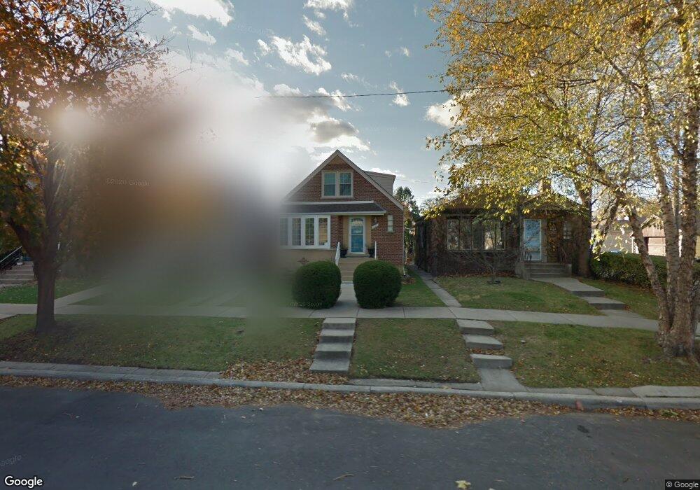
5140 N Normandy Ave Chicago, IL 60656
Norwood Park NeighborhoodEstimated Value: $435,000 - $534,000
4
Beds
3
Baths
1,497
Sq Ft
$321/Sq Ft
Est. Value
About This Home
This home is located at 5140 N Normandy Ave, Chicago, IL 60656 and is currently estimated at $481,157, approximately $321 per square foot. 5140 N Normandy Ave is a home located in Cook County with nearby schools including Garvy J Elementary School, Taft High School, and St. Monica Academy.
Ownership History
Date
Name
Owned For
Owner Type
Purchase Details
Closed on
Feb 29, 2012
Sold by
Otoole Joseph P
Bought by
Vanpelt Kathleen Rose
Current Estimated Value
Purchase Details
Closed on
Sep 24, 2010
Sold by
Betty Geraldine C
Bought by
Betty Geraldine C and Trust #5140-414
Purchase Details
Closed on
Jun 13, 2005
Sold by
Parkway Bank & Trust Co
Bought by
Betty Geraldine C
Create a Home Valuation Report for This Property
The Home Valuation Report is an in-depth analysis detailing your home's value as well as a comparison with similar homes in the area
Home Values in the Area
Average Home Value in this Area
Purchase History
| Date | Buyer | Sale Price | Title Company |
|---|---|---|---|
| Vanpelt Kathleen Rose | $210,000 | First American Title | |
| Betty Geraldine C | -- | None Available | |
| Betty Geraldine C | -- | -- |
Source: Public Records
Tax History Compared to Growth
Tax History
| Year | Tax Paid | Tax Assessment Tax Assessment Total Assessment is a certain percentage of the fair market value that is determined by local assessors to be the total taxable value of land and additions on the property. | Land | Improvement |
|---|---|---|---|---|
| 2024 | $8,167 | $42,000 | $9,300 | $32,700 |
| 2023 | $7,940 | $42,000 | $7,440 | $34,560 |
| 2022 | $7,940 | $42,000 | $7,440 | $34,560 |
| 2021 | $7,781 | $42,003 | $7,443 | $34,560 |
| 2020 | $6,316 | $28,335 | $4,650 | $23,685 |
| 2019 | $6,329 | $31,484 | $4,650 | $26,834 |
| 2018 | $6,223 | $31,484 | $4,650 | $26,834 |
| 2017 | $5,340 | $24,791 | $4,092 | $20,699 |
| 2016 | $4,968 | $24,791 | $4,092 | $20,699 |
| 2015 | $4,785 | $26,096 | $4,092 | $22,004 |
| 2014 | $4,774 | $25,712 | $3,720 | $21,992 |
| 2013 | $4,680 | $25,712 | $3,720 | $21,992 |
Source: Public Records
Map
Nearby Homes
- 5245 N Rutherford Ave
- 5131 N Newland Ave
- 6754 W Higgins Ave
- 5409 N New England Ave
- 5107 N Sayre Ave
- 4841 N Rutherford Ave
- 4828 N Newcastle Ave
- 5452 N Natchez Ave
- 6520 W Gunnison St
- 4824 N Natchez Ave
- 5000 N Mobile Ave
- 4829 N Newland Ave
- 6420 W Gunnison St
- 6959 W Higgins Ave Unit 1S
- 5048 N Nottingham Ave
- 5334 N Melvina Ave
- 5345 N Neva Ave
- 4748 N Newland Ave
- 5526 N Nordica Ave
- 5608 N Nagle Ave
- 5142 N Normandy Ave
- 5136 N Normandy Ave
- 5134 N Normandy Ave
- 5132 N Normandy Ave
- 5126 N Normandy Ave
- 6641 W Foster Ave
- 6637 W Foster Ave
- 6643 W Foster Ave
- 6635 W Foster Ave
- 5141 N Rutherford Ave
- 6647 W Foster Ave
- 5143 N Rutherford Ave
- 5137 N Rutherford Ave
- 5124 N Normandy Ave
- 6649 W Foster Ave
- 5131 N Rutherford Ave
- 5131 N Rutherford Ave
- 6653 W Foster Ave
- 5122 N Normandy Ave
- 5141 N Normandy Ave