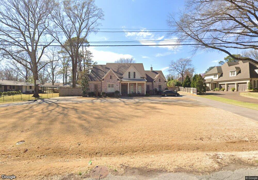
5145 Barry Rd Memphis, TN 38117
East Memphis NeighborhoodEstimated Value: $990,000 - $1,045,033
5
Beds
5
Baths
5,840
Sq Ft
$174/Sq Ft
Est. Value
About This Home
This home is located at 5145 Barry Rd, Memphis, TN 38117 and is currently estimated at $1,015,508, approximately $173 per square foot. 5145 Barry Rd is a home located in Shelby County with nearby schools including White Station Elementary School, White Station High, and White Station Middle.
Ownership History
Date
Name
Owned For
Owner Type
Purchase Details
Closed on
Sep 20, 2018
Sold by
Klazmer Sklar Llc
Bought by
Robinson Burtis Bradwyck
Current Estimated Value
Home Financials for this Owner
Home Financials are based on the most recent Mortgage that was taken out on this home.
Original Mortgage
$846,560
Outstanding Balance
$736,730
Interest Rate
4.5%
Mortgage Type
New Conventional
Estimated Equity
$278,778
Purchase Details
Closed on
Feb 21, 2017
Sold by
Ybos Ii Chris and Ybos Carrie
Bought by
Klazmer Sklar Llc
Home Financials for this Owner
Home Financials are based on the most recent Mortgage that was taken out on this home.
Original Mortgage
$241,000
Interest Rate
4.12%
Mortgage Type
Commercial
Purchase Details
Closed on
Nov 30, 2016
Sold by
Pumroy Margaret Ruth
Bought by
Ybos Ii Chirs and Ybos Carrie
Create a Home Valuation Report for This Property
The Home Valuation Report is an in-depth analysis detailing your home's value as well as a comparison with similar homes in the area
Home Values in the Area
Average Home Value in this Area
Purchase History
| Date | Buyer | Sale Price | Title Company |
|---|---|---|---|
| Robinson Burtis Bradwyck | $832,000 | Memphis Title Co | |
| Klazmer Sklar Llc | $241,000 | Memphis Title Co | |
| Ybos Ii Chirs | $220,000 | Mid South Title Services Llc |
Source: Public Records
Mortgage History
| Date | Status | Borrower | Loan Amount |
|---|---|---|---|
| Open | Robinson Burtis Bradwyck | $846,560 | |
| Previous Owner | Klazmer Sklar Llc | $241,000 |
Source: Public Records
Tax History
| Year | Tax Paid | Tax Assessment Tax Assessment Total Assessment is a certain percentage of the fair market value that is determined by local assessors to be the total taxable value of land and additions on the property. | Land | Improvement |
|---|---|---|---|---|
| 2025 | $7,673 | $280,325 | $53,425 | $226,900 |
| 2024 | $7,673 | $226,350 | $39,050 | $187,300 |
| 2023 | $13,788 | $226,350 | $39,050 | $187,300 |
| 2022 | $13,788 | $226,350 | $39,050 | $187,300 |
| 2021 | $7,809 | $226,350 | $39,050 | $187,300 |
| 2020 | $14,316 | $197,575 | $39,050 | $158,525 |
| 2019 | $6,146 | $184,850 | $39,050 | $145,800 |
| 2018 | $1,248 | $39,050 | $39,050 | $0 |
| 2017 | $1,971 | $60,250 | $39,050 | $21,200 |
| 2016 | $2,538 | $58,075 | $0 | $0 |
| 2014 | $2,538 | $58,075 | $0 | $0 |
Source: Public Records
Map
Nearby Homes
- 5155 Shady Grove Rd
- 344 Greenway Place
- 65 Laverne Ln
- 5099 Walnut Grove Rd
- 5188 Gwynne Rd
- 5264 S Angela Rd
- 4910 Cole Rd
- 5207 Juniper Ave
- 5280 Cole Rd
- 326 Saint Nick Dr
- 35 W Bendel Cir
- 472 Jack Kramer Dr
- 4948 Fairfield Cir
- 364 Clawson Cove
- 5330 Walnut Grove Rd
- 4792 Whitehall Cove
- 5285 Normandy Rd
- 5385 Walnut Grove Rd
- 400 Colonial Rd
- 4935 Robindale Ln
- 5135 Barry Rd
- 5096 Shady Grove Rd
- 5074 Shady Grove Rd
- 5125 Barry Rd
- 5168 Barry Rd
- 5160 Barry Rd
- 5060 Shady Grove Rd
- 5150 Barry Rd
- 5140 Barry Rd
- 5087 Shady Grove Rd
- 5130 Barry Rd
- 5118 Shady Grove Rd
- 5115 Barry Rd
- 5120 Shady Grove Rd
- 5101 Shady Grove Rd
- 5064 Anchor Cove
- 5056 Shady Grove Rd
- 5130 Shady Grove Rd
- 5115 Shady Grove Rd
- 5120 Barry Rd
Your Personal Tour Guide
Ask me questions while you tour the home.