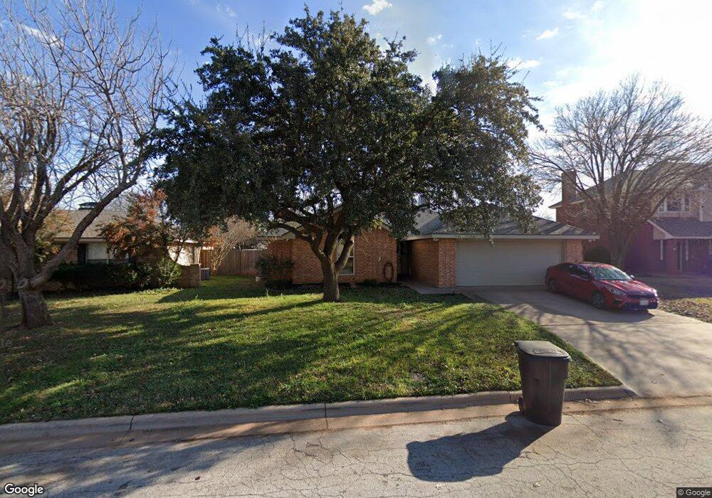
5149 Bridle Path Ln Abilene, TX 79606
Far Southside NeighborhoodEstimated Value: $275,000 - $297,535
4
Beds
2
Baths
1,611
Sq Ft
$177/Sq Ft
Est. Value
About This Home
This home is located at 5149 Bridle Path Ln, Abilene, TX 79606 and is currently estimated at $285,634, approximately $177 per square foot. 5149 Bridle Path Ln is a home with nearby schools including Wylie West Early Childhood Center, Wylie West Intermediate School, and Wylie West Elementary School.
Ownership History
Date
Name
Owned For
Owner Type
Purchase Details
Closed on
Sep 13, 2024
Sold by
Ferrell Danna Maxwell and Maxwell Danna Sue
Bought by
Byard Cheranda S and Byard Jonathon D
Current Estimated Value
Home Financials for this Owner
Home Financials are based on the most recent Mortgage that was taken out on this home.
Original Mortgage
$299,000
Outstanding Balance
$295,801
Interest Rate
6.73%
Mortgage Type
VA
Estimated Equity
-$10,167
Purchase Details
Closed on
Dec 30, 2013
Sold by
Ferrell Scott Rader
Bought by
Ferrell Danna Maxwell
Create a Home Valuation Report for This Property
The Home Valuation Report is an in-depth analysis detailing your home's value as well as a comparison with similar homes in the area
Home Values in the Area
Average Home Value in this Area
Purchase History
| Date | Buyer | Sale Price | Title Company |
|---|---|---|---|
| Byard Cheranda S | -- | None Listed On Document | |
| Ferrell Danna Maxwell | -- | None Available |
Source: Public Records
Mortgage History
| Date | Status | Borrower | Loan Amount |
|---|---|---|---|
| Open | Byard Cheranda S | $299,000 |
Source: Public Records
Tax History Compared to Growth
Tax History
| Year | Tax Paid | Tax Assessment Tax Assessment Total Assessment is a certain percentage of the fair market value that is determined by local assessors to be the total taxable value of land and additions on the property. | Land | Improvement |
|---|---|---|---|---|
| 2025 | $4,496 | $255,029 | $24,469 | $230,560 |
| 2023 | $4,496 | $220,746 | $0 | $0 |
| 2022 | $3,925 | $166,356 | $0 | $0 |
| 2021 | $3,896 | $151,233 | $17,478 | $133,755 |
| 2020 | $3,912 | $149,381 | $17,478 | $131,903 |
| 2019 | $3,990 | $147,895 | $17,478 | $130,417 |
| 2018 | $3,588 | $143,339 | $17,478 | $125,861 |
| 2017 | $3,348 | $138,823 | $17,478 | $121,345 |
| 2016 | $3,380 | $140,178 | $17,478 | $122,700 |
| 2015 | $2,628 | $137,559 | $17,478 | $120,081 |
| 2014 | $2,628 | $131,125 | $0 | $0 |
Source: Public Records
Map
Nearby Homes
- 6509 Randy Ave
- 5114 Rossland Rd
- 7705 Randy Ave
- 7034 Pebbles Place
- 5114 Fernie St
- 5325 Rio Mesa Dr
- 5084 Fernie St
- 5002 Meadow Dr
- 7018 Springwater Ave
- 6833 Desert Willow Trail
- 4833 Meadow Dr
- 5001 Buffalo Gap Rd
- 6825 Beals Creek Dr
- 6642 Buffalo Gap Rd
- 5602 Wagon Wheel Ave
- 7118 Sable Cir
- 6801 Desert Willow Trail
- 7302 Lantana Ave
- 6710 Desert Willow Trail
- 6702 Cedar Elm Dr
- 5141 Bridle Path Ln
- 5157 Bridle Path Ln
- 5133 Bridle Path Ln
- 5218 Wagon Wheel Ave
- 5210 Wagon Wheel Ave
- 5150 Bridle Path Ln
- 5165 Bridle Path Ln
- 5226 Wagon Wheel Ave
- 5202 Wagon Wheel Ave
- 5158 Bridle Path Ln
- 5142 Bridle Path Ln
- 7302 Silver Spur Ln
- 5198 Wagon Wheel Ave
- 7310 Silver Spur Ln
- 5234 Wagon Wheel Ave
- 5134 Bridle Path Ln
- 5233 Randy Ave
- 7326 Silver Spur Ln
- 7333 Randy Ave
- 5241 Randy Ave