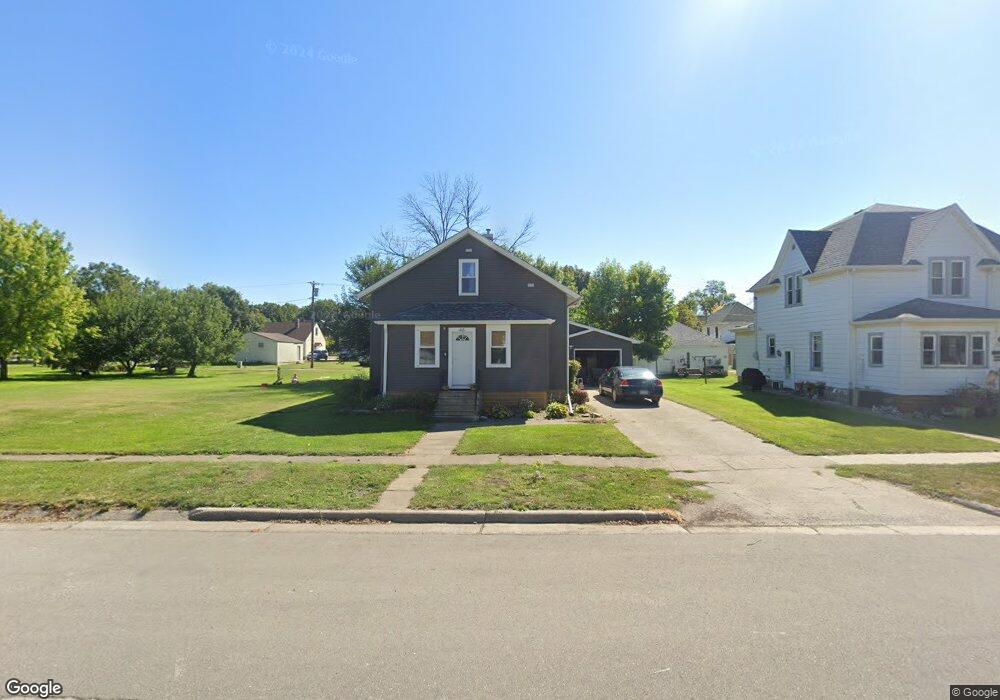
515 5th St Whittemore, IA 50598
Estimated Value: $108,000 - $125,000
2
Beds
1
Bath
1,305
Sq Ft
$88/Sq Ft
Est. Value
About This Home
This home is located at 515 5th St, Whittemore, IA 50598 and is currently estimated at $114,916, approximately $88 per square foot. 515 5th St is a home located in Kossuth County with nearby schools including Bertha Godfrey Elementary School, Bryant Elementary School, and Lucia Wallace Elementary School.
Ownership History
Date
Name
Owned For
Owner Type
Purchase Details
Closed on
Jan 27, 2010
Sold by
Householder Warren W and Householder Jean M
Bought by
Ostwald Justin R and Ostwald Diana
Current Estimated Value
Home Financials for this Owner
Home Financials are based on the most recent Mortgage that was taken out on this home.
Original Mortgage
$38,610
Outstanding Balance
$26,505
Interest Rate
5.87%
Mortgage Type
Adjustable Rate Mortgage/ARM
Estimated Equity
$88,411
Create a Home Valuation Report for This Property
The Home Valuation Report is an in-depth analysis detailing your home's value as well as a comparison with similar homes in the area
Home Values in the Area
Average Home Value in this Area
Purchase History
| Date | Buyer | Sale Price | Title Company |
|---|---|---|---|
| Ostwald Justin R | $43,000 | None Available |
Source: Public Records
Mortgage History
| Date | Status | Borrower | Loan Amount |
|---|---|---|---|
| Open | Ostwald Justin R | $38,610 |
Source: Public Records
Tax History Compared to Growth
Tax History
| Year | Tax Paid | Tax Assessment Tax Assessment Total Assessment is a certain percentage of the fair market value that is determined by local assessors to be the total taxable value of land and additions on the property. | Land | Improvement |
|---|---|---|---|---|
| 2025 | $1,106 | $89,259 | $6,270 | $82,989 |
| 2024 | $1,106 | $76,056 | $6,270 | $69,786 |
| 2023 | $5 | $76,056 | $6,270 | $69,786 |
| 2022 | $835 | $74,470 | $6,270 | $68,200 |
| 2021 | $796 | $53,768 | $6,270 | $47,498 |
| 2020 | $780 | $52,114 | $7,260 | $44,854 |
| 2019 | $780 | $50,365 | $0 | $0 |
| 2018 | $748 | $50,365 | $0 | $0 |
| 2017 | $672 | $45,877 | $0 | $0 |
| 2016 | $672 | $45,877 | $0 | $0 |
| 2015 | $672 | $40,934 | $0 | $0 |
| 2014 | $578 | $40,934 | $0 | $0 |
Source: Public Records
Map
Nearby Homes