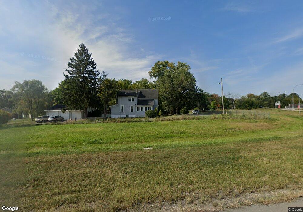
515 Arnold Ave Mansfield, OH 44903
Estimated Value: $68,408 - $89,000
3
Beds
1
Bath
874
Sq Ft
$87/Sq Ft
Est. Value
About This Home
This home is located at 515 Arnold Ave, Mansfield, OH 44903 and is currently estimated at $75,852, approximately $86 per square foot. 515 Arnold Ave is a home located in Richland County with nearby schools including Foundation Academy, Mansfield Elective Academy, and Interactive Media & Construction (IMAC) Academy.
Ownership History
Date
Name
Owned For
Owner Type
Purchase Details
Closed on
Jan 15, 2004
Sold by
Rahall Vicki S
Bought by
Rahall Vicki S and Eaton William
Current Estimated Value
Home Financials for this Owner
Home Financials are based on the most recent Mortgage that was taken out on this home.
Original Mortgage
$60,500
Outstanding Balance
$28,313
Interest Rate
5.91%
Mortgage Type
Purchase Money Mortgage
Estimated Equity
$47,539
Purchase Details
Closed on
Jun 19, 2000
Sold by
Clay Donald E
Bought by
Rahall Vicki S
Home Financials for this Owner
Home Financials are based on the most recent Mortgage that was taken out on this home.
Original Mortgage
$32,800
Interest Rate
11.6%
Mortgage Type
New Conventional
Purchase Details
Closed on
Feb 8, 1999
Sold by
Mcclintock Charles
Bought by
Clay Donald E
Home Financials for this Owner
Home Financials are based on the most recent Mortgage that was taken out on this home.
Original Mortgage
$27,000
Interest Rate
6.81%
Mortgage Type
New Conventional
Create a Home Valuation Report for This Property
The Home Valuation Report is an in-depth analysis detailing your home's value as well as a comparison with similar homes in the area
Home Values in the Area
Average Home Value in this Area
Purchase History
| Date | Buyer | Sale Price | Title Company |
|---|---|---|---|
| Rahall Vicki S | $30,250 | Chelsea Title Agency | |
| Rahall Vicki S | $41,000 | -- | |
| Clay Donald E | $30,000 | -- |
Source: Public Records
Mortgage History
| Date | Status | Borrower | Loan Amount |
|---|---|---|---|
| Open | Rahall Vicki S | $60,500 | |
| Closed | Rahall Vicki S | $32,800 | |
| Previous Owner | Clay Donald E | $27,000 |
Source: Public Records
Tax History
| Year | Tax Paid | Tax Assessment Tax Assessment Total Assessment is a certain percentage of the fair market value that is determined by local assessors to be the total taxable value of land and additions on the property. | Land | Improvement |
|---|---|---|---|---|
| 2024 | $655 | $14,300 | $2,090 | $12,210 |
| 2023 | $670 | $14,300 | $2,090 | $12,210 |
| 2022 | $632 | $11,300 | $1,900 | $9,400 |
| 2021 | $636 | $11,300 | $1,900 | $9,400 |
| 2020 | $650 | $11,300 | $1,900 | $9,400 |
| 2019 | $721 | $11,300 | $1,900 | $9,400 |
| 2018 | $711 | $11,300 | $1,900 | $9,400 |
| 2017 | $714 | $11,300 | $1,900 | $9,400 |
| 2016 | $736 | $11,650 | $1,750 | $9,900 |
| 2015 | $703 | $11,650 | $1,750 | $9,900 |
| 2014 | $693 | $11,650 | $1,750 | $9,900 |
| 2012 | $278 | $12,260 | $1,840 | $10,420 |
Source: Public Records
Map
Nearby Homes
- 516 Burns St
- 572 France St
- 701 Springmill St
- 492 Stark St
- 0 State Route 314 Unit 9069650
- 688 Mcpherson St
- 0 Voegele Ave Unit Lot 6048, 6049, 6
- 739 Armstrong St
- 0 Lemley Ave Unit 9070540
- 447 Spayer Ln
- 799 Mcpherson St
- 641 Averill Ave
- 230 Rae Ave
- 524 Lida St
- 368 W 6th St
- 212 Penn Ave
- 580 N Mulberry St
- 118 Raymond Ave
- 344 W 5th St
- 891 Springmill Rd
Your Personal Tour Guide
Ask me questions while you tour the home.