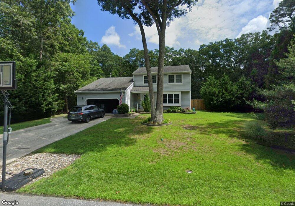
515 Forrest Brook Dr Galloway, NJ 08205
Estimated Value: $420,000 - $448,000
3
Beds
3
Baths
2,100
Sq Ft
$208/Sq Ft
Est. Value
About This Home
This home is located at 515 Forrest Brook Dr, Galloway, NJ 08205 and is currently estimated at $436,189, approximately $207 per square foot. 515 Forrest Brook Dr is a home located in Atlantic County with nearby schools including Absegami High School, Oakcrest High School, and Cedar Creek High School.
Ownership History
Date
Name
Owned For
Owner Type
Purchase Details
Closed on
Jun 30, 2009
Sold by
Parson Thomas and Parson Theresa
Bought by
Delbaugh Douglas and Delbaugh Anne Marie
Current Estimated Value
Home Financials for this Owner
Home Financials are based on the most recent Mortgage that was taken out on this home.
Original Mortgage
$209,500
Outstanding Balance
$134,068
Interest Rate
4.93%
Mortgage Type
Purchase Money Mortgage
Estimated Equity
$302,121
Create a Home Valuation Report for This Property
The Home Valuation Report is an in-depth analysis detailing your home's value as well as a comparison with similar homes in the area
Home Values in the Area
Average Home Value in this Area
Purchase History
| Date | Buyer | Sale Price | Title Company |
|---|---|---|---|
| Delbaugh Douglas | $262,500 | Commonwealth Land Title Insu |
Source: Public Records
Mortgage History
| Date | Status | Borrower | Loan Amount |
|---|---|---|---|
| Open | Delbaugh Douglas | $209,500 |
Source: Public Records
Tax History Compared to Growth
Tax History
| Year | Tax Paid | Tax Assessment Tax Assessment Total Assessment is a certain percentage of the fair market value that is determined by local assessors to be the total taxable value of land and additions on the property. | Land | Improvement |
|---|---|---|---|---|
| 2025 | $6,993 | $209,500 | $53,800 | $155,700 |
| 2024 | $6,993 | $209,500 | $53,800 | $155,700 |
| 2023 | $6,727 | $209,500 | $53,800 | $155,700 |
| 2022 | $6,727 | $209,500 | $53,800 | $155,700 |
| 2021 | $6,593 | $209,500 | $53,800 | $155,700 |
| 2020 | $6,488 | $209,500 | $53,800 | $155,700 |
| 2019 | $6,369 | $209,500 | $53,800 | $155,700 |
| 2018 | $6,459 | $209,500 | $53,800 | $155,700 |
| 2017 | $6,459 | $209,500 | $53,800 | $155,700 |
| 2016 | $5,819 | $190,400 | $53,800 | $136,600 |
| 2015 | $5,792 | $190,400 | $53,800 | $136,600 |
| 2014 | $5,600 | $190,400 | $53,800 | $136,600 |
Source: Public Records
Map
Nearby Homes
- 515 E Brook Ln
- 506 E Forestbrook Dr
- 428 E Elm Ave
- 546 A E Brook Ln
- 0 E Dickinson Ave
- 611 S New York Rd
- 613 S New York Rd
- 621 S New York Rd
- 90 E Woodland Ave Unit E90
- 743 N Shore Rd
- 47 E Woodland Ave Unit C47
- 399 E Upland Ave
- 19 E Woodland Ave Unit E101
- 503 S Seaview Ave
- 709 E Pennsylvania Ave
- Block:1223 lot:10.02 New York Rd
- 709 E Chip Shot Ln
- 625 N Shore Rd
- 615 N Shore Rd
- 4 E Curran Dr
- 515 Forrest Brook Dr
- 513 Forrest Brook Dr
- 517 Forrest Brook Dr
- 532 Forrest Brook Dr
- 534 Forrest Brook Dr
- 534 Forrest Brook Dr
- 530 Forrest Brook Dr
- 511 Forrest Brook Dr
- 529 Forrest Brook Dr
- 519 Forrest Brook Dr
- 520 Forrest Brook Dr
- 520 Forrest Brook Dr
- 528 Forrest Brook Dr
- 509 Forrest Brook Dr
- 509 Forrest Brook Dr
- 518 Forrest Brook Dr
- 522 Forrest Brook Dr
- 525 Forrest Brook Dr
- 516 Forrest Brook Dr
- 521 Forrest Brook Dr