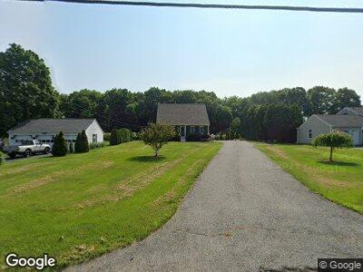
515 Maple Ave Swansea, MA 02777
Estimated Value: $479,000 - $557,000
3
Beds
2
Baths
1,455
Sq Ft
$364/Sq Ft
Est. Value
About This Home
This home is located at 515 Maple Ave, Swansea, MA 02777 and is currently estimated at $529,881, approximately $364 per square foot. 515 Maple Ave is a home located in Bristol County with nearby schools including Joseph Case High School and Swansea Wood School.
Ownership History
Date
Name
Owned For
Owner Type
Purchase Details
Closed on
Nov 13, 2009
Sold by
Neves Lisa and Lachapelle Lucille
Bought by
Neves Lisa
Current Estimated Value
Purchase Details
Closed on
Mar 29, 2000
Sold by
Lima John A and Lima Christine M
Bought by
Neves Lisa and Lachapelle Lucille
Purchase Details
Closed on
Jul 24, 1996
Sold by
Hopkins Doris B
Bought by
Rose Timothy
Purchase Details
Closed on
Sep 1, 1995
Sold by
Martin Robert J
Bought by
Fort Phoenix Rt
Purchase Details
Closed on
May 31, 1991
Sold by
Langill Alice L
Bought by
Ferland Edward J and Ferland Linda M
Purchase Details
Closed on
Feb 11, 1991
Sold by
Benoit Albert L and Benoit Irene M
Bought by
Debarros Vasco and Debarros Matilde
Purchase Details
Closed on
May 14, 1987
Sold by
Yale Russell J
Bought by
Wilson David
Create a Home Valuation Report for This Property
The Home Valuation Report is an in-depth analysis detailing your home's value as well as a comparison with similar homes in the area
Home Values in the Area
Average Home Value in this Area
Purchase History
| Date | Buyer | Sale Price | Title Company |
|---|---|---|---|
| Neves Lisa | -- | -- | |
| Neves Lisa | $170,000 | -- | |
| Rose Timothy | $35,000 | -- | |
| Fort Phoenix Rt | $25,000 | -- | |
| Ferland Edward J | $20,000 | -- | |
| Debarros Vasco | $116,000 | -- | |
| Wilson David | $195,000 | -- |
Source: Public Records
Mortgage History
| Date | Status | Borrower | Loan Amount |
|---|---|---|---|
| Open | Neves Lisa | $185,000 | |
| Previous Owner | Neves Lisa | $202,000 | |
| Previous Owner | Neves Lisa | $37,000 | |
| Previous Owner | Neves Lisa | $18,000 | |
| Previous Owner | Neves Lisa | $164,000 | |
| Previous Owner | Wilson David | $148,000 | |
| Previous Owner | Wilson David | $14,000 |
Source: Public Records
Tax History Compared to Growth
Tax History
| Year | Tax Paid | Tax Assessment Tax Assessment Total Assessment is a certain percentage of the fair market value that is determined by local assessors to be the total taxable value of land and additions on the property. | Land | Improvement |
|---|---|---|---|---|
| 2025 | $5,710 | $479,000 | $155,000 | $324,000 |
| 2024 | $5,671 | $473,000 | $155,000 | $318,000 |
| 2023 | $4,954 | $377,300 | $113,500 | $263,800 |
| 2022 | $4,818 | $334,800 | $103,200 | $231,600 |
| 2021 | $4,389 | $280,800 | $103,200 | $177,600 |
| 2020 | $4,372 | $280,600 | $103,200 | $177,400 |
| 2019 | $4,115 | $265,300 | $91,800 | $173,500 |
| 2018 | $4,029 | $263,700 | $90,200 | $173,500 |
| 2017 | $3,607 | $271,600 | $90,200 | $181,400 |
| 2016 | $3,412 | $252,400 | $78,000 | $174,400 |
| 2015 | $3,160 | $240,700 | $78,000 | $162,700 |
| 2014 | $3,037 | $236,500 | $78,000 | $158,500 |
Source: Public Records
Map
Nearby Homes
- 998 Wood St
- 0 Grand Army of the Republic Hwy
- 73 Maple Ave
- 0 Community Ln (Ss)
- 17 Paula Dr
- 89 Cypress Dr
- 0 Proprietors Way Unit 73324662
- 19 Lazywood Ln
- 9 Hidden Woods Place
- 397RR Locust St
- 39 Oliver Way
- 196 Bushee Rd
- 397 Locust St
- 356 Old Fall River Rd
- 284 Hortonville Rd
- 5 Daniel Ln
- 0 Hortonville Rd Unit 73242268
- 2 Mount Hope Ave
- 56 Evergreen Dr
- 32 Macomber Ave