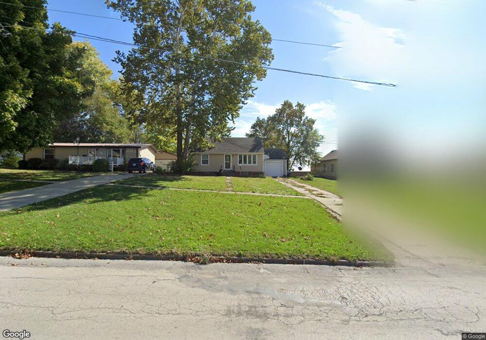
515 New York Ave Creston, IA 50801
Estimated Value: $84,095 - $121,000
2
Beds
1
Bath
768
Sq Ft
$125/Sq Ft
Est. Value
About This Home
This home is located at 515 New York Ave, Creston, IA 50801 and is currently estimated at $95,774, approximately $124 per square foot. 515 New York Ave is a home located in Union County with nearby schools including Creston Early Childhood Center, Creston Elementary School, and Creston Middle School.
Ownership History
Date
Name
Owned For
Owner Type
Purchase Details
Closed on
May 5, 2015
Sold by
Saxton Roger and Saxton Mary
Bought by
Klontz Nicolas A
Current Estimated Value
Home Financials for this Owner
Home Financials are based on the most recent Mortgage that was taken out on this home.
Original Mortgage
$6,632
Outstanding Balance
$5,098
Interest Rate
3.62%
Mortgage Type
New Conventional
Estimated Equity
$90,676
Create a Home Valuation Report for This Property
The Home Valuation Report is an in-depth analysis detailing your home's value as well as a comparison with similar homes in the area
Home Values in the Area
Average Home Value in this Area
Purchase History
| Date | Buyer | Sale Price | Title Company |
|---|---|---|---|
| Klontz Nicolas A | $55,500 | None Available |
Source: Public Records
Mortgage History
| Date | Status | Borrower | Loan Amount |
|---|---|---|---|
| Open | Klontz Nicolas A | $6,632 |
Source: Public Records
Tax History Compared to Growth
Tax History
| Year | Tax Paid | Tax Assessment Tax Assessment Total Assessment is a certain percentage of the fair market value that is determined by local assessors to be the total taxable value of land and additions on the property. | Land | Improvement |
|---|---|---|---|---|
| 2025 | $1,390 | $83,640 | $8,480 | $75,160 |
| 2024 | $1,390 | $74,640 | $8,480 | $66,160 |
| 2023 | $1,576 | $76,620 | $9,560 | $67,060 |
| 2022 | $1,742 | $65,270 | $9,560 | $55,710 |
| 2021 | $1,562 | $61,000 | $8,930 | $52,070 |
| 2020 | $1,422 | $57,390 | $7,500 | $49,890 |
| 2019 | $1,450 | $57,390 | $0 | $0 |
| 2018 | $1,384 | $57,390 | $0 | $0 |
| 2017 | $1,384 | $57,390 | $0 | $0 |
| 2016 | $1,378 | $57,390 | $0 | $0 |
| 2015 | $1,378 | $52,650 | $0 | $0 |
| 2014 | $1,298 | $52,650 | $0 | $0 |
Source: Public Records
Map
Nearby Homes
- 519 New York Ave
- 510 Wyoming Ave
- 411 New York Ave
- 700 Hickory St
- 203 Russell St
- 606 S Elm St
- 408 S Elm St
- 104 S Sumner Ave
- 600 W Adams St Unit B South Side
- 1100 W Jefferson St
- 103 N Sumner Ave
- 103 N Sycamore St
- 602 W Montgomery St
- 609 W Montgomery St
- 203 N Jarvis St
- 1104 W Adams St
- 915 W Montgomery St
- 101 S Stone St
- 605 S Pine St
- 1109 W Mills St
- 517 New York Ave
- 513 & 511 New York Ave
- 509 New York Ave
- 521 New York Ave
- 523 New York Ave
- 518 New York Ave
- 516 New York Ave
- 506 New York Ave
- 507 New York Ave
- 505 New York Ave
- 500 New York Ave
- 516 Livingston Ave
- 510 Livingston Ave
- 704 W Fremont St
- 501 New York Ave
- 508 Livingston Ave
- 506 Livingston Ave
- 426 New York Ave
- 512 Livingston Ave
- 500 Livingston Ave