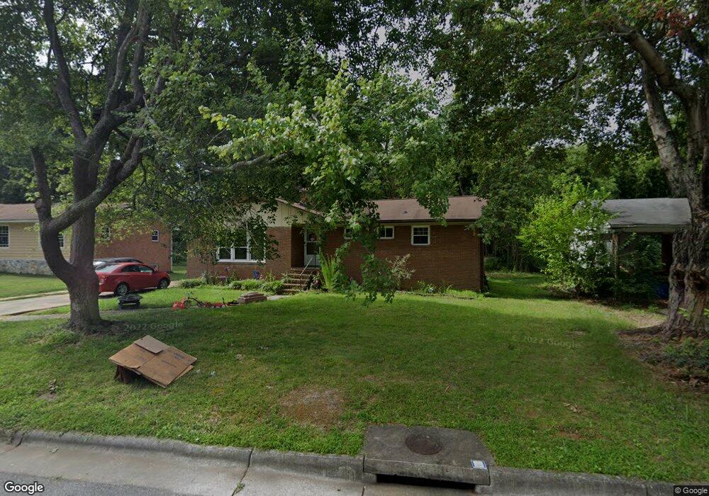
515 Sherbrook Dr High Point, NC 27262
Greater High Point NeighborhoodEstimated Value: $227,000 - $282,000
3
Beds
2
Baths
1,613
Sq Ft
$162/Sq Ft
Est. Value
About This Home
This home is located at 515 Sherbrook Dr, High Point, NC 27262 and is currently estimated at $260,800, approximately $161 per square foot. 515 Sherbrook Dr is a home located in Guilford County with nearby schools including Oak View Elementary School, Ferndale Middle School, and High Point Central High School.
Ownership History
Date
Name
Owned For
Owner Type
Purchase Details
Closed on
Mar 12, 2025
Sold by
Buchanan Annette
Bought by
Grant Michael and Grant Tara
Current Estimated Value
Purchase Details
Closed on
Dec 24, 2003
Sold by
Carpenter Deborah T
Bought by
Buchanan Beryl
Home Financials for this Owner
Home Financials are based on the most recent Mortgage that was taken out on this home.
Original Mortgage
$87,300
Interest Rate
6.05%
Mortgage Type
Purchase Money Mortgage
Purchase Details
Closed on
Dec 23, 2003
Sold by
Kelemen Mary Jan T and Kelemen Marc P
Bought by
Buchanan Beryl
Home Financials for this Owner
Home Financials are based on the most recent Mortgage that was taken out on this home.
Original Mortgage
$87,300
Interest Rate
6.05%
Mortgage Type
Purchase Money Mortgage
Purchase Details
Closed on
Dec 21, 2003
Sold by
Tucker Robert Jay C and Tucker Laura F
Bought by
Buchanan Beryl
Home Financials for this Owner
Home Financials are based on the most recent Mortgage that was taken out on this home.
Original Mortgage
$87,300
Interest Rate
6.05%
Mortgage Type
Purchase Money Mortgage
Create a Home Valuation Report for This Property
The Home Valuation Report is an in-depth analysis detailing your home's value as well as a comparison with similar homes in the area
Home Values in the Area
Average Home Value in this Area
Purchase History
| Date | Buyer | Sale Price | Title Company |
|---|---|---|---|
| Grant Michael | -- | None Listed On Document | |
| Grant Michael | -- | None Listed On Document | |
| Buchanan Beryl | -- | -- | |
| Buchanan Beryl | -- | -- | |
| Buchanan Beryl | $97,000 | -- |
Source: Public Records
Mortgage History
| Date | Status | Borrower | Loan Amount |
|---|---|---|---|
| Previous Owner | Buchanan Beryl | $87,300 |
Source: Public Records
Tax History
| Year | Tax Paid | Tax Assessment Tax Assessment Total Assessment is a certain percentage of the fair market value that is determined by local assessors to be the total taxable value of land and additions on the property. | Land | Improvement |
|---|---|---|---|---|
| 2025 | $2,323 | $168,600 | $38,000 | $130,600 |
| 2024 | $2,323 | $168,600 | $38,000 | $130,600 |
| 2023 | $2,323 | $168,600 | $38,000 | $130,600 |
| 2022 | $2,273 | $168,600 | $38,000 | $130,600 |
| 2021 | $1,891 | $137,200 | $25,000 | $112,200 |
| 2020 | $1,891 | $137,200 | $25,000 | $112,200 |
| 2019 | $1,891 | $137,200 | $0 | $0 |
| 2018 | $1,881 | $137,200 | $0 | $0 |
| 2017 | $1,891 | $137,200 | $0 | $0 |
| 2016 | $1,792 | $127,800 | $0 | $0 |
| 2015 | $1,802 | $127,800 | $0 | $0 |
| 2014 | $1,833 | $127,800 | $0 | $0 |
Source: Public Records
Map
Nearby Homes
- 1508 Wendover Dr
- 607 Rockspring Rd
- 708 Rockspring Rd
- 443 W Lexington Ave
- 1700 Long St
- 1311 Prescott Place
- 417 Hillcrest Dr
- 914 Flicker Ln
- 427 Woodbrook Dr
- 416 Greenwood Dr
- 1001 Nuthatch Ct
- 510 Greenwood Dr
- 506 Greenwood Dr
- 510 Otteray Ave
- 207 Hillcrest Dr
- 1507 Larkin St
- 1607 Larkin St
- 101 Oxford Place Unit 19
- 1101 Robin Hood Rd
- 1602 Larkin St
- 513 Sherbrook Dr
- 517 Sherbrook Dr
- 510 Hayworth Cir
- 512 Hayworth Cir
- 508 Hayworth Cir
- 515 Birchwood Dr
- 603 Sherbrook Dr
- 512 Sherbrook Dr
- 514 Hayworth Cir
- 506 Hayworth Cir
- 602 Sherbrook Dr
- 510 Sherbrook Dr
- 509 Sherbrook Dr
- 509 Hayworth Cir
- 605 Sherbrook Dr
- 511 Hayworth Cir
- 513 Birchwood Dr
- 516 Hayworth Cir
- 507 Hayworth Cir
- 504 Hayworth Cir
Your Personal Tour Guide
Ask me questions while you tour the home.