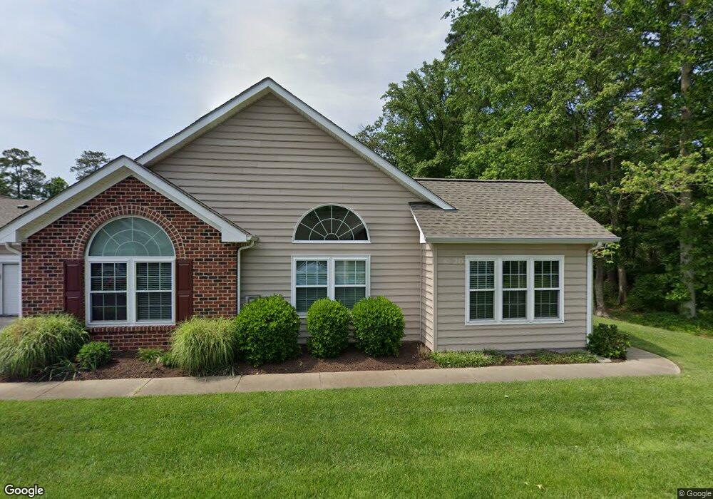
516 Tabb Smith Trail Yorktown, VA 23693
Tabb NeighborhoodEstimated Value: $368,840 - $384,000
2
Beds
2
Baths
1,622
Sq Ft
$234/Sq Ft
Est. Value
About This Home
This home is located at 516 Tabb Smith Trail, Yorktown, VA 23693 and is currently estimated at $379,210, approximately $233 per square foot. 516 Tabb Smith Trail is a home located in York County with nearby schools including Tabb Elementary School, Tabb Middle School, and Tabb High School.
Ownership History
Date
Name
Owned For
Owner Type
Purchase Details
Closed on
Jun 11, 2020
Sold by
Wassmer Bernice
Bought by
Golart Kevin P and Golart Erika J
Current Estimated Value
Home Financials for this Owner
Home Financials are based on the most recent Mortgage that was taken out on this home.
Original Mortgage
$208,000
Interest Rate
2.7%
Mortgage Type
New Conventional
Purchase Details
Closed on
Aug 12, 2019
Sold by
Wassmer Jeffrey D and Wassmer Bernice
Bought by
Wassmer Bernice
Create a Home Valuation Report for This Property
The Home Valuation Report is an in-depth analysis detailing your home's value as well as a comparison with similar homes in the area
Home Values in the Area
Average Home Value in this Area
Purchase History
| Date | Buyer | Sale Price | Title Company |
|---|---|---|---|
| Golart Kevin P | $260,000 | Home Title Of Virginia Llc | |
| Wassmer Bernice | -- | None Available |
Source: Public Records
Mortgage History
| Date | Status | Borrower | Loan Amount |
|---|---|---|---|
| Previous Owner | Golart Kevin P | $208,000 |
Source: Public Records
Tax History Compared to Growth
Tax History
| Year | Tax Paid | Tax Assessment Tax Assessment Total Assessment is a certain percentage of the fair market value that is determined by local assessors to be the total taxable value of land and additions on the property. | Land | Improvement |
|---|---|---|---|---|
| 2025 | $2,494 | $337,000 | $80,000 | $257,000 |
| 2024 | $2,494 | $337,000 | $80,000 | $257,000 |
| 2023 | $2,024 | $262,900 | $80,000 | $182,900 |
| 2022 | $2,051 | $262,900 | $80,000 | $182,900 |
| 2021 | $1,972 | $248,000 | $72,000 | $176,000 |
| 2020 | $1,972 | $248,000 | $72,000 | $176,000 |
| 2019 | $2,793 | $245,000 | $69,000 | $176,000 |
| 2018 | $2,793 | $245,000 | $69,000 | $176,000 |
| 2017 | $1,826 | $243,000 | $0 | $243,000 |
| 2016 | -- | $243,000 | $0 | $243,000 |
| 2015 | -- | $251,800 | $0 | $251,800 |
| 2014 | -- | $251,800 | $0 | $251,800 |
Source: Public Records
Map
Nearby Homes
- 604 Tabb Smith Trail
- 111 Hautz Way
- 129 Ponsonby Dr
- 323 Vista Point Dr
- 104 Camden Way Unit G
- 104 Camden Way
- 209 Cattail Ln
- 201 Amersham Dr Unit B
- 205 Amersham Dr
- 205 Amersham Dr Unit B
- 301 Derby Run
- 105 Overlook Point
- 14 Firefly Ln
- 6+ AC Vista Point Dr
- 200 Clay Pipe Ln
- 3017 Hampton Hwy
- 123 Locust Ln
- 102 Corwin Cir
- 90 Madison Chase
- 55 Madison Chase
- 520 Tabb Smith Trail
- 514 Tabb Smith Trail
- 518 Tabb Smith Trail
- 508 Tabb Smith Trail
- 510 Tabb Smith Trail
- 602 Tabb Smith Trail
- 506 Tabb Smith Trail
- 600 Tabb Smith Trail
- 606 Tabb Smith Trail
- 513 Tabb Smith Trail
- 512-Z Tabb Smith Trail
- 128 Hautz Way
- 500 Tabb Smith Trail
- 507 Tabb Smith Trail
- 502 Tabb Smith Trail
- 601 Tabb Smith Trail
- 610 Tabb Smith Trail
- 612 Tabb Smith Trail
- 101 Dockside Way
- 135 Hautz Way