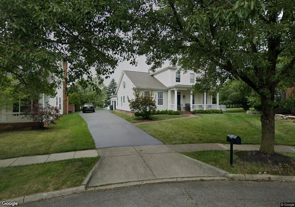
5161 Marks Ct New Albany, OH 43054
Fodor NeighborhoodEstimated Value: $583,000 - $650,000
4
Beds
3
Baths
2,482
Sq Ft
$252/Sq Ft
Est. Value
About This Home
This home is located at 5161 Marks Ct, New Albany, OH 43054 and is currently estimated at $625,980, approximately $252 per square foot. 5161 Marks Ct is a home located in Franklin County with nearby schools including New Albany Primary School, New Albany Intermediate School, and New Albany Middle School.
Ownership History
Date
Name
Owned For
Owner Type
Purchase Details
Closed on
Aug 3, 2021
Sold by
Estate Of Irina Ryazansky
Bought by
Zuravlov Roman
Current Estimated Value
Purchase Details
Closed on
Jul 10, 2018
Sold by
Wilson Ronald C and Fifth Third Mortgage Co
Bought by
Mirinvest Llc
Purchase Details
Closed on
Jul 22, 2015
Sold by
U S Bank N A
Bought by
Zuravlov Roman
Create a Home Valuation Report for This Property
The Home Valuation Report is an in-depth analysis detailing your home's value as well as a comparison with similar homes in the area
Home Values in the Area
Average Home Value in this Area
Purchase History
| Date | Buyer | Sale Price | Title Company |
|---|---|---|---|
| Zuravlov Roman | -- | None Available | |
| Mirinvest Llc | $100,700 | None Available | |
| Zuravlov Roman | $35,000 | Gahanna Title Agency |
Source: Public Records
Tax History
| Year | Tax Paid | Tax Assessment Tax Assessment Total Assessment is a certain percentage of the fair market value that is determined by local assessors to be the total taxable value of land and additions on the property. | Land | Improvement |
|---|---|---|---|---|
| 2025 | $10,602 | $194,960 | $55,830 | $139,130 |
| 2024 | $10,602 | $194,960 | $55,830 | $139,130 |
| 2023 | $10,514 | $194,950 | $55,825 | $139,125 |
| 2022 | $9,822 | $138,890 | $37,700 | $101,190 |
| 2021 | $9,417 | $138,890 | $37,700 | $101,190 |
| 2020 | $9,342 | $138,890 | $37,700 | $101,190 |
| 2019 | $8,477 | $114,560 | $31,430 | $83,130 |
| 2018 | $8,135 | $114,560 | $31,430 | $83,130 |
| 2017 | $8,458 | $114,560 | $31,430 | $83,130 |
| 2016 | $7,891 | $98,140 | $23,450 | $74,690 |
| 2015 | $7,909 | $98,140 | $23,450 | $74,690 |
| 2014 | $7,558 | $98,140 | $23,450 | $74,690 |
| 2013 | $3,899 | $93,450 | $22,330 | $71,120 |
Source: Public Records
Map
Nearby Homes
- 5069 Cloudberry Pass
- 5308 Apple Ridge Place Unit 5308
- 10 Pickett Place
- 7120 Connaught Dr
- 5328 Branscom Blvd
- 6836 Newrock Dr Unit 21
- 5556 Falco Dr
- 5326 Bridwell Ln
- 6431 Gossamer Ct
- 5412 Tathwell Dr Unit 39
- 6988 Greensward Rd
- 16 Wiveliscombe
- 0 N Hamilton Rd
- 6789 Rolfe Ave Unit 11
- 4554 Commons Park Dr
- 6940 Clivdon Mews
- 6463 Rose Garden Dr
- 5600 Apothecary Way
- 5604 Apothecary Way Unit 4
- 5396 Nottinghamshire Ln Unit 5396
- 5177 Marks Ct
- 5145 Marks Ct
- 5160 Mount Row
- 5176 Mount Row
- 5144 Mount Row
- 5192 Mount Row
- 5193 Marks Ct
- 5128 Mount Row
- 5204 Mount Row
- 5204 Mount Row Unit 101
- 5113 Marks Ct
- 5112 Mount Row
- 5130 Marks Ct
- 5220 Mount Row
- 5097 Marks Ct
- 6789 Upper Brook Way
- 5194 Marks Ct
- 6790 Upper Brook Way
- 5096 Mount Row
- 5236 Mount Row
Your Personal Tour Guide
Ask me questions while you tour the home.