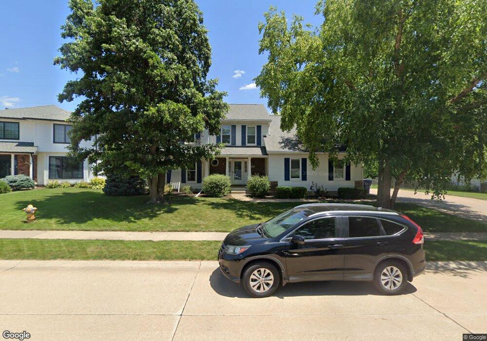
5163 Fox Ridge Rd Bettendorf, IA 52722
Estimated Value: $447,533 - $504,000
5
Beds
4
Baths
2,502
Sq Ft
$194/Sq Ft
Est. Value
About This Home
This home is located at 5163 Fox Ridge Rd, Bettendorf, IA 52722 and is currently estimated at $485,633, approximately $194 per square foot. 5163 Fox Ridge Rd is a home located in Scott County with nearby schools including Paul Norton Elementary School, Bettendorf Middle School, and Bettendorf High School.
Ownership History
Date
Name
Owned For
Owner Type
Purchase Details
Closed on
Jun 2, 2015
Sold by
Lipes Danny G and Lipes Brenda K
Bought by
Muehlbauer William W and Muehlbauer Lindsay L
Current Estimated Value
Home Financials for this Owner
Home Financials are based on the most recent Mortgage that was taken out on this home.
Original Mortgage
$263,600
Outstanding Balance
$204,094
Interest Rate
3.82%
Mortgage Type
New Conventional
Estimated Equity
$281,539
Create a Home Valuation Report for This Property
The Home Valuation Report is an in-depth analysis detailing your home's value as well as a comparison with similar homes in the area
Home Values in the Area
Average Home Value in this Area
Purchase History
| Date | Buyer | Sale Price | Title Company |
|---|---|---|---|
| Muehlbauer William W | $329,500 | Attorney |
Source: Public Records
Mortgage History
| Date | Status | Borrower | Loan Amount |
|---|---|---|---|
| Open | Muehlbauer William W | $263,600 |
Source: Public Records
Tax History Compared to Growth
Tax History
| Year | Tax Paid | Tax Assessment Tax Assessment Total Assessment is a certain percentage of the fair market value that is determined by local assessors to be the total taxable value of land and additions on the property. | Land | Improvement |
|---|---|---|---|---|
| 2025 | $6,210 | $475,000 | $103,300 | $371,700 |
| 2024 | $6,160 | $411,800 | $57,100 | $354,700 |
| 2023 | $6,000 | $411,800 | $57,100 | $354,700 |
| 2022 | $5,938 | $349,700 | $57,140 | $292,560 |
| 2021 | $5,938 | $349,700 | $57,140 | $292,560 |
| 2020 | $5,850 | $331,140 | $57,140 | $274,000 |
| 2019 | $6,244 | $342,820 | $57,140 | $285,680 |
| 2018 | $6,240 | $342,820 | $57,140 | $285,680 |
| 2017 | $1,907 | $342,820 | $57,140 | $285,680 |
| 2016 | $5,466 | $301,730 | $0 | $0 |
| 2015 | $5,466 | $288,650 | $0 | $0 |
| 2014 | $5,286 | $288,650 | $0 | $0 |
| 2013 | $5,168 | $0 | $0 | $0 |
| 2012 | -- | $291,410 | $40,100 | $251,310 |
Source: Public Records
Map
Nearby Homes
- 2744 Rosehill Ave
- 2946 Summertree Ave
- 4906 Fox Ridge Rd
- 2605 Hunter Rd
- 3115 Meridith Way
- 4730 Apple Valley Dr
- 3179 Meridith Way
- 4725 Kynnelworth Dr Unit 8
- 2510 Eastberry Ct
- 3347 Glenbrook Cir N
- 4255 Apple Valley Dr
- 4331 Augusta Ct
- 3260 Parkwild Dr Unit 3D
- 3405 Marynoel Ave
- 6547 Cardinal Rd
- 6559 Cardinal Rd
- 6202 Crow Valley Dr
- 4190 Mallard Ct Unit 10
- 3845 Prairie Ln
- 2315 Kingsway Dr
- 5143 Fox Ridge Rd
- 5185 Fox Ridge Rd
- 5114 Mayfield Dr
- 5112 Mayfield Dr
- 5122 Mayfield Dr
- 5150 Fox Ridge Rd
- 2729 Rosehill Ave
- 2760 Rosehill Ave
- 5128 Fox Ridge Rd
- 5202 Mayfield Dr
- 5097 Fox Ridge Rd
- 5022 Mayfield Dr
- 5104 Fox Ridge Rd
- 2722 Rosehill Ave
- 2695 Rosehill Ave
- 5151 Greystone Dr
- 5117 Mayfield Dr
- 5129 Greystone Dr
- 5131 Mayfield Dr
- 5113 Mayfield Dr