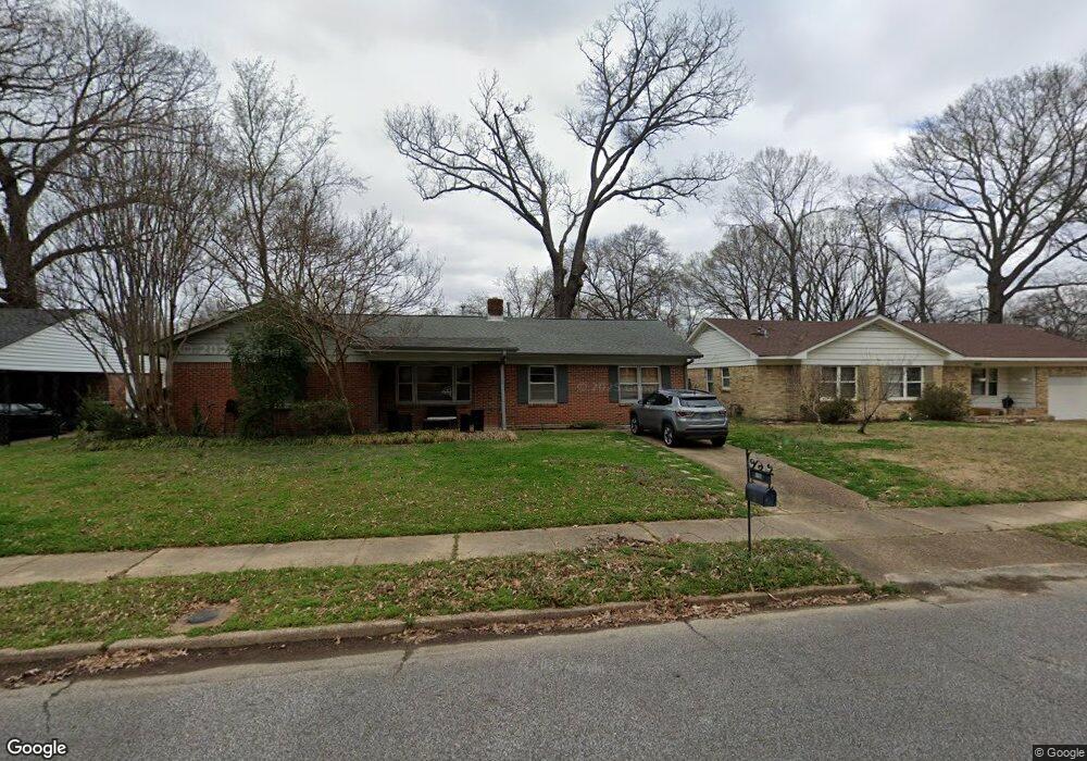
5166 Mason Rd Memphis, TN 38117
Audubon Park NeighborhoodEstimated Value: $305,490 - $332,000
3
Beds
3
Baths
2,012
Sq Ft
$159/Sq Ft
Est. Value
About This Home
This home is located at 5166 Mason Rd, Memphis, TN 38117 and is currently estimated at $319,873, approximately $158 per square foot. 5166 Mason Rd is a home located in Shelby County with nearby schools including Richland Elementary School, White Station Middle, and White Station High.
Ownership History
Date
Name
Owned For
Owner Type
Purchase Details
Closed on
Jun 28, 2007
Sold by
Gibert Stan E and Gibert Carrie J
Bought by
Kirkland Michael D
Current Estimated Value
Home Financials for this Owner
Home Financials are based on the most recent Mortgage that was taken out on this home.
Original Mortgage
$183,603
Outstanding Balance
$113,856
Interest Rate
6.35%
Mortgage Type
FHA
Estimated Equity
$206,017
Create a Home Valuation Report for This Property
The Home Valuation Report is an in-depth analysis detailing your home's value as well as a comparison with similar homes in the area
Home Values in the Area
Average Home Value in this Area
Purchase History
| Date | Buyer | Sale Price | Title Company |
|---|---|---|---|
| Kirkland Michael D | $186,000 | None Available |
Source: Public Records
Mortgage History
| Date | Status | Borrower | Loan Amount |
|---|---|---|---|
| Open | Kirkland Michael D | $183,603 |
Source: Public Records
Tax History Compared to Growth
Tax History
| Year | Tax Paid | Tax Assessment Tax Assessment Total Assessment is a certain percentage of the fair market value that is determined by local assessors to be the total taxable value of land and additions on the property. | Land | Improvement |
|---|---|---|---|---|
| 2025 | $2,244 | $72,600 | $9,775 | $62,825 |
| 2024 | $2,244 | $66,200 | $9,775 | $56,425 |
| 2023 | $4,033 | $66,200 | $9,775 | $56,425 |
| 2022 | $4,033 | $66,200 | $9,775 | $56,425 |
| 2021 | $4,080 | $66,200 | $9,775 | $56,425 |
| 2020 | $3,630 | $50,100 | $8,300 | $41,800 |
| 2019 | $3,630 | $50,100 | $8,300 | $41,800 |
| 2018 | $3,630 | $50,100 | $8,300 | $41,800 |
| 2017 | $2,059 | $50,100 | $8,300 | $41,800 |
| 2016 | $1,939 | $44,375 | $0 | $0 |
| 2014 | $1,939 | $44,375 | $0 | $0 |
Source: Public Records
Map
Nearby Homes
- 5121 Lynbar Ave
- 352 Leonora Dr
- 346 Leonora Dr
- 5238 Peg Ln
- 448 N White Station Rd
- 296 N White Station Rd
- 446 Rosser Rd
- 5119 Tarrytown Dr
- 258 N White Station Rd
- 5137 Whitehall Ave
- 226 N White Station Rd
- 496 Chalmers Rd
- 529 Fleda Rd
- 202 Betty jo Ln
- 5033 Henry Heights Dr
- 379 Mcelroy Rd
- 5017 Henry Heights Dr
- 551 N White Station Rd
- 5009 Henry Heights Dr
- 192 N White Station Rd