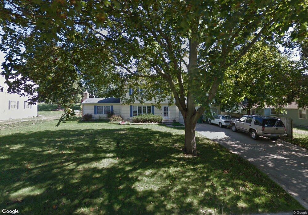
517 N Monroe St Hastings, MI 49058
Estimated Value: $246,000 - $279,000
3
Beds
2
Baths
1,594
Sq Ft
$165/Sq Ft
Est. Value
About This Home
This home is located at 517 N Monroe St, Hastings, MI 49058 and is currently estimated at $262,985, approximately $164 per square foot. 517 N Monroe St is a home located in Barry County with nearby schools including Hastings High School and St. Rose of Lima School.
Ownership History
Date
Name
Owned For
Owner Type
Purchase Details
Closed on
May 24, 2015
Sold by
The Gilbert Blok & Nancy J Blok Revocabl and Block Nancy J
Bought by
Blok Nancy J
Current Estimated Value
Purchase Details
Closed on
Feb 25, 2015
Sold by
Casarez Wesley R and Casarez Jennifer L
Bought by
Volosky Randy S and Volosky Victoria L
Home Financials for this Owner
Home Financials are based on the most recent Mortgage that was taken out on this home.
Original Mortgage
$110,000
Interest Rate
3.64%
Mortgage Type
USDA
Purchase Details
Closed on
Jan 12, 2001
Bought by
Casarez Wesley R and Casarez Jennifer L
Create a Home Valuation Report for This Property
The Home Valuation Report is an in-depth analysis detailing your home's value as well as a comparison with similar homes in the area
Home Values in the Area
Average Home Value in this Area
Purchase History
| Date | Buyer | Sale Price | Title Company |
|---|---|---|---|
| Blok Nancy J | -- | Attorney | |
| Volosky Randy S | $110,000 | Lighthouse Title Inc | |
| Casarez Wesley R | $137,000 | -- |
Source: Public Records
Mortgage History
| Date | Status | Borrower | Loan Amount |
|---|---|---|---|
| Previous Owner | Volosky Randy S | $110,000 |
Source: Public Records
Tax History Compared to Growth
Tax History
| Year | Tax Paid | Tax Assessment Tax Assessment Total Assessment is a certain percentage of the fair market value that is determined by local assessors to be the total taxable value of land and additions on the property. | Land | Improvement |
|---|---|---|---|---|
| 2025 | $2,639 | $118,200 | $0 | $0 |
| 2024 | $2,639 | $108,400 | $0 | $0 |
| 2023 | $2,430 | $95,900 | $0 | $0 |
| 2022 | $2,430 | $95,900 | $0 | $0 |
| 2021 | $2,430 | $81,900 | $0 | $0 |
| 2020 | $2,430 | $74,400 | $0 | $0 |
| 2019 | $2,430 | $67,900 | $0 | $0 |
| 2018 | $0 | $60,700 | $0 | $0 |
| 2017 | $0 | $61,900 | $0 | $0 |
| 2016 | -- | $54,500 | $0 | $0 |
| 2015 | -- | $54,000 | $0 | $0 |
| 2014 | -- | $54,000 | $0 | $0 |
Source: Public Records
Map
Nearby Homes
- 610 Riverwalk St Unit 18
- 618 Riverwalk St
- 1130 N Broadway St
- V/L S M 43 Hwy
- 903 N Michigan Ave
- 502 W State St
- 236 E Lincoln St
- 1544 Liberty Ln
- 727 N East St
- 714 W Green St
- 520 E Thorn St
- 112 E Green St
- 610 S Park St
- 344 E North St Unit 23
- 720 S Jefferson St Unit 722
- 502 W Clinton St
- 612 E Green St
- 000 E Mill St
- 821 S Michigan Ave
- 611 E Walnut St
- 525 N Monroe St
- 523 W Prairie Ave
- 512 N Congress St
- 518 N Congress St
- 506 N Congress St
- 520 N Monroe St
- 528 N Monroe St
- 512 N Monroe St
- 518 W Prairie Ave
- 526 W Prairie Ave
- 711 N Hillcrest Dr
- 501 W State Rd
- 510 W Prairie Ave
- 520 W State Rd
- 507 W State Rd
- 517 N Congress St
- 428 N Congress St
- 431 W State Rd
- 511 N Congress St
- 515 W State Rd