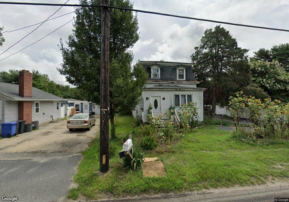
517 S Main St West Creek, NJ 08092
Stafford NeighborhoodEstimated Value: $340,000 - $456,000
3
Beds
1
Bath
1,388
Sq Ft
$286/Sq Ft
Est. Value
About This Home
This home is located at 517 S Main St, West Creek, NJ 08092 and is currently estimated at $396,411, approximately $285 per square foot. 517 S Main St is a home located in Ocean County with nearby schools including Oxycocus Elementary School, Ocean Acres Elementary School, and McKinley Avenue Elementary School.
Ownership History
Date
Name
Owned For
Owner Type
Purchase Details
Closed on
May 3, 2000
Sold by
Carey Michael
Bought by
Leal Marcelo and Leal Paula
Current Estimated Value
Home Financials for this Owner
Home Financials are based on the most recent Mortgage that was taken out on this home.
Original Mortgage
$73,400
Outstanding Balance
$25,485
Interest Rate
8.21%
Estimated Equity
$370,926
Purchase Details
Closed on
Aug 26, 1994
Sold by
Parker Julius
Bought by
Parker Michael and Parker Catherine
Create a Home Valuation Report for This Property
The Home Valuation Report is an in-depth analysis detailing your home's value as well as a comparison with similar homes in the area
Home Values in the Area
Average Home Value in this Area
Purchase History
| Date | Buyer | Sale Price | Title Company |
|---|---|---|---|
| Leal Marcelo | $77,300 | -- | |
| Parker Michael | $25,000 | -- |
Source: Public Records
Mortgage History
| Date | Status | Borrower | Loan Amount |
|---|---|---|---|
| Open | Leal Marcelo | $73,400 |
Source: Public Records
Tax History Compared to Growth
Tax History
| Year | Tax Paid | Tax Assessment Tax Assessment Total Assessment is a certain percentage of the fair market value that is determined by local assessors to be the total taxable value of land and additions on the property. | Land | Improvement |
|---|---|---|---|---|
| 2025 | $3,178 | $128,000 | $46,200 | $81,800 |
| 2024 | $3,148 | $128,000 | $46,200 | $81,800 |
| 2023 | $3,013 | $128,000 | $46,200 | $81,800 |
| 2022 | $3,013 | $128,000 | $46,200 | $81,800 |
| 2021 | $2,972 | $128,000 | $46,200 | $81,800 |
| 2020 | $2,976 | $128,000 | $46,200 | $81,800 |
| 2019 | $2,934 | $128,000 | $46,200 | $81,800 |
| 2018 | $2,916 | $128,000 | $46,200 | $81,800 |
| 2017 | $2,817 | $119,700 | $46,200 | $73,500 |
| 2016 | $2,788 | $119,700 | $46,200 | $73,500 |
| 2015 | $2,690 | $119,700 | $46,200 | $73,500 |
| 2014 | $2,703 | $118,800 | $46,200 | $72,600 |
Source: Public Records
Map
Nearby Homes
- 15 Cedar Hill Dr
- 1076 S Main St
- 40 Pine Grove Ave
- 84 Jennings Rd
- 75 Perry Ln
- 71 Oak Ridge Ln
- 30 Fort Lee Dr
- 36 Fort Lee Dr
- 25 N Union St
- 247 Jennings Rd
- 303 S Lakeshore Dr
- 76 Beach Ave
- 670 Julian Ct
- 275 Jennings Rd
- 0 Dinner Point Unit NJOC2036750
- 34 Holly Rd
- 49 Oxycocus Rd
- 129 Bruce Dr
- 0 Dinner Point Ave Unit 22526583
- 295 N Main St
- 515 S Main St
- 525 S Main St Unit D8
- 527 S Main St
- 531 S Main St
- 507 S Main St
- 507 S Main St
- 541 S Main St
- 6 Green Briar Rd
- 38 Cedar Run Dock Rd
- 0 Cedar Run Dock Rd
- 549 S Main Street (Rt 9)
- 550 S Main St
- 487 S Main St
- 508 S Main St
- 494 S Main St
- 57 Cedar Run Dock Rd
- 556 S Main St
- 65 Cedar Run Dock Rd
- 60 Cedar Run Dock Rd
- 551 S Main St