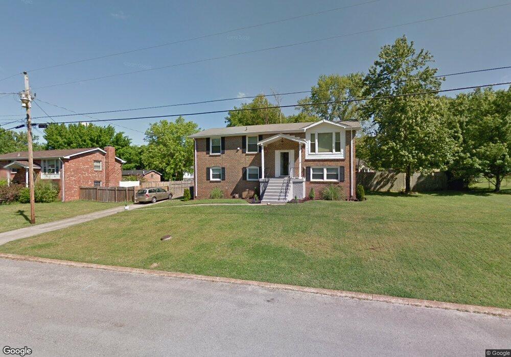
517 Sandy Dr Mount Juliet, TN 37122
Estimated Value: $354,000 - $423,000
4
Beds
2
Baths
2,200
Sq Ft
$172/Sq Ft
Est. Value
About This Home
This home is located at 517 Sandy Dr, Mount Juliet, TN 37122 and is currently estimated at $377,884, approximately $171 per square foot. 517 Sandy Dr is a home located in Wilson County with nearby schools including W.A. Wright Elementary School, Mt. Juliet Middle School, and Green Hill High School.
Ownership History
Date
Name
Owned For
Owner Type
Purchase Details
Closed on
Nov 19, 2010
Sold by
Jones Wilson
Bought by
Ols Bradley A
Current Estimated Value
Home Financials for this Owner
Home Financials are based on the most recent Mortgage that was taken out on this home.
Original Mortgage
$115,044
Outstanding Balance
$76,020
Interest Rate
4.3%
Estimated Equity
$301,864
Purchase Details
Closed on
Jul 16, 2010
Sold by
Rodger Mitchell Properties
Bought by
Jones Wilson
Purchase Details
Closed on
Mar 10, 1999
Sold by
John Biggerstaff
Bought by
Tamala O'Fallon=Venable
Purchase Details
Closed on
Dec 29, 1993
Sold by
Diehl Timothy A
Bought by
John Biggerstaff
Purchase Details
Closed on
Jul 12, 1985
Bought by
Diehl Timothy A
Create a Home Valuation Report for This Property
The Home Valuation Report is an in-depth analysis detailing your home's value as well as a comparison with similar homes in the area
Home Values in the Area
Average Home Value in this Area
Purchase History
| Date | Buyer | Sale Price | Title Company |
|---|---|---|---|
| Ols Bradley A | $119,900 | -- | |
| Jones Wilson | $87,000 | -- | |
| Rodger Mitchell Properties Llc | $87,000 | -- | |
| Tamala O'Fallon=Venable | $109,900 | -- | |
| Tamala O'Fallon-Venable | $109,900 | -- | |
| John Biggerstaff | $69,900 | -- | |
| Diehl Timothy A | -- | -- |
Source: Public Records
Mortgage History
| Date | Status | Borrower | Loan Amount |
|---|---|---|---|
| Open | Diehl Timothy A | $115,044 |
Source: Public Records
Tax History Compared to Growth
Tax History
| Year | Tax Paid | Tax Assessment Tax Assessment Total Assessment is a certain percentage of the fair market value that is determined by local assessors to be the total taxable value of land and additions on the property. | Land | Improvement |
|---|---|---|---|---|
| 2024 | $1,251 | $65,550 | $22,500 | $43,050 |
| 2022 | $1,251 | $65,550 | $22,500 | $43,050 |
| 2021 | $1,251 | $65,550 | $22,500 | $43,050 |
| 2020 | $1,190 | $65,550 | $22,500 | $43,050 |
| 2019 | $1,189 | $47,200 | $13,750 | $33,450 |
| 2018 | $1,189 | $47,200 | $13,750 | $33,450 |
| 2017 | $1,189 | $47,200 | $13,750 | $33,450 |
| 2016 | $1,189 | $47,200 | $13,750 | $33,450 |
| 2015 | $1,213 | $47,200 | $13,750 | $33,450 |
| 2014 | $951 | $36,999 | $0 | $0 |
Source: Public Records
Map
Nearby Homes
- 120 Ravens Crest Ave
- 220 Bass Dr
- 1041 Cedar Creek Village Rd
- 1035 Waters Edge Cir
- 21 Cinnamon Ct
- 802 Crystal Ct
- 8530 Saundersville Rd
- 1671 Nonaville Rd
- 0 Cedar Grove Church Rd Unit RTC2942278
- 0 Cedar Grove Church Rd Unit 20311085
- 1011 Carriage Trail
- 2027 Hunters Place
- 3009 Nottingham Cir
- 3150 Nonaville Rd
- 104 Spring Hill Rd
- 1003 Bellwood Dr
- 622 Oakwood Terrace
- 110 Devan Kishan Way
- 44 Kimwood Dr
- 181 Windtree Club Dr
- 521 Sandy Dr
- 513 Sandy Dr
- 7880 Saundersville Rd
- 7860 Saundersville Rd
- 516 Sandy Dr
- 7900 Saundersville Rd
- 520 Sandy Dr
- 525 Sandy Dr
- 511 Sandy Dr
- 512 Sandy Dr
- 7846 Saundersville Rd
- 7920 Saundersville Rd
- 524 Sandy Dr
- 529 Sandy Dr
- 509 Sandy Dr
- 7875 Saundersville Rd
- 7891 Saundersville Rd
- 7820 Saundersville Rd
- 7861 Saundersville Rd
- 534 Sandy Dr