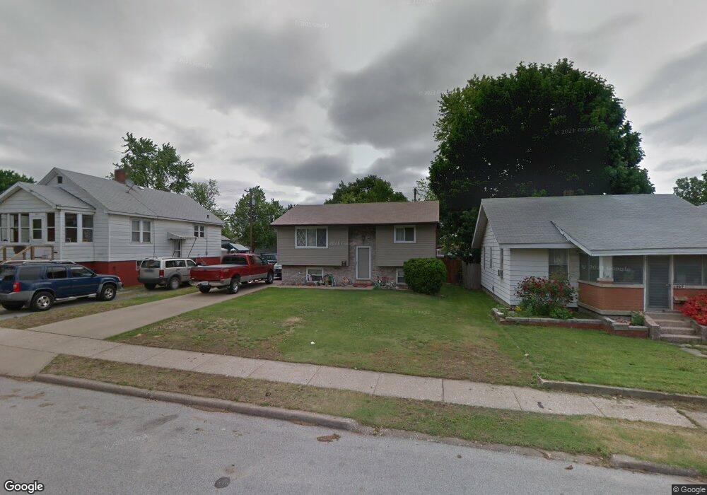
517 State St Wood River, IL 62095
Estimated Value: $105,899 - $152,000
3
Beds
2
Baths
768
Sq Ft
$164/Sq Ft
Est. Value
About This Home
This home is located at 517 State St, Wood River, IL 62095 and is currently estimated at $126,225, approximately $164 per square foot. 517 State St is a home located in Madison County with nearby schools including Lewis-Clark Elementary School and East Alton-Wood River High School.
Ownership History
Date
Name
Owned For
Owner Type
Purchase Details
Closed on
Aug 18, 2025
Sold by
Yates Jennifer
Bought by
Lucas Terrell
Current Estimated Value
Purchase Details
Closed on
Jul 31, 2025
Sold by
Dublo Jeffrey
Bought by
Lucas Terrell Deshawn
Purchase Details
Closed on
Jun 27, 2025
Sold by
Yates Jennifer M
Bought by
Dublo Jeffrey L
Purchase Details
Closed on
Jun 18, 2025
Sold by
Yates Jeremy and Ronald P Yates Estate Ronald P Yates Estate
Bought by
Yates Jennifer
Create a Home Valuation Report for This Property
The Home Valuation Report is an in-depth analysis detailing your home's value as well as a comparison with similar homes in the area
Home Values in the Area
Average Home Value in this Area
Purchase History
| Date | Buyer | Sale Price | Title Company |
|---|---|---|---|
| Lucas Terrell | -- | Serenity Title & Escrow Ltd | |
| Lucas Terrell Deshawn | $1,000 | Ck | |
| Dublo Jeffrey L | -- | Ck | |
| Yates Jennifer | -- | Ck |
Source: Public Records
Tax History Compared to Growth
Tax History
| Year | Tax Paid | Tax Assessment Tax Assessment Total Assessment is a certain percentage of the fair market value that is determined by local assessors to be the total taxable value of land and additions on the property. | Land | Improvement |
|---|---|---|---|---|
| 2024 | $2,433 | $34,270 | $3,730 | $30,540 |
| 2023 | $2,433 | $31,950 | $3,480 | $28,470 |
| 2022 | $2,273 | $29,490 | $3,210 | $26,280 |
| 2021 | $1,994 | $27,480 | $2,990 | $24,490 |
| 2020 | $1,930 | $26,470 | $2,880 | $23,590 |
| 2019 | $1,844 | $25,680 | $2,790 | $22,890 |
| 2018 | $1,780 | $24,400 | $2,650 | $21,750 |
| 2017 | $1,660 | $23,820 | $2,590 | $21,230 |
| 2016 | $1,629 | $23,820 | $2,590 | $21,230 |
| 2015 | $1,618 | $23,570 | $2,560 | $21,010 |
| 2014 | $1,618 | $23,570 | $2,560 | $21,010 |
| 2013 | $1,618 | $23,910 | $2,600 | $21,310 |
Source: Public Records
Map
Nearby Homes
- 726 Rice St
- 41 W Penning Ave
- 777 Condit St
- 469 N 1st St
- 833 State St
- 830 N Wood River Ave
- 209 Elble Ave
- 72 E Acton Ave
- 641 Leslie Ave
- 207 E Penning Ave
- 98 Wood River Ave
- 121 Whitelaw Ave
- 104 Whitelaw Ave
- 133 Lincoln Ave
- 242 E Lorena Ave
- 330 S Pence St
- 537 Tipton Ave
- 959 Cedar Dr
- 565 5th St
- 529 5th St