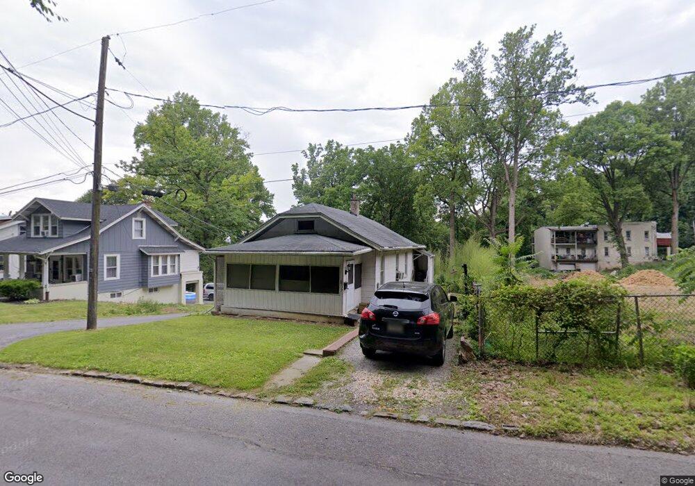
517 W Normandy St Unit 519 Allentown, PA 18103
Southside NeighborhoodEstimated Value: $191,000 - $266,000
2
Beds
1
Bath
686
Sq Ft
$329/Sq Ft
Est. Value
About This Home
This home is located at 517 W Normandy St Unit 519, Allentown, PA 18103 and is currently estimated at $225,553, approximately $328 per square foot. 517 W Normandy St Unit 519 is a home located in Lehigh County with nearby schools including Hiram W Dodd Elementary School, South Mountain Middle School, and Louis E. Dieruff High School.
Ownership History
Date
Name
Owned For
Owner Type
Purchase Details
Closed on
Mar 10, 1995
Sold by
Yons Jr Willard John
Bought by
Sandrock Mark A
Current Estimated Value
Purchase Details
Closed on
Dec 22, 1994
Sold by
Weber Frank C and Weber Gertrude M
Bought by
Yons Willard John
Purchase Details
Closed on
Jan 13, 1977
Bought by
Weber Frank C and Weber Gertrude M
Create a Home Valuation Report for This Property
The Home Valuation Report is an in-depth analysis detailing your home's value as well as a comparison with similar homes in the area
Home Values in the Area
Average Home Value in this Area
Purchase History
| Date | Buyer | Sale Price | Title Company |
|---|---|---|---|
| Sandrock Mark A | $68,900 | -- | |
| Yons Willard John | $40,000 | -- | |
| Weber Frank C | $18,000 | -- |
Source: Public Records
Tax History Compared to Growth
Tax History
| Year | Tax Paid | Tax Assessment Tax Assessment Total Assessment is a certain percentage of the fair market value that is determined by local assessors to be the total taxable value of land and additions on the property. | Land | Improvement |
|---|---|---|---|---|
| 2025 | $2,758 | $79,300 | $16,200 | $63,100 |
| 2024 | $2,758 | $79,300 | $16,200 | $63,100 |
| 2023 | $2,758 | $79,300 | $16,200 | $63,100 |
| 2022 | $2,667 | $79,300 | $63,100 | $16,200 |
| 2021 | $2,618 | $79,300 | $16,200 | $63,100 |
| 2020 | $2,554 | $79,300 | $16,200 | $63,100 |
| 2019 | $2,515 | $79,300 | $16,200 | $63,100 |
| 2018 | $2,322 | $79,300 | $16,200 | $63,100 |
| 2017 | $2,267 | $79,300 | $16,200 | $63,100 |
| 2016 | -- | $79,300 | $16,200 | $63,100 |
| 2015 | -- | $79,300 | $16,200 | $63,100 |
| 2014 | -- | $79,300 | $16,200 | $63,100 |
Source: Public Records
Map
Nearby Homes
- 316 W Mountain Rd
- 618 Clifford St
- 2441 S 4th St
- 2421 S Wood St
- 2416 S Alice St Unit 2418
- 2429 S Front St
- 121 Woodcrest Cir
- 2413 S Church St
- 2347 S Law St Unit 2349
- 2401 S Church St
- 3017 S Pike Ave
- 566 W Emaus Ave
- 566 588 W Emaus Ave
- 206 208 W Emaus Ave
- 2531 S Carbon St
- 642 W Emaus Ave
- 1852 S 2nd St
- 2343 S 9th St
- 102 W Brookdale St
- 148 W Brookdale St
- 521 W Normandy St Unit 523
- 523 W Normandy St
- 525 W Normandy St Unit 527
- 2638 S 4th St Unit 2656
- 529 W Normandy St Unit 531
- 2640 S 4th St
- 533 W Normandy St Unit 535
- 2632 S 4th St
- 2632 2656 S 4th St
- 2636 S East St
- 537 W Normandy St Unit 539
- 541 W Normandy St Unit 543
- 543 W Normandy St
- 2611 S Law St Unit 2619
- 2664 S 4th St
- 2675 S 4th St
- 554 Greenwood St
- 544 Greenwood St Unit 550
- 544 Greenwood St Unit 1
- 544 Greenwood St Unit 2