Estimated Value: $246,986 - $339,000
3
Beds
2
Baths
1,230
Sq Ft
$241/Sq Ft
Est. Value
About This Home
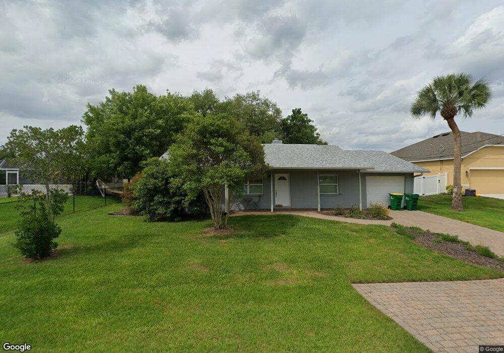
This home is located at 5170 Carter St, Cocoa, FL 32927 and is currently estimated at $296,747, approximately $241 per square foot. 5170 Carter St is a home located in Brevard County with nearby schools including Atlantis Elementary School, Space Coast Junior/Senior High School, and Sculptor Charter School.
Ownership History
Date
Name
Owned For
Owner Type
Purchase Details
Closed on
Apr 7, 2014
Sold by
Blaetz Virginia A
Bought by
Blaetz Virginia A and Dean Devin B
Current Estimated Value
Purchase Details
Closed on
Feb 22, 2005
Sold by
Chuckran Craig D and Chuckran Gail I
Bought by
Blaetz Virginia A
Home Financials for this Owner
Home Financials are based on the most recent Mortgage that was taken out on this home.
Original Mortgage
$134,900
Interest Rate
5.68%
Create a Home Valuation Report for This Property
The Home Valuation Report is an in-depth analysis detailing your home's value as well as a comparison with similar homes in the area
Home Values in the Area
Average Home Value in this Area
Purchase History
| Date | Buyer | Sale Price | Title Company |
|---|---|---|---|
| Blaetz Virginia A | -- | Attorney | |
| Blaetz Virginia A | $142,000 | Security First Title Partner |
Source: Public Records
Mortgage History
| Date | Status | Borrower | Loan Amount |
|---|---|---|---|
| Previous Owner | Blaetz Virginia A | $134,900 |
Source: Public Records
Tax History
| Year | Tax Paid | Tax Assessment Tax Assessment Total Assessment is a certain percentage of the fair market value that is determined by local assessors to be the total taxable value of land and additions on the property. | Land | Improvement |
|---|---|---|---|---|
| 2025 | $1,002 | $71,100 | -- | -- |
| 2024 | $983 | $69,100 | -- | -- |
| 2023 | $983 | $67,090 | $0 | $0 |
| 2022 | $931 | $65,140 | $0 | $0 |
| 2021 | $932 | $63,250 | $0 | $0 |
| 2020 | $886 | $62,380 | $0 | $0 |
| 2019 | $834 | $60,980 | $0 | $0 |
| 2018 | $834 | $59,850 | $0 | $0 |
| 2017 | $835 | $58,620 | $0 | $0 |
| 2016 | $841 | $57,420 | $18,000 | $39,420 |
| 2015 | $847 | $57,030 | $15,000 | $42,030 |
| 2014 | $851 | $56,580 | $11,000 | $45,580 |
Source: Public Records
Map
Nearby Homes
- 5155 Mayflower St
- 5165 Patricia St
- 6990 Bryant Rd
- 5075 Carter St
- 5080 Mayflower St
- 6815 Bryant Rd
- 7065 Hundred Acre Dr
- 5200 Frisco St
- 7155 Export Ave
- 7045 Grissom Pkwy
- 6760 Cairo Rd
- 7230 Venus Ave
- 5150 Melody St
- 5555 Brandon St
- 7635 Fringe Place
- 7245 Grissom Pkwy
- 7606 Fringe Place
- 6620 Grissom Pkwy
- 7200 Oakwood Ave
- 6615 Dock Ave
- 5160 Carter St
- 7017 Holly Ave
- 7025 Holly Ave
- 5185 Mayflower St
- 5175 Mayflower St
- 5150 Carter St
- 5175 Carter St
- 0 Mayflower Holly
- 7033 Holly Ave
- 5185 Carter St
- 5165 Mayflower St
- 5155 Carter St
- 5140 Carter St
- 5195 Carter St
- 5145 Carter St
- 7049 Holly Ave
- 7024 Holly Ave
- 5180 Mayflower St
- 7016 Holly Ave
- 5170 Mayflower St
Your Personal Tour Guide
Ask me questions while you tour the home.