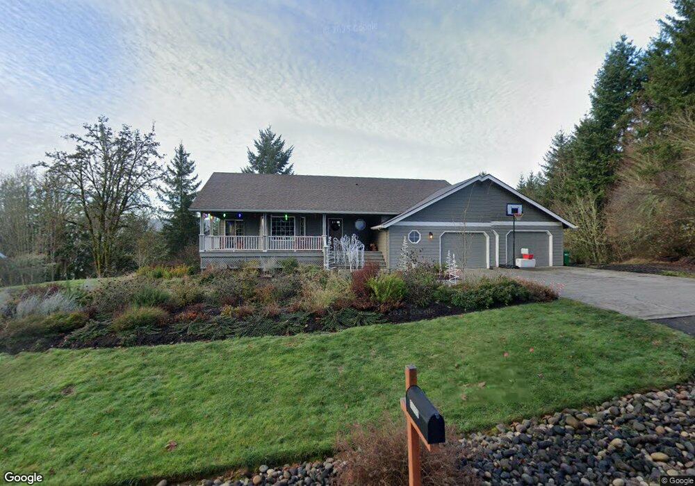
51723 Mountain View Rd Scappoose, OR 97056
Estimated Value: $826,260 - $1,141,000
4
Beds
4
Baths
1,380
Sq Ft
$713/Sq Ft
Est. Value
About This Home
This home is located at 51723 Mountain View Rd, Scappoose, OR 97056 and is currently estimated at $983,630, approximately $712 per square foot. 51723 Mountain View Rd is a home located in Columbia County with nearby schools including Scappoose High School and Scappoose Adventist School.
Ownership History
Date
Name
Owned For
Owner Type
Purchase Details
Closed on
Jun 24, 2016
Sold by
Palin Douglas Lee and Palin Jeanne C
Bought by
Peterson Aaron R and Peterson Monica L
Current Estimated Value
Home Financials for this Owner
Home Financials are based on the most recent Mortgage that was taken out on this home.
Original Mortgage
$417,000
Outstanding Balance
$331,093
Interest Rate
3.58%
Mortgage Type
New Conventional
Estimated Equity
$652,537
Create a Home Valuation Report for This Property
The Home Valuation Report is an in-depth analysis detailing your home's value as well as a comparison with similar homes in the area
Home Values in the Area
Average Home Value in this Area
Purchase History
| Date | Buyer | Sale Price | Title Company |
|---|---|---|---|
| Peterson Aaron R | $660,000 | Ticor Title Company Of Or |
Source: Public Records
Mortgage History
| Date | Status | Borrower | Loan Amount |
|---|---|---|---|
| Open | Peterson Aaron R | $417,000 |
Source: Public Records
Tax History Compared to Growth
Tax History
| Year | Tax Paid | Tax Assessment Tax Assessment Total Assessment is a certain percentage of the fair market value that is determined by local assessors to be the total taxable value of land and additions on the property. | Land | Improvement |
|---|---|---|---|---|
| 2025 | $6,638 | $495,807 | $66,017 | $429,790 |
| 2024 | $6,453 | $481,376 | $64,096 | $417,280 |
| 2023 | $6,421 | $467,355 | $75,275 | $392,080 |
| 2022 | $6,132 | $453,746 | $73,076 | $380,670 |
| 2021 | $5,958 | $440,538 | $69,768 | $370,770 |
| 2020 | $5,469 | $427,712 | $65,722 | $361,990 |
| 2019 | $5,332 | $415,257 | $63,007 | $352,250 |
| 2018 | $5,032 | $403,163 | $70,033 | $333,130 |
| 2017 | $5,032 | $397,112 | $68,682 | $328,430 |
| 2016 | $4,992 | $385,550 | $66,670 | $318,880 |
| 2015 | $4,674 | $371,340 | $63,080 | $308,260 |
| 2014 | $4,014 | $316,302 | $61,352 | $254,950 |
Source: Public Records
Map
Nearby Homes
- 32922 Coal Creek Rd
- 51557 SW Em Watts Rd
- 32373 Jp West Rd
- 32839 SW Crystal Springs Ct
- 32898 SW Keys Landing Way
- Hillsdale Plan at Dutch Canyon
- Aubrey Plan at Dutch Canyon
- Carmichael Plan at Dutch Canyon
- Carlton Plan at Dutch Canyon
- 0 Hemlock Ave Unit 120247766
- 33279 SW Havlik Dr
- 33298 SW Meadowbrook Dr
- 51350 SW Randstad St
- 33344 SW Rokin Way
- 33358 SW Rokin Way
- 33374 SW Rokin Way
- 33363 SW Rokin Way
- 33370 SW Rokin Way
- 33375 SW Rokin Way
- 0 Hawthorne Unit 8 23537227
- 51680 Mountain View Rd
- 51816 Mountain View Rd
- 32055 Dutch Canyon Rd
- 51616 Mountain View Rd
- 51632 Mountain View Rd
- 32275 Baker View Dr
- 32255 Dutch Canyon Rd
- 51876 Mountain View Rd
- 32051 Dutch Canyon Rd
- 32158 Raymond Creek Rd
- 32140 Raymond Creek Rd
- 32110 Raymond Creek Rd
- 51614 Mountain View Rd
- 32084 Raymond Creek Rd
- 51465 Branch Dr
- 32062 Raymond Creek Rd
- 32056 Raymond Creek Rd
- 51923 Mountain View Rd
- 32022 Raymond Creek Rd
- 32153 Meadow Ln