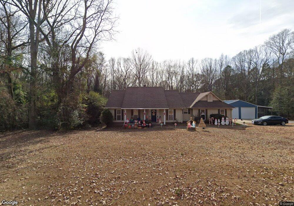
5173 Detonti Rd Benton, AR 72015
Estimated Value: $227,000 - $272,000
--
Bed
2
Baths
1,658
Sq Ft
$150/Sq Ft
Est. Value
About This Home
This home is located at 5173 Detonti Rd, Benton, AR 72015 and is currently estimated at $248,439, approximately $149 per square foot. 5173 Detonti Rd is a home located in Saline County with nearby schools including Pine Haven Elementary School, Bauxite Middle School, and Bauxite High School.
Ownership History
Date
Name
Owned For
Owner Type
Purchase Details
Closed on
Mar 2, 2009
Sold by
Lupton Adrian and Lupton Chryl
Bought by
Lupton Adrian L and Lupton Cheryl L
Current Estimated Value
Home Financials for this Owner
Home Financials are based on the most recent Mortgage that was taken out on this home.
Original Mortgage
$102,000
Outstanding Balance
$25,542
Interest Rate
5.13%
Mortgage Type
New Conventional
Estimated Equity
$222,897
Purchase Details
Closed on
Jan 16, 2004
Bought by
Lupton
Purchase Details
Closed on
Dec 12, 2003
Bought by
Lupton
Create a Home Valuation Report for This Property
The Home Valuation Report is an in-depth analysis detailing your home's value as well as a comparison with similar homes in the area
Home Values in the Area
Average Home Value in this Area
Purchase History
| Date | Buyer | Sale Price | Title Company |
|---|---|---|---|
| Lupton Adrian L | -- | -- | |
| Lupton | -- | -- | |
| Lupton | -- | -- |
Source: Public Records
Mortgage History
| Date | Status | Borrower | Loan Amount |
|---|---|---|---|
| Open | Lupton Adrian L | $102,000 |
Source: Public Records
Tax History Compared to Growth
Tax History
| Year | Tax Paid | Tax Assessment Tax Assessment Total Assessment is a certain percentage of the fair market value that is determined by local assessors to be the total taxable value of land and additions on the property. | Land | Improvement |
|---|---|---|---|---|
| 2025 | $1,841 | $41,750 | $2,000 | $39,750 |
| 2024 | $1,841 | $41,750 | $2,000 | $39,750 |
| 2023 | $1,411 | $41,750 | $2,000 | $39,750 |
| 2022 | $1,381 | $41,750 | $2,000 | $39,750 |
| 2021 | $1,301 | $33,140 | $4,000 | $29,140 |
| 2020 | $1,301 | $33,140 | $4,000 | $29,140 |
| 2019 | $1,301 | $33,140 | $4,000 | $29,140 |
| 2018 | $1,326 | $33,140 | $4,000 | $29,140 |
| 2017 | $1,284 | $33,140 | $4,000 | $29,140 |
| 2016 | $1,485 | $30,740 | $4,000 | $26,740 |
| 2015 | $1,210 | $30,740 | $4,000 | $26,740 |
| 2014 | $1,210 | $30,740 | $4,000 | $26,740 |
Source: Public Records
Map
Nearby Homes
- 5501 Amber Cir N
- 12607 Arkansas 35
- TBD Arkansas 35
- 5167 Dale Rd
- Lot 14 Dale Road Acres
- Lot 11 Dale Road Acres
- Lot 13 Dale Road Acres
- 7381 Mars Hill Rd
- 4977 Lexie Ln
- 4924 N Detonti Rd
- 4188 Serene Dr
- 1060 Creekwood Cir
- 1008 Creekwood Cir
- 4039 Creek Top
- 4150 Serene Dr
- 4021 Creek Top
- 4016 Creek Top
- 4008 Creek Top
- 5429 Dew Trail
- 9135 Mars Hill Rd
- 000 Detonti Rd
- 5222 Detonti Rd
- 5126 Detonti Rd
- 7017 Fulcher Rd
- 7210 Fulcher Rd
- 5410 Detonti Rd
- 6800 Croxton Rd
- 7215 Fulcher Rd
- 5047 Detonti Rd
- 7112 Croxton Rd
- 7225 Fulcher Rd
- 7230 Fulcher Rd
- 4971 Detonti Rd
- 4918 Detonti Rd
- 4911 Detonti Rd
- 7200 Croxton Rd
- 4896 Detonti Rd
- 4817 Detonti Rd
- 4816 Detonti Rd
- 4804 Detonti Rd