Estimated Value: $217,000 - $263,000
Studio
1
Bath
1,320
Sq Ft
$185/Sq Ft
Est. Value
About This Home
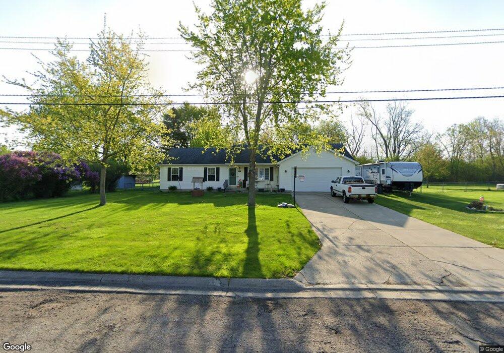
This home is located at 5175 Capri Ln, Flint, MI 48507 and is currently estimated at $244,721, approximately $185 per square foot. 5175 Capri Ln is a home located in Genesee County with nearby schools including Anderson Elementary School, McGrath Elementary School, and Grand Blanc West Middle School.
Ownership History
Date
Name
Owned For
Owner Type
Purchase Details
Closed on
Dec 19, 2018
Sold by
Gilbert Knust Diane L and Estate Of Evander J Knust
Bought by
Hervert David and Hervert Ashlie
Current Estimated Value
Home Financials for this Owner
Home Financials are based on the most recent Mortgage that was taken out on this home.
Original Mortgage
$120,000
Outstanding Balance
$105,723
Interest Rate
4.8%
Mortgage Type
New Conventional
Estimated Equity
$138,998
Purchase Details
Closed on
May 20, 2005
Sold by
Estate Of Donald Leroy Hann
Bought by
Knust Evander J
Purchase Details
Closed on
Jul 30, 2003
Sold by
Lewis David W and Lewis Rachael M
Bought by
Hann Donald L
Create a Home Valuation Report for This Property
The Home Valuation Report is an in-depth analysis detailing your home's value as well as a comparison with similar homes in the area
Home Values in the Area
Average Home Value in this Area
Purchase History
| Date | Buyer | Sale Price | Title Company |
|---|---|---|---|
| Hervert David | $150,000 | Bell Title Agency Of Fenton | |
| Knust Evander J | $177,000 | Metropolitan Title Company | |
| Hann Donald L | $170,000 | Metropolitan Title Company |
Source: Public Records
Mortgage History
| Date | Status | Borrower | Loan Amount |
|---|---|---|---|
| Open | Hervert David | $120,000 |
Source: Public Records
Tax History
| Year | Tax Paid | Tax Assessment Tax Assessment Total Assessment is a certain percentage of the fair market value that is determined by local assessors to be the total taxable value of land and additions on the property. | Land | Improvement |
|---|---|---|---|---|
| 2025 | $3,981 | $134,100 | $0 | $0 |
| 2024 | $2,461 | $124,500 | $0 | $0 |
| 2023 | $2,348 | $110,800 | $0 | $0 |
| 2022 | $3,534 | $100,000 | $0 | $0 |
| 2021 | $3,475 | $94,400 | $0 | $0 |
| 2020 | $2,165 | $88,500 | $0 | $0 |
| 2019 | $2,133 | $83,300 | $0 | $0 |
| 2018 | $2,337 | $75,100 | $0 | $0 |
| 2017 | $2,240 | $76,100 | $0 | $0 |
| 2016 | $2,220 | $71,400 | $0 | $0 |
| 2015 | $1,941 | $63,000 | $0 | $0 |
| 2014 | $1,326 | $59,800 | $0 | $0 |
| 2012 | -- | $53,300 | $53,300 | $0 |
Source: Public Records
Map
Nearby Homes
- 5221 Capri Ln
- 1449 Sunset Blvd
- 00 Coolidge Dr
- 000 Coolidge Dr
- 1331 Sunset Blvd Unit 11
- 0000 Coolidge Dr
- 0000 Mckinley Blvd
- 1063 Lincoln Dr
- 1131 Linus St
- 00 Mckinley Blvd
- 000 Mckinley Blvd
- 1203 Pickwick Place
- 0 Harding Dr Unit 20251056693
- 0 Jefferson Blvd
- 1075 E Hill Rd
- 1226 Harding Dr
- 1195 Alton Ave
- 302 Rochford Square
- 5366 van Slyke Rd
- 1115 Kingston Ave
Your Personal Tour Guide
Ask me questions while you tour the home.