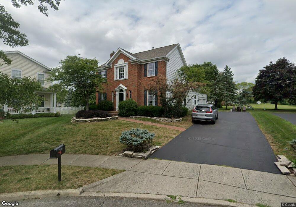
5177 Marks Ct New Albany, OH 43054
Fodor NeighborhoodEstimated Value: $608,857 - $689,000
4
Beds
3
Baths
2,322
Sq Ft
$275/Sq Ft
Est. Value
About This Home
This home is located at 5177 Marks Ct, New Albany, OH 43054 and is currently estimated at $638,214, approximately $274 per square foot. 5177 Marks Ct is a home located in Franklin County with nearby schools including New Albany Primary School, New Albany Intermediate School, and New Albany Middle School.
Ownership History
Date
Name
Owned For
Owner Type
Purchase Details
Closed on
Oct 12, 2012
Sold by
Jerwers Martin L
Bought by
Jerwers Martin L and Jerwers Whitney
Current Estimated Value
Home Financials for this Owner
Home Financials are based on the most recent Mortgage that was taken out on this home.
Original Mortgage
$232,900
Outstanding Balance
$40,156
Interest Rate
3.53%
Mortgage Type
New Conventional
Estimated Equity
$598,058
Purchase Details
Closed on
May 26, 1999
Sold by
M/I Schottenstein Homes Inc
Bought by
Jerwers Martin L
Home Financials for this Owner
Home Financials are based on the most recent Mortgage that was taken out on this home.
Original Mortgage
$189,850
Interest Rate
6.92%
Create a Home Valuation Report for This Property
The Home Valuation Report is an in-depth analysis detailing your home's value as well as a comparison with similar homes in the area
Home Values in the Area
Average Home Value in this Area
Purchase History
| Date | Buyer | Sale Price | Title Company |
|---|---|---|---|
| Jerwers Martin L | -- | Title First Agency Inc | |
| Jerwers Martin L | $237,400 | Transohio Residential Title |
Source: Public Records
Mortgage History
| Date | Status | Borrower | Loan Amount |
|---|---|---|---|
| Open | Jerwers Martin L | $232,900 | |
| Previous Owner | Jerwers Martin L | $189,850 |
Source: Public Records
Tax History Compared to Growth
Tax History
| Year | Tax Paid | Tax Assessment Tax Assessment Total Assessment is a certain percentage of the fair market value that is determined by local assessors to be the total taxable value of land and additions on the property. | Land | Improvement |
|---|---|---|---|---|
| 2024 | $10,208 | $183,300 | $55,830 | $127,470 |
| 2023 | $10,117 | $183,295 | $55,825 | $127,470 |
| 2022 | $9,107 | $125,720 | $33,600 | $92,120 |
| 2021 | $8,869 | $125,720 | $33,600 | $92,120 |
| 2020 | $8,677 | $125,720 | $33,600 | $92,120 |
| 2019 | $7,908 | $104,160 | $28,000 | $76,160 |
| 2018 | $7,869 | $104,160 | $28,000 | $76,160 |
| 2017 | $7,917 | $104,160 | $28,000 | $76,160 |
| 2016 | $7,916 | $95,870 | $23,800 | $72,070 |
| 2015 | $7,935 | $95,870 | $23,800 | $72,070 |
| 2014 | $7,594 | $95,870 | $23,800 | $72,070 |
| 2013 | $3,913 | $91,315 | $22,680 | $68,635 |
Source: Public Records
Map
Nearby Homes
- 6813 Ridge Rock Dr Unit 14
- 7362 Tottenham Place
- 4774 Bosk Dr
- 5556 Falco Dr
- 5288 Abby Gate Ave Unit 16
- 0 N Hamilton Rd
- 5600 Apothecary Way
- 5604 Apothecary Way Unit 4
- 5450 Nottinghamshire Ln
- 6929 Clivdon Mews
- 5468 Nottinghamshire Ln
- 5396 Nottinghamshire Ln Unit 5396
- 5656 Apothecary Way Unit 2
- 6923 Rothwell St Unit 46923
- 5478 Albany Terrace Way Unit 1405
- 6931 Rothwell St Unit 36931
- 5318 Nottinghamshire Ln Unit 5318
- 6501 Walnut Fork Dr Unit 6501
- 6455 Walnut Fork Dr Unit 6455
- 6498 Ash Rock Cir Unit 6498
- 5161 Marks Ct
- 5193 Marks Ct
- 5145 Marks Ct
- 5176 Mount Row
- 5192 Mount Row
- 5160 Mount Row
- 5194 Marks Ct
- 5204 Mount Row
- 5204 Mount Row Unit 101
- 5144 Mount Row
- 5220 Mount Row
- 5130 Marks Ct
- 5128 Mount Row
- 5113 Marks Ct
- 5178 Marks Ct
- 5236 Mount Row
- 5112 Mount Row
- 5146 Marks Ct
- 5162 Marks Ct
- 6790 Upper Brook Way