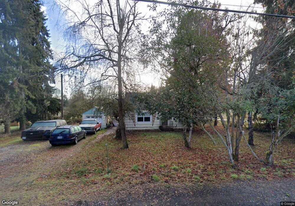
51770 SW Em Watts Rd Scappoose, OR 97056
Estimated Value: $448,000 - $460,000
3
Beds
2
Baths
2,128
Sq Ft
$213/Sq Ft
Est. Value
About This Home
This home is located at 51770 SW Em Watts Rd, Scappoose, OR 97056 and is currently estimated at $453,546, approximately $213 per square foot. 51770 SW Em Watts Rd is a home located in Columbia County with nearby schools including Scappoose High School and Scappoose Adventist School.
Ownership History
Date
Name
Owned For
Owner Type
Purchase Details
Closed on
Sep 28, 2007
Sold by
Ochs Peter D
Bought by
Aschoff Dorinda
Current Estimated Value
Home Financials for this Owner
Home Financials are based on the most recent Mortgage that was taken out on this home.
Original Mortgage
$142,000
Outstanding Balance
$90,498
Interest Rate
6.61%
Mortgage Type
Commercial
Estimated Equity
$363,048
Create a Home Valuation Report for This Property
The Home Valuation Report is an in-depth analysis detailing your home's value as well as a comparison with similar homes in the area
Home Values in the Area
Average Home Value in this Area
Purchase History
| Date | Buyer | Sale Price | Title Company |
|---|---|---|---|
| Aschoff Dorinda | $177,500 | Ticor Title |
Source: Public Records
Mortgage History
| Date | Status | Borrower | Loan Amount |
|---|---|---|---|
| Open | Aschoff Dorinda | $142,000 |
Source: Public Records
Tax History Compared to Growth
Tax History
| Year | Tax Paid | Tax Assessment Tax Assessment Total Assessment is a certain percentage of the fair market value that is determined by local assessors to be the total taxable value of land and additions on the property. | Land | Improvement |
|---|---|---|---|---|
| 2021 | $3,092 | $186,180 | $98,740 | $87,440 |
| 2020 | $2,868 | $180,760 | $90,110 | $90,650 |
| 2019 | $2,494 | $156,700 | $86,880 | $69,820 |
| 2018 | $2,437 | $152,140 | $99,330 | $52,810 |
| 2017 | $2,393 | $147,710 | $96,440 | $51,270 |
| 2016 | $2,362 | $143,410 | $93,630 | $49,780 |
| 2015 | $2,243 | $139,240 | $83,830 | $55,410 |
| 2014 | $2,186 | $135,190 | $93,280 | $41,910 |
Source: Public Records
Map
Nearby Homes
- 32922 Coal Creek Rd
- 51557 SW Em Watts Rd
- 33279 SW Havlik Dr
- 33298 SW Meadowbrook Dr
- 33344 SW Rokin Way
- 33370 SW Rokin Way
- 33358 SW Rokin Way
- 33374 SW Rokin Way
- 33363 SW Rokin Way
- 33375 SW Rokin Way
- 33410 Meadowbrook Dr
- 51925 Columbia River Hwy
- 32839 SW Crystal Springs Ct
- 51350 SW Randstad St
- 32898 SW Keys Landing Way
- 51692 SE 3rd St
- Hillsdale Plan at Dutch Canyon
- Aubrey Plan at Dutch Canyon
- Carmichael Plan at Dutch Canyon
- Carlton Plan at Dutch Canyon
- 51797 SW Em Watts Rd
- 51891 SW Em Watts Rd
- 0 Bare-Developable Lnd Unit 19021821
- 0 Bare-Developable Lnd Unit 19289147
- 51822 SW Em Watts Rd
- 51817 SW Em Watts Rd
- 51770 SW E M Watts Rd N T
- 51736 SW Em Watts Rd
- 51701 SW M Watts Rd
- 51704 SW Em Watts Rd
- 51719 SW Em Watts Rd
- 51701 SW Em Watts Rd
- 33010 Coal Creek Rd
- 33038 Coal Creek Rd
- 33221 Linden St
- 33234 SW Sequoia St
- 33231 Linden St
- 32996 Coal Creek Rd
- 33241 Linden St
- 33244 SW Sequoia St