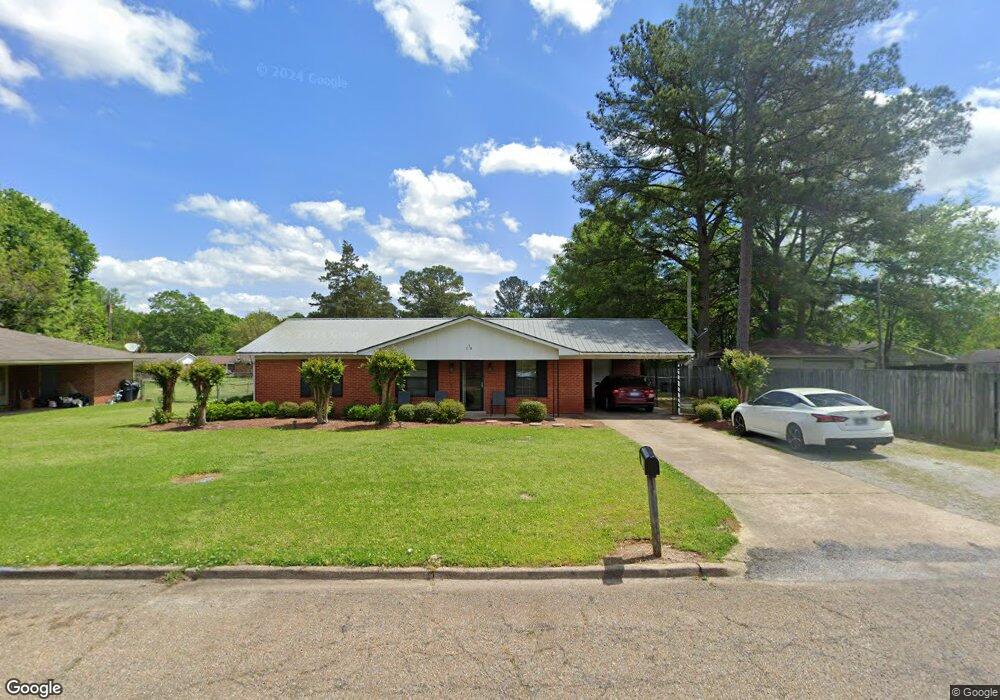
518 Avalon St West Point, MS 39773
Estimated Value: $133,730 - $170,000
3
Beds
--
Bath
1,322
Sq Ft
$115/Sq Ft
Est. Value
About This Home
This home is located at 518 Avalon St, West Point, MS 39773 and is currently estimated at $152,433, approximately $115 per square foot. 518 Avalon St is a home located in Clay County with nearby schools including East Side Elementary School, West Clay Elementary School, and Church Hill Elementary School.
Ownership History
Date
Name
Owned For
Owner Type
Purchase Details
Closed on
Jul 2, 2009
Sold by
Ryland Dorothy J
Bought by
Brown Angela D
Current Estimated Value
Home Financials for this Owner
Home Financials are based on the most recent Mortgage that was taken out on this home.
Original Mortgage
$95,000
Outstanding Balance
$67,454
Interest Rate
5.27%
Estimated Equity
$84,979
Create a Home Valuation Report for This Property
The Home Valuation Report is an in-depth analysis detailing your home's value as well as a comparison with similar homes in the area
Home Values in the Area
Average Home Value in this Area
Purchase History
| Date | Buyer | Sale Price | Title Company |
|---|---|---|---|
| Brown Angela D | -- | -- |
Source: Public Records
Mortgage History
| Date | Status | Borrower | Loan Amount |
|---|---|---|---|
| Open | Brown Angela D | $95,000 |
Source: Public Records
Tax History Compared to Growth
Tax History
| Year | Tax Paid | Tax Assessment Tax Assessment Total Assessment is a certain percentage of the fair market value that is determined by local assessors to be the total taxable value of land and additions on the property. | Land | Improvement |
|---|---|---|---|---|
| 2024 | $321 | $8,693 | $1,838 | $6,855 |
| 2023 | $794 | $7,268 | $1,838 | $5,430 |
| 2022 | $249 | $7,268 | $1,838 | $5,430 |
| 2021 | $248 | $7,268 | $1,838 | $5,430 |
| 2020 | $248 | $7,268 | $1,838 | $5,430 |
| 2019 | $226 | $7,220 | $1,838 | $5,382 |
| 2018 | $211 | $7,220 | $1,838 | $5,382 |
| 2017 | $210 | $7,220 | $1,838 | $5,382 |
| 2016 | $197 | $7,220 | $1,838 | $5,382 |
| 2015 | $189 | $6,514 | $1,838 | $4,676 |
| 2014 | $417 | $6,514 | $1,838 | $4,676 |
| 2013 | $417 | $6,514 | $1,838 | $4,676 |
Source: Public Records
Map
Nearby Homes
- 44 Torbert Dr
- 472 S Eshman Ave
- 329 Converse Dr
- 278 Converse Dr
- 164 Belvedere Ave
- 1046 E Brame Ave
- 15 David St
- 389 Mapleview Rd
- 1180 E Broad St
- 551 E Westbrook St
- 27445 E Main St
- 1153 E Broad St
- 485 E Westbrook St
- 480 E Westbrook St
- 1104 E Broad St
- 479 E Westbrook St
- 1124 N Eshman Ave
- 238 Calhoun St
- 219 Mapleview Rd
- 26596 E Main St
- 516 Avalon St
- 242 Avalon St
- 1303 Torbert Dr
- 1307 Torbert Dr
- 517 Belvedere Ave
- 514 Avalon St
- 519 Belvedere Ave
- 1213 Torbert Dr
- 1311 Torbert Dr
- 519 Avalon St
- 1212 Eugene St
- 515 Belvedere Ave
- 1207 Torbert Dr
- 512 Avalon St
- 1208 Eugene St
- 1304 Torbert Dr
- 513 Belvedere Ave
- 391 Converse Dr
- 1308 Torbert Dr
- 524 Converse Dr