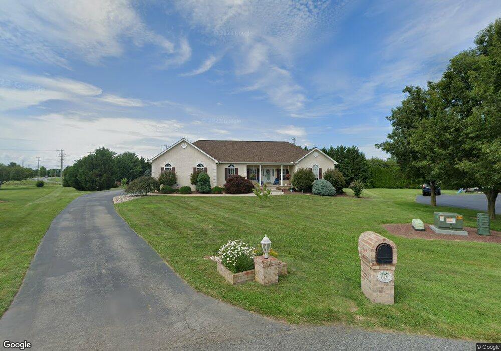
518 Burnham Ln Middletown, DE 19709
Estimated Value: $605,000 - $762,000
4
Beds
3
Baths
2,363
Sq Ft
$275/Sq Ft
Est. Value
About This Home
This home is located at 518 Burnham Ln, Middletown, DE 19709 and is currently estimated at $649,012, approximately $274 per square foot. 518 Burnham Ln is a home located in New Castle County with nearby schools including Everett Meredith Middle School and Appoquinimink High School.
Ownership History
Date
Name
Owned For
Owner Type
Purchase Details
Closed on
Sep 28, 2007
Sold by
Hudson Richard W and Hudson Gayle E
Bought by
Hedrick Donald E and Hedrick Brenda A
Current Estimated Value
Home Financials for this Owner
Home Financials are based on the most recent Mortgage that was taken out on this home.
Original Mortgage
$240,000
Interest Rate
6.59%
Mortgage Type
Purchase Money Mortgage
Create a Home Valuation Report for This Property
The Home Valuation Report is an in-depth analysis detailing your home's value as well as a comparison with similar homes in the area
Home Values in the Area
Average Home Value in this Area
Purchase History
| Date | Buyer | Sale Price | Title Company |
|---|---|---|---|
| Hedrick Donald E | $408,000 | None Available |
Source: Public Records
Mortgage History
| Date | Status | Borrower | Loan Amount |
|---|---|---|---|
| Previous Owner | Hedrick Donald E | $240,000 |
Source: Public Records
Tax History
| Year | Tax Paid | Tax Assessment Tax Assessment Total Assessment is a certain percentage of the fair market value that is determined by local assessors to be the total taxable value of land and additions on the property. | Land | Improvement |
|---|---|---|---|---|
| 2024 | $4,029 | $93,100 | $13,500 | $79,600 |
| 2023 | $3,456 | $93,100 | $13,500 | $79,600 |
| 2022 | $3,465 | $93,100 | $13,500 | $79,600 |
| 2021 | $3,423 | $93,100 | $13,500 | $79,600 |
| 2020 | $3,385 | $93,100 | $13,500 | $79,600 |
| 2019 | $3,144 | $93,100 | $13,500 | $79,600 |
| 2018 | $3,042 | $93,100 | $13,500 | $79,600 |
| 2017 | $2,919 | $93,100 | $13,500 | $79,600 |
| 2016 | $2,657 | $93,100 | $13,500 | $79,600 |
| 2015 | $2,586 | $93,100 | $13,500 | $79,600 |
| 2014 | $2,594 | $93,100 | $13,500 | $79,600 |
Source: Public Records
Map
Nearby Homes
- 114 Colonel Clayton Dr
- 411 Crownleaf Dr
- 54 Meadow Dr
- 866 Old School House Rd
- 103 Westside Ln
- 278 Abbotsford Dr Unit PLAZA LOT 22
- 240 Abbotsford Dr Unit PHIL GRAND LOT 18
- 503 Tarbet Ct Unit PHIL GRAND LOT 31
- 129 Ayshire Dr Unit RITTENHOUSE
- 129 Ayshire Dr Unit PLAZA
- 129 Ayshire Dr Unit PHILADELPHIAN GRAND
- 129 Ayshire Dr Unit SOMERSET FLOORPLAN
- 129 Ayshire Dr Unit BRANDYWINE GRAND
- 129 Ayshire Dr Unit HANCOCK GRAND
- 129 Ayshire Dr Unit LEXINGTON
- 129 Ayshire Dr Unit CORONADO
- 93 W Delaware Canal Ct
- 107 Bohemia Mill Pond Dr
- 251 Dillon Cir
- 1455 Cayots Corner Rd
- 519 Burnham Ln
- 516 Burnham Ln
- 0 Choptank Rd
- 1 Choptank Rd
- 4 Choptank Rd
- 3 Choptank Rd
- 1 Choptank Rd Unit (1675)
- 514 Burnham Ln
- 1412 Choptank Rd
- 517 Burnham Ln
- 515 Burnham Ln
- 1400 Choptank Rd
- 1420 Choptank Rd
- 1379 Choptank Rd
- 512 Burnham Ln
- 509 Burnham Ln
- 1394 Choptank Rd
- 1415 Norva Dr
- 1428 Choptank Rd
- 1409 Norva Dr
Your Personal Tour Guide
Ask me questions while you tour the home.