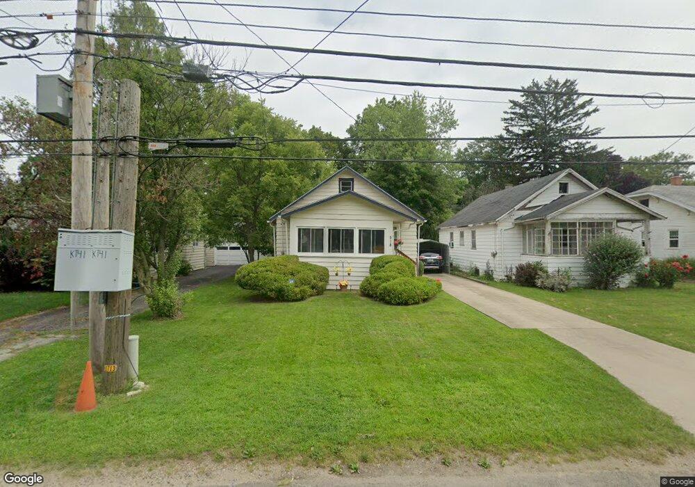
518 N Dartmouth St Kalamazoo, MI 49006
Westwood NeighborhoodEstimated Value: $161,882 - $227,000
2
Beds
1
Bath
912
Sq Ft
$198/Sq Ft
Est. Value
About This Home
This home is located at 518 N Dartmouth St, Kalamazoo, MI 49006 and is currently estimated at $180,971, approximately $198 per square foot. 518 N Dartmouth St is a home located in Kalamazoo County with nearby schools including Northglade Montessori School, Hillside Middle School, and Kalamazoo Central High School.
Ownership History
Date
Name
Owned For
Owner Type
Purchase Details
Closed on
May 22, 2003
Sold by
Baker Carrie L and Whitfield Carrie L
Bought by
Baker Carrie L
Current Estimated Value
Purchase Details
Closed on
Oct 25, 2002
Sold by
Whitfield Carrie L
Bought by
Harden Carrie L
Home Financials for this Owner
Home Financials are based on the most recent Mortgage that was taken out on this home.
Original Mortgage
$79,200
Interest Rate
9.75%
Mortgage Type
Purchase Money Mortgage
Create a Home Valuation Report for This Property
The Home Valuation Report is an in-depth analysis detailing your home's value as well as a comparison with similar homes in the area
Home Values in the Area
Average Home Value in this Area
Purchase History
| Date | Buyer | Sale Price | Title Company |
|---|---|---|---|
| Baker Carrie L | -- | Alpha Title Agency | |
| Harden Carrie L | -- | American Title Works |
Source: Public Records
Mortgage History
| Date | Status | Borrower | Loan Amount |
|---|---|---|---|
| Previous Owner | Harden Carrie L | $79,200 |
Source: Public Records
Tax History Compared to Growth
Tax History
| Year | Tax Paid | Tax Assessment Tax Assessment Total Assessment is a certain percentage of the fair market value that is determined by local assessors to be the total taxable value of land and additions on the property. | Land | Improvement |
|---|---|---|---|---|
| 2025 | $2,217 | $75,800 | $0 | $0 |
| 2024 | $425 | $69,200 | $0 | $0 |
| 2023 | $405 | $60,300 | $0 | $0 |
| 2022 | $2,016 | $54,200 | $0 | $0 |
| 2021 | $1,892 | $48,500 | $0 | $0 |
| 2020 | $1,861 | $43,800 | $0 | $0 |
| 2019 | $1,779 | $39,600 | $0 | $0 |
| 2018 | $1,734 | $35,200 | $0 | $0 |
| 2017 | $0 | $35,200 | $0 | $0 |
| 2016 | -- | $34,000 | $0 | $0 |
| 2015 | -- | $33,800 | $0 | $0 |
| 2014 | -- | $31,800 | $0 | $0 |
Source: Public Records
Map
Nearby Homes
- 1904 W North St
- 545 N Berkley St
- 511 Campbell Ave
- 1617 Jefferson Ave
- 1514 Jefferson Ave
- 438 Wealthy St
- 224 W Westwood Dr
- 421 Hilbert St
- 130 S Clarendon St
- 134 S Clarendon St
- 107 Inverness Ct Unit 80
- 141 Selkirk Ct Unit 103
- 115 Monroe St
- 902 Coolidge Ave
- 113 Inverness Ct Unit C
- 1302 Ogden Ave
- 2431 Hillsdale Ave
- 1120 Jefferson Ave
- 1117 Cadillac St
- 227 Douglas Ave
- 514 N Dartmouth St
- 524 N Dartmouth St
- 510 N Dartmouth St
- 528 N Dartmouth St
- 513 N Clarendon St
- 521 N Clarendon St
- 506 N Dartmouth St
- 534 N Dartmouth St
- 529 N Clarendon St
- 501 N Clarendon St
- 517 N Dartmouth St
- 513 N Dartmouth St
- 540 N Dartmouth St
- 509 N Dartmouth St
- 525 N Dartmouth St
- 533 N Clarendon St
- 505 N Dartmouth St
- 505 Dartmouth Ave
- 533 N Dartmouth St
- 1922 Commonwealth Ave