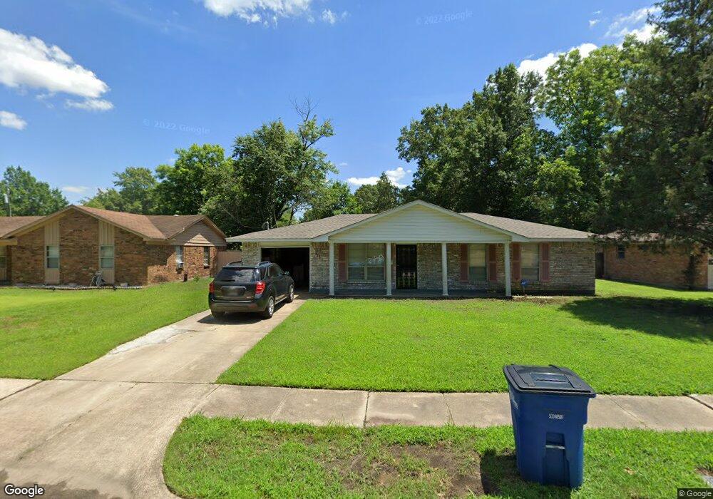
518 Purdue Ave West Memphis, AR 72301
Estimated Value: $122,000 - $168,000
3
Beds
2
Baths
1,168
Sq Ft
$121/Sq Ft
Est. Value
About This Home
This home is located at 518 Purdue Ave, West Memphis, AR 72301 and is currently estimated at $141,842, approximately $121 per square foot. 518 Purdue Ave is a home located in Crittenden County with nearby schools including Faulk Elementary School, Wonder Junior High School, and The Academies of West Memphis Charter School.
Ownership History
Date
Name
Owned For
Owner Type
Purchase Details
Closed on
Oct 15, 2021
Sold by
Clays Construction & Rentals Llc
Bought by
Smith Charles
Current Estimated Value
Home Financials for this Owner
Home Financials are based on the most recent Mortgage that was taken out on this home.
Original Mortgage
$100,152
Outstanding Balance
$91,329
Interest Rate
2.8%
Mortgage Type
FHA
Estimated Equity
$50,513
Purchase Details
Closed on
Oct 30, 2013
Sold by
Gholson Barbara J
Bought by
Clay Derrick
Purchase Details
Closed on
Feb 18, 2005
Sold by
Not Provided
Bought by
Gholson Barbara J
Purchase Details
Closed on
May 1, 1989
Bought by
To
Purchase Details
Closed on
Sep 1, 1988
Bought by
To
Create a Home Valuation Report for This Property
The Home Valuation Report is an in-depth analysis detailing your home's value as well as a comparison with similar homes in the area
Home Values in the Area
Average Home Value in this Area
Purchase History
| Date | Buyer | Sale Price | Title Company |
|---|---|---|---|
| Smith Charles | $102,000 | Stewart Title | |
| Clay Derrick | $20,000 | -- | |
| Gholson Barbara J | $73,000 | -- | |
| To | $54,000 | -- | |
| To | -- | -- |
Source: Public Records
Mortgage History
| Date | Status | Borrower | Loan Amount |
|---|---|---|---|
| Open | Smith Charles | $100,152 |
Source: Public Records
Tax History Compared to Growth
Tax History
| Year | Tax Paid | Tax Assessment Tax Assessment Total Assessment is a certain percentage of the fair market value that is determined by local assessors to be the total taxable value of land and additions on the property. | Land | Improvement |
|---|---|---|---|---|
| 2024 | $225 | $15,010 | $3,200 | $11,810 |
| 2023 | $300 | $15,010 | $3,200 | $11,810 |
| 2022 | $350 | $15,010 | $3,200 | $11,810 |
| 2021 | $351 | $15,010 | $3,200 | $11,810 |
| 2020 | $680 | $15,010 | $3,200 | $11,810 |
| 2019 | $620 | $16,390 | $3,200 | $13,190 |
| 2018 | $668 | $16,390 | $3,200 | $13,190 |
| 2017 | $668 | $16,390 | $3,200 | $13,190 |
| 2016 | $626 | $16,390 | $3,200 | $13,190 |
| 2015 | $675 | $16,390 | $3,200 | $13,190 |
| 2014 | $315 | $16,400 | $3,200 | $13,200 |
Source: Public Records
Map
Nearby Homes
- 503 Tulane Dr
- 811 Maple Dr
- 501 Oxford St
- 806 W Walnut Dr
- 402 Oxford St
- 819 Walnut Dr
- 912 Mimosa Dr
- 1003 Mimosa Dr
- 715 Foxwood St
- 920 Mimosa Dr
- 522 Lois Marie Cove
- 765 Dogwood Cove
- 905 Foxwood Cir
- 237 W Jefferson Ave
- 917 Foxwood Cir
- 908 Winchell St
- 1200 Winchell St
- 000 Garrison Ave
- 503 W Oliver Ave
- 302 Georgetown Dr