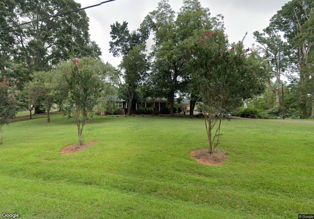
518 Sherrill Farm Rd Lincolnton, NC 28092
Estimated Value: $339,000 - $368,000
3
Beds
2
Baths
1,546
Sq Ft
$226/Sq Ft
Est. Value
About This Home
This home is located at 518 Sherrill Farm Rd, Lincolnton, NC 28092 and is currently estimated at $349,805, approximately $226 per square foot. 518 Sherrill Farm Rd is a home located in Lincoln County with nearby schools including Iron Station Elementary School, North Lincoln Middle School, and North Lincoln High School.
Ownership History
Date
Name
Owned For
Owner Type
Purchase Details
Closed on
Jan 14, 2022
Sold by
Townsend and Jessica
Bought by
Townsend Michael and Townsend Jessica
Current Estimated Value
Purchase Details
Closed on
Nov 4, 2021
Sold by
Townsend Michael and Townsend Jessica
Bought by
Townsend Michael and Townsend Jessica
Purchase Details
Closed on
Sep 3, 1999
Bought by
Townsend Michael and Jessica Townsen
Create a Home Valuation Report for This Property
The Home Valuation Report is an in-depth analysis detailing your home's value as well as a comparison with similar homes in the area
Home Values in the Area
Average Home Value in this Area
Purchase History
| Date | Buyer | Sale Price | Title Company |
|---|---|---|---|
| Townsend Michael | -- | Jonas Law Firm Pllc | |
| Townsend Michael | -- | None Available | |
| Townsend Michael | $125,000 | -- |
Source: Public Records
Tax History Compared to Growth
Tax History
| Year | Tax Paid | Tax Assessment Tax Assessment Total Assessment is a certain percentage of the fair market value that is determined by local assessors to be the total taxable value of land and additions on the property. | Land | Improvement |
|---|---|---|---|---|
| 2025 | $2,022 | $301,658 | $32,875 | $268,783 |
| 2024 | $2,002 | $301,658 | $32,875 | $268,783 |
| 2023 | $1,997 | $301,658 | $32,875 | $268,783 |
| 2022 | $1,454 | $180,021 | $26,364 | $153,657 |
| 2021 | $1,454 | $180,021 | $26,364 | $153,657 |
| 2020 | $1,303 | $180,021 | $26,364 | $153,657 |
| 2019 | $1,267 | $180,021 | $26,364 | $153,657 |
| 2018 | $1,328 | $171,352 | $23,910 | $147,442 |
| 2017 | $1,218 | $171,352 | $23,910 | $147,442 |
| 2016 | $1,218 | $171,352 | $23,910 | $147,442 |
| 2015 | $1,280 | $171,352 | $23,910 | $147,442 |
| 2014 | $1,057 | $141,094 | $23,910 | $117,184 |
Source: Public Records
Map
Nearby Homes
- 370 Sherrill Farm Rd
- 2583 Wallace Acres Ln
- 2794 N Carolina Highway 150
- 2984 N Carolina 27
- 000 Curveview Rd
- 2546 N Carolina Highway 150
- 2914 Weatherfield Dr
- 2911 Weatherfield Dr
- 741 Sunridge Dr
- 1471 Arden Dr
- 2983 Tavistock Ln
- 1335 Huckleberry Dr
- 3478 N Carolina Highway 150
- lot 22 Weatherwood Dr Unit 22
- 00 Mcalister Rd
- 1818 Maple Ln
- 2202 Carpenter Farms Dr
- 3164 Andrew Link Rd
- 575 Hill Rd
- 1681 Woolie Rd
- 544 Sherrill Farm Rd
- 517 Sherrill Farm Rd
- 483 Sherrill Farm Rd
- 539 Sherrill Farm Rd
- 484 Sherrill Farm Rd
- 563 Sherrill Farm Rd
- 464 Sherrill Farm Rd
- 459 Sherrill Farm Rd
- 580 Sherrill Farm Rd
- 446 Sherrill Farm Rd
- 462 Sherrill Farm Rd
- 550 Sherrill Farm Rd
- 436 Sherrill Farm Rd
- 543 Sherrill Farm Rd
- 431 Sherrill Farm Rd
- 612 Sherrill Farm Rd
- 415 Sherrill Farm Rd
- 569 Sherrill Farm Rd
- 405 Sherrill Farm Rd
- 408 Sherrill Farm Rd