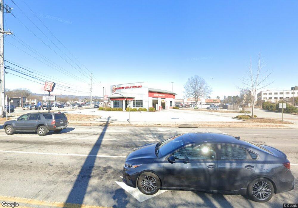
5188 Highway 153 Hixson, TN 37343
North Gate-Big Ridge Neighborhood
--
Bed
--
Bath
2,080
Sq Ft
0.78
Acres
About This Home
This home is located at 5188 Highway 153, Hixson, TN 37343. 5188 Highway 153 is a home located in Hamilton County with nearby schools including Big Ridge Elementary School, Hixson Middle School, and Hixson High School.
Ownership History
Date
Name
Owned For
Owner Type
Purchase Details
Closed on
Jun 25, 2021
Sold by
Firstbank
Bought by
Acre Hixson Llc
Home Financials for this Owner
Home Financials are based on the most recent Mortgage that was taken out on this home.
Original Mortgage
$1,780,688
Outstanding Balance
$1,612,191
Interest Rate
2.9%
Mortgage Type
Construction
Purchase Details
Closed on
Apr 5, 2019
Sold by
Atlantic Capital Bank Na
Bought by
Firstbank
Purchase Details
Closed on
Jun 12, 2008
Sold by
Yother Arthur and Yother Larry
Bought by
Fsgbank Na
Purchase Details
Closed on
Oct 12, 2006
Sold by
C S G Leasing Corp
Bought by
Yother Arthur and Yother Larry
Create a Home Valuation Report for This Property
The Home Valuation Report is an in-depth analysis detailing your home's value as well as a comparison with similar homes in the area
Home Values in the Area
Average Home Value in this Area
Purchase History
| Date | Buyer | Sale Price | Title Company |
|---|---|---|---|
| Acre Hixson Llc | $1,400,000 | Jones Title Ins Agency | |
| Acre Hixson Llc | $1,400,000 | Jones Title | |
| Firstbank | $589,267 | None Available | |
| Fsgbank Na | $1,150,000 | Pioneer Title Agency Inc | |
| Yother Arthur | -- | Pioneer Title Agency Inc | |
| Yother Arthur | $975,000 | None Available |
Source: Public Records
Mortgage History
| Date | Status | Borrower | Loan Amount |
|---|---|---|---|
| Open | Acre Hixson Llc | $1,780,688 | |
| Closed | Acre Hixson Llc | $1,712,200 |
Source: Public Records
Tax History Compared to Growth
Tax History
| Year | Tax Paid | Tax Assessment Tax Assessment Total Assessment is a certain percentage of the fair market value that is determined by local assessors to be the total taxable value of land and additions on the property. | Land | Improvement |
|---|---|---|---|---|
| 2024 | $14,197 | $634,560 | $0 | $0 |
| 2023 | $14,197 | $634,560 | $0 | $0 |
| 2022 | $14,197 | $634,560 | $0 | $0 |
| 2021 | $11,730 | $524,280 | $0 | $0 |
| 2020 | $9,785 | $353,880 | $0 | $0 |
| 2019 | $9,785 | $353,880 | $0 | $0 |
| 2018 | $9,070 | $353,880 | $0 | $0 |
| 2017 | $9,785 | $353,880 | $0 | $0 |
| 2016 | $9,986 | $0 | $0 | $0 |
| 2015 | $19,246 | $361,120 | $0 | $0 |
| 2014 | $31,944 | $0 | $0 | $0 |
Source: Public Records
Map
Nearby Homes
- 1716 Strawberry Ln
- 1422 Cloverdale Cir
- 1237 Cranbrook Dr
- 2525 Crescent Club Dr
- 1331 Cloverdale Cir
- 5195 Austin Rd
- 4630 Ansel Cir
- 5215 Austin Rd
- 5388 Mandarin Cir
- 5459 Mandarin Cir
- 0 Hamill Rd Unit RTC2969382
- 0 Hamill Rd Unit 1518098
- 5396 Mandarin Cir
- 5478 Mandarin Cir
- 1328 Michael Ln
- 3909 Memphis Dr
- 5414 Mandarin Cir
- 955 Brynwood Dr
- 1308 Gadd Rd
- 1212 Helena Dr
- 0 Highway 153
- 2060 Hamill Rd
- 5114 Tennessee 153
- 2062 Hamill Rd
- 1997 Abbington Farm Way
- 1996 Abbington Farm Way
- 1984 Abbington Farm Way
- 1985 Abbington Farm Way
- 1973 Abbington Farm Way
- 1961 Abbington Farm Way
- 1972 Abbington Farm Way
- 1960 Abbington Farm Way
- 1948 Abbington Farm Way
- 1937 Abbington Farm Way
- 1925 Abbington Farm Way
- 1913 Abbington Farm Way
- 1932 Abbington Farm Way
- 1924 Abbington Farm Way
- 1910 Abbington Farm Way
- 1887 Abbington Farm Way
