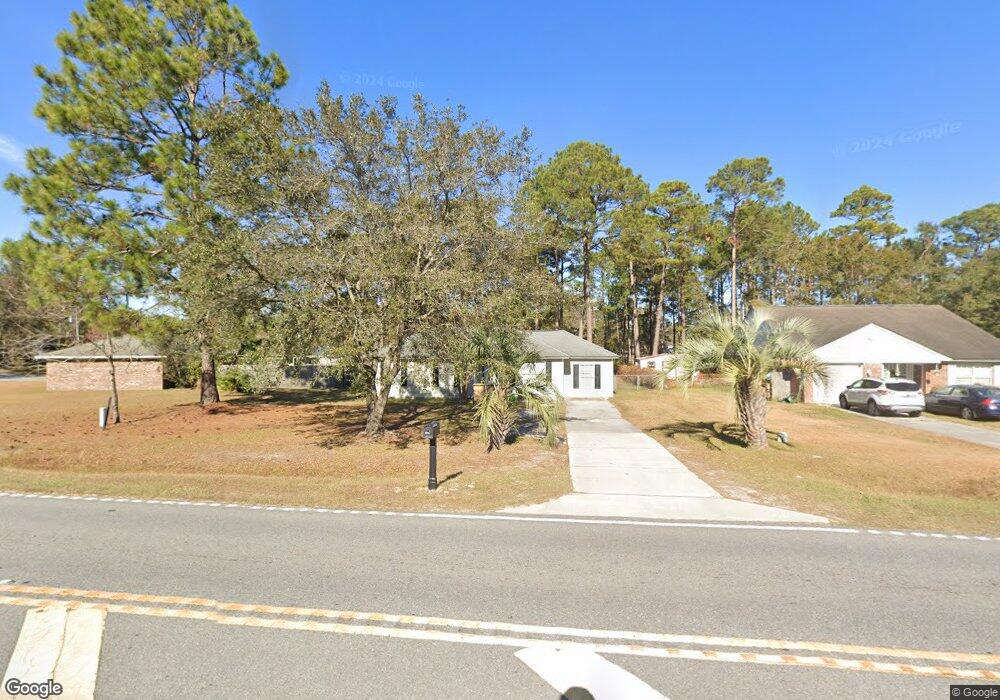
5189 Mccall Rd Rincon, GA 31326
Estimated Value: $226,369 - $240,000
3
Beds
2
Baths
1,016
Sq Ft
$229/Sq Ft
Est. Value
About This Home
This home is located at 5189 Mccall Rd, Rincon, GA 31326 and is currently estimated at $233,092, approximately $229 per square foot. 5189 Mccall Rd is a home located in Effingham County with nearby schools including Blandford Elementary School, Ebenezer Middle School, and South Effingham High School.
Ownership History
Date
Name
Owned For
Owner Type
Purchase Details
Closed on
Oct 28, 2021
Sold by
Sampson Michael A
Bought by
Stuart Annie
Current Estimated Value
Purchase Details
Closed on
Jul 18, 2008
Sold by
Sampson Annie
Bought by
Sampson Michael A
Home Financials for this Owner
Home Financials are based on the most recent Mortgage that was taken out on this home.
Original Mortgage
$119,262
Interest Rate
6.37%
Mortgage Type
FHA
Create a Home Valuation Report for This Property
The Home Valuation Report is an in-depth analysis detailing your home's value as well as a comparison with similar homes in the area
Home Values in the Area
Average Home Value in this Area
Purchase History
| Date | Buyer | Sale Price | Title Company |
|---|---|---|---|
| Stuart Annie | -- | -- | |
| Sampson Michael A | -- | -- | |
| Sampson Michael A | $110,000 | -- |
Source: Public Records
Mortgage History
| Date | Status | Borrower | Loan Amount |
|---|---|---|---|
| Previous Owner | Sampson Michael A | $119,262 |
Source: Public Records
Tax History
| Year | Tax Paid | Tax Assessment Tax Assessment Total Assessment is a certain percentage of the fair market value that is determined by local assessors to be the total taxable value of land and additions on the property. | Land | Improvement |
|---|---|---|---|---|
| 2025 | $2,137 | $77,977 | $22,800 | $55,177 |
| 2024 | $2,137 | $77,087 | $22,800 | $54,287 |
| 2023 | $1,352 | $58,066 | $18,800 | $39,266 |
| 2022 | $1,653 | $45,090 | $14,000 | $31,090 |
| 2021 | $1,631 | $44,672 | $14,000 | $30,672 |
| 2020 | $1,574 | $43,479 | $12,000 | $31,479 |
| 2019 | $1,448 | $38,966 | $10,000 | $28,966 |
| 2018 | $1,429 | $38,025 | $10,000 | $28,025 |
| 2017 | $1,387 | $36,433 | $9,560 | $26,873 |
| 2016 | $1,186 | $31,291 | $8,000 | $23,291 |
| 2015 | $1,085 | $27,964 | $5,600 | $22,364 |
| 2014 | $1,093 | $27,964 | $5,600 | $22,364 |
| 2013 | -- | $25,364 | $3,000 | $22,364 |
Source: Public Records
Map
Nearby Homes
- 5323 Mccall Rd
- 138 John Glenn Dr
- 5033 Mccall Rd
- 204 Whitehall Ave
- 125 Westwood Dr
- 127 John Glenn Dr
- 124 Oak St
- 117 Whitehall Ave
- 100 Usher Place
- 119 Mulberry Way
- 127 Crystal Dr
- 107 Melrose Place
- 121 Crystal Dr
- 5475 Mccall Rd
- 105 Melrose Place
- 104 Frontage Rd
- 144 Lewis Dr
- 100 Cypress Dr
- 5030 Winfield Dr
- 13 Towne Park Ct
- 5197 Mccall Rd
- 225 Lord Effingham Dr
- 223 Lord Effingham Dr
- 5205 Mccall Rd
- 221 Greene Dr
- 5213 Mccall Rd
- 219 Greene Dr
- 224 Lord Effingham Dr
- 5188 Mccall Rd
- 217 Greene Dr
- 5210 Mccall Rd
- 5221 Mccall Rd
- 5198 Mccall Rd
- 222 Lord Effingham Dr
- 215 Greene Dr
- 5220 Mccall Rd
- 5174 Mccall Rd
- 5229 Mccall Rd
- 220 Lord Effingham Dr
- 213 Greene Dr
Your Personal Tour Guide
Ask me questions while you tour the home.