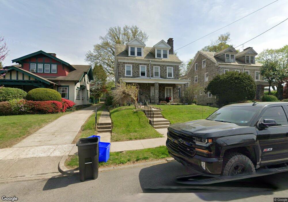
519 Gates St Philadelphia, PA 19128
Roxborough NeighborhoodEstimated Value: $688,000 - $734,000
4
Beds
2
Baths
3,314
Sq Ft
$217/Sq Ft
Est. Value
About This Home
This home is located at 519 Gates St, Philadelphia, PA 19128 and is currently estimated at $717,516, approximately $216 per square foot. 519 Gates St is a home located in Philadelphia County with nearby schools including Shawmont School, Roxborough High School, and Green Woods CS.
Ownership History
Date
Name
Owned For
Owner Type
Purchase Details
Closed on
Oct 19, 2014
Sold by
Ely Erle E
Bought by
Mullarkey Lauren E and Mullarkey Michael W
Current Estimated Value
Home Financials for this Owner
Home Financials are based on the most recent Mortgage that was taken out on this home.
Original Mortgage
$292,339
Outstanding Balance
$224,778
Interest Rate
4.18%
Mortgage Type
VA
Estimated Equity
$492,738
Purchase Details
Closed on
Jun 15, 1951
Bought by
Ehly Erle E and Ehly Janet T
Create a Home Valuation Report for This Property
The Home Valuation Report is an in-depth analysis detailing your home's value as well as a comparison with similar homes in the area
Home Values in the Area
Average Home Value in this Area
Purchase History
| Date | Buyer | Sale Price | Title Company |
|---|---|---|---|
| Mullarkey Lauren E | -- | None Available | |
| Ehly Erle E | -- | -- |
Source: Public Records
Mortgage History
| Date | Status | Borrower | Loan Amount |
|---|---|---|---|
| Open | Mullarkey Lauren E | $292,339 |
Source: Public Records
Tax History Compared to Growth
Tax History
| Year | Tax Paid | Tax Assessment Tax Assessment Total Assessment is a certain percentage of the fair market value that is determined by local assessors to be the total taxable value of land and additions on the property. | Land | Improvement |
|---|---|---|---|---|
| 2025 | $6,470 | $592,300 | $118,460 | $473,840 |
| 2024 | $6,470 | $592,300 | $118,460 | $473,840 |
| 2023 | $6,470 | $462,200 | $92,440 | $369,760 |
| 2022 | $4,113 | $417,200 | $92,440 | $324,760 |
| 2021 | $4,743 | $0 | $0 | $0 |
| 2020 | $4,743 | $0 | $0 | $0 |
| 2019 | $4,661 | $0 | $0 | $0 |
| 2018 | $5,336 | $0 | $0 | $0 |
| 2017 | $5,336 | $0 | $0 | $0 |
| 2016 | $5,336 | $0 | $0 | $0 |
| 2015 | $5,108 | $0 | $0 | $0 |
| 2014 | -- | $381,200 | $300,152 | $81,048 |
| 2012 | -- | $45,120 | $8,377 | $36,743 |
Source: Public Records
Map
Nearby Homes
- 577 Acorn St
- 6232 Ridge Ave
- 539 Overlook Rd
- 572 Hermitage St
- 514 Overlook Rd
- 468 Leverington Ave
- 450 Ripka St
- 562 Leverington Ave
- 438 1/2 Leverington Ave
- 6526 Ridge Ave
- 623 Hermitage St
- 640 Hermitage St
- 628 Leverington Ave Unit 1
- 4538 Mitchell St
- 4531 Mitchell St
- 412 Delmar St
- 354 Ripka St
- 452 Green Ln
- 603 Green Ln
- 400 Delmar St
- 523 Gates St
- 515 Gates St
- 527 Gates St
- 511 Gates St
- 529-31 Gates St
- 529 Gates St Unit 31
- 531 Gates St
- 535 Gates St
- 6321 Ridge Ave
- 522 Hermitage St Unit 24
- 524 Gates St Unit 26
- 524-26 Gates St
- 520 Gates St Unit 22
- 520-22 Gates St
- 539 Gates St
- 526-28 Hermitage St
- 526 Hermitage St Unit 28
- 516 Gates St
- 528 Gates St Unit 30
- 512 Gates St Unit 14