
Seller's Agent in 2026
Michelle Theriault
J. Barrett & Company
(978) 578-0778
1 in this area
37 Total Sales
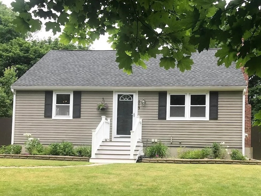
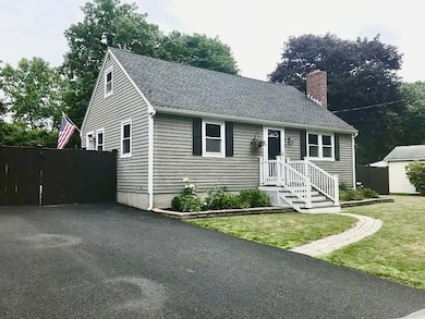
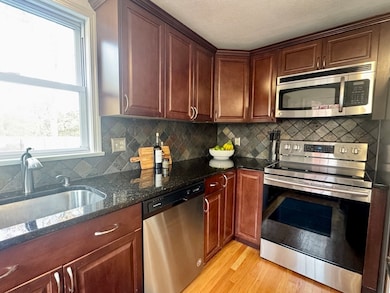
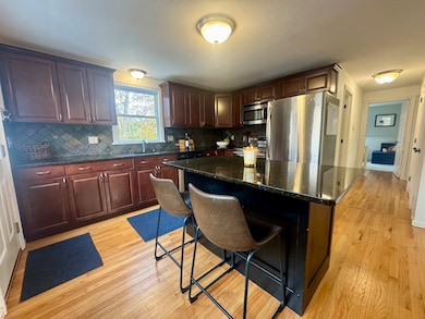
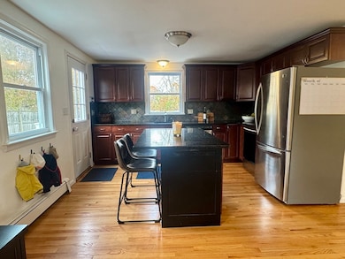
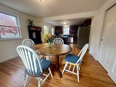
Nestled at 519 Maple Street, Danvers, MA, this single-family residence presents an inviting home, ready to move in and start creating memories. The heart of this home is undoubtedly the kitchen, designed for both culinary exploration and social gatherings; imagine preparing delicious meals on the stone countertops, utilizing the expansive kitchen island, and enjoying casual conversation at the kitchen bar while appreciating the elegant backsplash. The living room offers a comforting atmosphere, featuring a fireplace that creates a cozy focal point for relaxation and gatherings. The property extends its charm outdoors, where a patio and outdoor dining area await, promising delightful moments spent enjoying the fresh air and sunshine by the pool. The fenced backyard provides a secure and private space for relaxation and recreation, complemented by a shed for convenient storage. Just beyond the backyard gate find a path that takes you to the Preston playground.
| Date | Type | Sale Price | Title Company |
|---|---|---|---|
| Quit Claim Deed | $685,000 | -- | |
| Quit Claim Deed | $615,000 | None Available | |
| Deed | $345,000 | -- |
| Date | Status | Loan Amount | Loan Type |
|---|---|---|---|
| Open | $616,500 | New Conventional | |
| Previous Owner | $584,250 | Purchase Money Mortgage | |
| Previous Owner | $10,000 | No Value Available | |
| Previous Owner | $276,000 | Purchase Money Mortgage | |
| Previous Owner | $32,000 | No Value Available |
| Date | Event | Price | List to Sale | Price per Sq Ft |
|---|---|---|---|---|
| 01/05/2026 01/05/26 | Sold | $685,000 | -0.6% | $480 / Sq Ft |
| 11/18/2025 11/18/25 | Pending | -- | -- | -- |
| 11/11/2025 11/11/25 | For Sale | $689,000 | -- | $482 / Sq Ft |
| Year | Tax Paid | Tax Assessment Tax Assessment Total Assessment is a certain percentage of the fair market value that is determined by local assessors to be the total taxable value of land and additions on the property. | Land | Improvement |
|---|---|---|---|---|
| 2025 | $6,317 | $574,800 | $330,300 | $244,500 |
| 2024 | $6,072 | $546,500 | $312,000 | $234,500 |
| 2023 | $5,843 | $497,300 | $281,400 | $215,900 |
| 2022 | $5,722 | $452,000 | $244,700 | $207,300 |
| 2021 | $5,556 | $416,200 | $234,900 | $181,300 |
| 2020 | $5,439 | $416,500 | $244,700 | $171,800 |
| 2019 | $4,888 | $368,100 | $199,400 | $168,700 |
| 2018 | $4,823 | $356,200 | $199,400 | $156,800 |
| 2017 | $4,710 | $331,900 | $183,500 | $148,400 |
| 2016 | $4,653 | $327,700 | $183,500 | $144,200 |
| 2015 | $4,510 | $302,500 | $159,000 | $143,500 |
Seller's Agent in 2026
Michelle Theriault
J. Barrett & Company
(978) 578-0778
1 in this area
37 Total Sales
Buyer's Agent in 2026
Cindy Moore
Moore Real Estate Team LLC
(978) 580-7044
3 in this area
17 Total Sales
Source: MLS Property Information Network (MLS PIN)
MLS Number: 73453462
APN: DANV-000018-000000-000014
Disclaimer: Certain information contained herein is derived from information provided by parties other than Homes.com. All information provided is deemed reliable, but is not guaranteed to be accurate and should be independently verified.
![]() The property listing data and information, or the Images, set forth herein were provided to MLS Property Information Network, Inc. from third party sources, including sellers, lessors and public records, and were compiled by MLS Property Information Network, Inc. The property listing data and information, and the Images, are for the personal, non-commercial use of consumers having a good faith interest in purchasing or leasing listed properties of the type displayed to them and may not be used for any purpose other than to identify prospective properties which such consumers may have a good faith interest in purchasing or leasing. MLS Property Information Network, Inc. and its subscribers disclaim any and all representations and warranties as to the accuracy of the property listing data and information, or as to the accuracy of any of the Images, set forth herein.
The property listing data and information, or the Images, set forth herein were provided to MLS Property Information Network, Inc. from third party sources, including sellers, lessors and public records, and were compiled by MLS Property Information Network, Inc. The property listing data and information, and the Images, are for the personal, non-commercial use of consumers having a good faith interest in purchasing or leasing listed properties of the type displayed to them and may not be used for any purpose other than to identify prospective properties which such consumers may have a good faith interest in purchasing or leasing. MLS Property Information Network, Inc. and its subscribers disclaim any and all representations and warranties as to the accuracy of the property listing data and information, or as to the accuracy of any of the Images, set forth herein.
Ask me questions while you tour the home.