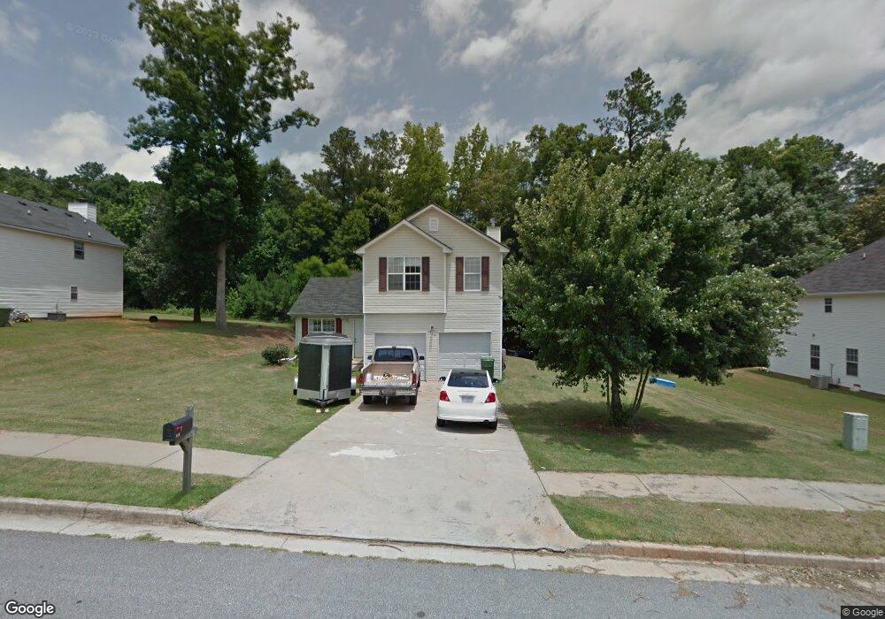
519 Michael Cir Monroe, GA 30655
Estimated Value: $270,000 - $325,000
3
Beds
3
Baths
1,677
Sq Ft
$178/Sq Ft
Est. Value
About This Home
This home is located at 519 Michael Cir, Monroe, GA 30655 and is currently estimated at $299,291, approximately $178 per square foot. 519 Michael Cir is a home located in Walton County with nearby schools including Atha Road Elementary School, Youth Middle School, and Walnut Grove High School.
Ownership History
Date
Name
Owned For
Owner Type
Purchase Details
Closed on
Aug 29, 2011
Sold by
Jones Thomas P
Bought by
Billings Linda L
Current Estimated Value
Purchase Details
Closed on
Feb 15, 2007
Sold by
Hud
Bought by
Jones Thomas P
Purchase Details
Closed on
Sep 5, 2006
Sold by
Gmac Mtg Corp
Bought by
Hud
Purchase Details
Closed on
Jun 28, 2002
Sold by
Scenic Homes
Bought by
Aponte Gisela
Home Financials for this Owner
Home Financials are based on the most recent Mortgage that was taken out on this home.
Original Mortgage
$121,546
Interest Rate
6.53%
Mortgage Type
FHA
Create a Home Valuation Report for This Property
The Home Valuation Report is an in-depth analysis detailing your home's value as well as a comparison with similar homes in the area
Home Values in the Area
Average Home Value in this Area
Purchase History
| Date | Buyer | Sale Price | Title Company |
|---|---|---|---|
| Billings Linda L | $70,000 | -- | |
| Jones Thomas P | -- | -- | |
| Hud | -- | -- | |
| Gmac Mtg Corp | $119,731 | -- | |
| Aponte Gisela | $122,600 | -- |
Source: Public Records
Mortgage History
| Date | Status | Borrower | Loan Amount |
|---|---|---|---|
| Previous Owner | Aponte Gisela | $121,546 |
Source: Public Records
Tax History
| Year | Tax Paid | Tax Assessment Tax Assessment Total Assessment is a certain percentage of the fair market value that is determined by local assessors to be the total taxable value of land and additions on the property. | Land | Improvement |
|---|---|---|---|---|
| 2025 | $1,078 | $101,960 | $22,000 | $79,960 |
| 2024 | $970 | $98,360 | $22,000 | $76,360 |
| 2023 | $642 | $97,680 | $22,000 | $75,680 |
| 2022 | $877 | $79,720 | $17,200 | $62,520 |
| 2021 | $761 | $60,360 | $13,200 | $47,160 |
| 2020 | $747 | $56,000 | $12,400 | $43,600 |
| 2019 | $752 | $47,960 | $12,000 | $35,960 |
| 2018 | $678 | $47,960 | $12,000 | $35,960 |
| 2017 | $1,683 | $40,160 | $8,000 | $32,160 |
| 2016 | $659 | $40,560 | $8,000 | $32,560 |
| 2015 | $628 | $35,680 | $8,000 | $27,680 |
| 2014 | $541 | $29,240 | $0 | $0 |
Source: Public Records
Map
Nearby Homes
- 525 Michael Cir
- 845 Ashley Ct
- 720 Overlook Crest
- 679 Michael Cir
- 675 Michael Cir
- 661 Michael Cir
- 631 St Ives Walk
- 921 Horizon Ct
- 911 Woodchase Dr
- 925 Tigers Way
- 810 Hampton
- 505 Breedlove Dr
- 506 Breedlove Dr
- 250 Martin Luther King Junior Blvd
- 0 Pine View Dr Unit CL350808
- 0 Pine View Dr Unit 10706074
- 0 Pine View Dr Unit 7731449
- 150 Mountain View Dr
- 299 Claiborne Way
- 1269 Georgia 138
- 521 Michael Cir
- 523 Michael Cir
- 515 Michael Cir
- 518 Michael Cir
- 850 Ashley Ct
- 516 Michael Cir
- 520 Michael Cir
- 514 Michael Cir
- 513 Michael Cir
- 522 Michael Cir
- 510 Michael Cir
- 711 Overlook Crest
- 709 Overlook Crest
- 715 Overlook Crest
- 524 Michael Cir
- 705 Overlook Crest
- 840 Ashley Ct
- 529 Michael Cir
- 511 Michael Cir
- 717 Overlook Crest
Your Personal Tour Guide
Ask me questions while you tour the home.