519 Southwest Pkwy Unit D College Station, TX 77840
Southside NeighborhoodEstimated Value: $194,000 - $218,000
4
Beds
4
Baths
1,236
Sq Ft
$166/Sq Ft
Est. Value
About This Home
This home is located at 519 Southwest Pkwy Unit D, College Station, TX 77840 and is currently estimated at $204,912, approximately $165 per square foot. 519 Southwest Pkwy Unit D is a home located in Brazos County with nearby schools including Forest Ridge Elementary School, A&M Consolidated Middle School, and Oakwood Intermediate School.
Ownership History
Date
Name
Owned For
Owner Type
Purchase Details
Closed on
Jun 17, 2005
Sold by
Andreani Nicolo and Andreani Fulvio S
Bought by
Johnson Richard D
Current Estimated Value
Home Financials for this Owner
Home Financials are based on the most recent Mortgage that was taken out on this home.
Original Mortgage
$79,920
Outstanding Balance
$44,221
Interest Rate
5.63%
Mortgage Type
Purchase Money Mortgage
Create a Home Valuation Report for This Property
The Home Valuation Report is an in-depth analysis detailing your home's value as well as a comparison with similar homes in the area
Home Values in the Area
Average Home Value in this Area
Purchase History
| Date | Buyer | Sale Price | Title Company |
|---|---|---|---|
| Johnson Richard D | -- | University Title Company |
Source: Public Records
Mortgage History
| Date | Status | Borrower | Loan Amount |
|---|---|---|---|
| Open | Johnson Richard D | $79,920 |
Source: Public Records
Tax History Compared to Growth
Tax History
| Year | Tax Paid | Tax Assessment Tax Assessment Total Assessment is a certain percentage of the fair market value that is determined by local assessors to be the total taxable value of land and additions on the property. | Land | Improvement |
|---|---|---|---|---|
| 2023 | $3,443 | $165,000 | $16,500 | $148,500 |
| 2022 | $2,681 | $125,757 | $15,000 | $110,757 |
| 2021 | $2,578 | $114,128 | $15,000 | $99,128 |
| 2020 | $2,620 | $115,366 | $15,000 | $100,366 |
| 2019 | $2,839 | $120,160 | $15,000 | $105,160 |
| 2018 | $3,156 | $132,570 | $15,000 | $117,570 |
| 2017 | $2,663 | $113,150 | $15,000 | $98,150 |
| 2016 | $2,550 | $108,360 | $15,000 | $93,360 |
| 2015 | $2,309 | $101,640 | $15,000 | $86,640 |
| 2014 | $2,309 | $99,620 | $15,000 | $84,620 |
Source: Public Records
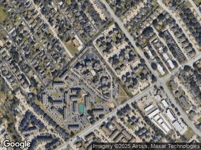
Map
Nearby Homes
- 525 SW #302
- 527 Southwest Pkwy Unit 103
- 519 Southwest Pkwy Unit 302
- 529 Southwest Pkwy Unit 201
- 1205 Carolina St
- 1209 Georgia St
- 1200 Georgia St
- 1610 Leona Dr
- 1200-02, 1137-39, 12 Georgia St
- 1137 Georgia St
- 1112 Detroit St
- 1112 and 1114 Georgia St
- 711 Swiss Ct
- 1125 Welsh Ave
- 612 Townplace Dr
- 1104 Georgia St
- 607 Townplace Dr
- 420 Edward St
- 1725 Harvey Mitchell Pkwy S Unit 211
- 1725 Harvey Mitchell Pkwy S Unit 2423
- 519 Southwest Pkwy Unit M
- 519 Southwest Pkwy Unit L
- 519 Southwest Pkwy Unit K
- 519 Southwest Pkwy Unit J
- 519 Southwest Pkwy Unit H
- 519 Southwest Pkwy Unit G
- 519 Southwest Pkwy Unit F
- 519 Southwest Pkwy
- 519 Southwest Pkwy Unit D
- 519 Southwest Pkwy Unit C
- 519 Southwest Pkwy Unit B
- 519 Southwest Pkwy Unit A
- 519 Southwest Pkwy Unit 201 Rm. 1
- 519 Southwest Pkwy Unit 204
- 519 Southwest Pkwy Unit 201 Rm. 2
- 519 Southwest Pkwy Unit 201 Rm. 3
- 519 Southwest Pkwy Unit 201 Rm. 4
- 519 Southwest Pkwy Unit 203
- 519 Southwest Pkwy Unit 103
- 519 Southwest Pkwy Unit 304