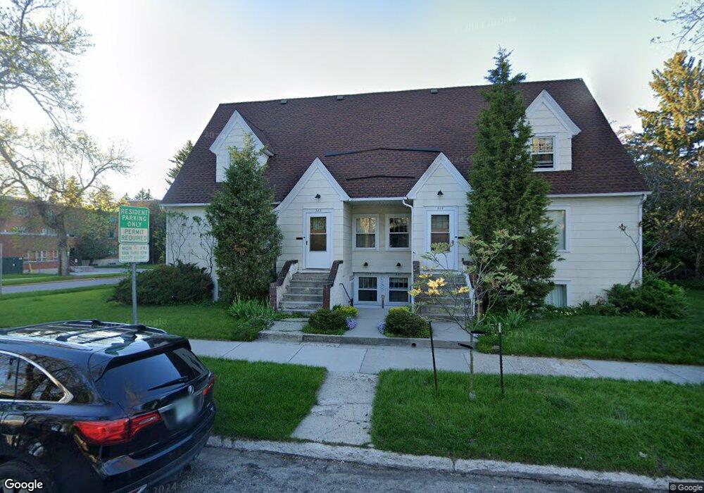
519 W Arthur St Bozeman, MT 59715
University NeighborhoodEstimated Value: $1,081,000 - $1,495,000
10
Beds
4
Baths
2,260
Sq Ft
$554/Sq Ft
Est. Value
About This Home
This home is located at 519 W Arthur St, Bozeman, MT 59715 and is currently estimated at $1,251,000, approximately $553 per square foot. 519 W Arthur St is a home located in Gallatin County with nearby schools including Irving Elementary School, Sacajawea Middle School, and Bozeman High School.
Ownership History
Date
Name
Owned For
Owner Type
Purchase Details
Closed on
Feb 9, 2021
Sold by
Breen Stephanie A
Bought by
West Arthur Street Llc
Current Estimated Value
Home Financials for this Owner
Home Financials are based on the most recent Mortgage that was taken out on this home.
Original Mortgage
$149,000
Interest Rate
2.7%
Mortgage Type
New Conventional
Purchase Details
Closed on
Dec 23, 2020
Sold by
West Arthur Street Llc
Bought by
Breen Stephanie A
Home Financials for this Owner
Home Financials are based on the most recent Mortgage that was taken out on this home.
Original Mortgage
$149,000
Interest Rate
2.7%
Mortgage Type
New Conventional
Purchase Details
Closed on
Aug 12, 2005
Sold by
Breen James
Bought by
Breen James
Create a Home Valuation Report for This Property
The Home Valuation Report is an in-depth analysis detailing your home's value as well as a comparison with similar homes in the area
Home Values in the Area
Average Home Value in this Area
Purchase History
| Date | Buyer | Sale Price | Title Company |
|---|---|---|---|
| West Arthur Street Llc | -- | Mclean Younkin & Willett Pllc | |
| Breen Stephanie A | -- | Amrock Inc | |
| Breen James | -- | None Available |
Source: Public Records
Mortgage History
| Date | Status | Borrower | Loan Amount |
|---|---|---|---|
| Previous Owner | Breen Stephanie A | $149,000 |
Source: Public Records
Tax History
| Year | Tax Paid | Tax Assessment Tax Assessment Total Assessment is a certain percentage of the fair market value that is determined by local assessors to be the total taxable value of land and additions on the property. | Land | Improvement |
|---|---|---|---|---|
| 2025 | $6,447 | $1,282,300 | $0 | $0 |
| 2024 | $6,514 | $978,500 | $0 | $0 |
| 2023 | $6,293 | $978,500 | $0 | $0 |
| 2022 | $4,238 | $552,700 | $0 | $0 |
| 2021 | $4,677 | $552,700 | $0 | $0 |
| 2020 | $4,562 | $534,900 | $0 | $0 |
| 2019 | $4,667 | $534,900 | $0 | $0 |
| 2018 | $4,203 | $446,400 | $0 | $0 |
| 2017 | $3,929 | $446,400 | $0 | $0 |
| 2016 | $3,796 | $403,000 | $0 | $0 |
| 2015 | $3,799 | $403,000 | $0 | $0 |
| 2014 | $2,868 | $178,957 | $0 | $0 |
Source: Public Records
Map
Nearby Homes
- 619 W Harrison St
- 1302 S 3rd Ave
- 723 S 5th Ave
- 911 S Willson Ave
- 707 S 10th Ave
- 507 S 8th Ave
- 419 S 3rd Ave
- 1014 W Dickerson St
- 112 E College St Unit 6
- 401 S Grand Ave
- 509 S Tracy Ave
- 412 S 11th Ave
- 319 S Willson Ave
- 221 S 7th Ave
- 516 W Olive St
- 416 W Olive St
- 405 Ice Pond Rd
- 209 S 8th Ave
- 102 Hoffman Dr Unit 1
- 1914 Spring Creek Dr
- 1014 S 6th Ave
- 1102 S 6th Ave
- 1010 S 6th Ave
- 1106 S 6th Ave
- 504 W Arthur St
- 516 W Cleveland St
- 1110 S 6th Ave
- 520 W Cleveland St
- 1114 S 6th Ave
- 504 W Cleveland St
- 1113 S 5th Ave
- 1120 S 6th Ave
- 1022 S 5th Ave
- 1016 S 5th Ave
- 1104 S 5th Ave
- 426 W Cleveland St
- 521 W Cleveland St
- 515 W Cleveland St
- 1200 S 6th Ave
- 1110 S 5th Ave
Your Personal Tour Guide
Ask me questions while you tour the home.