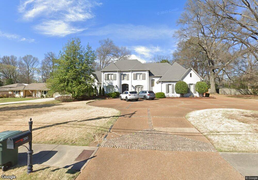
5190 Cole Rd Memphis, TN 38117
Audubon Park NeighborhoodEstimated Value: $407,000 - $1,150,000
4
Beds
4
Baths
6,369
Sq Ft
$144/Sq Ft
Est. Value
About This Home
This home is located at 5190 Cole Rd, Memphis, TN 38117 and is currently estimated at $914,361, approximately $143 per square foot. 5190 Cole Rd is a home located in Shelby County with nearby schools including White Station Elementary School, White Station High, and White Station Middle.
Ownership History
Date
Name
Owned For
Owner Type
Purchase Details
Closed on
Nov 14, 2002
Sold by
Dattel Samuel
Bought by
Belvin Sean T and Belvin Audrey D
Current Estimated Value
Home Financials for this Owner
Home Financials are based on the most recent Mortgage that was taken out on this home.
Original Mortgage
$574,550
Outstanding Balance
$239,413
Interest Rate
5.95%
Estimated Equity
$674,948
Purchase Details
Closed on
Jun 1, 2001
Sold by
Mcadoo Frances M
Bought by
Dattel Samuel
Purchase Details
Closed on
Jul 12, 1996
Sold by
Mcadoo Frances M
Bought by
Mcadoo Frances M
Purchase Details
Closed on
Jul 9, 1996
Sold by
Cotton Margee Morgan
Bought by
Mcadoo Frances M
Purchase Details
Closed on
Jul 8, 1996
Sold by
Pendergrast Bobara Ann
Bought by
Mcadoo Frances M
Create a Home Valuation Report for This Property
The Home Valuation Report is an in-depth analysis detailing your home's value as well as a comparison with similar homes in the area
Home Values in the Area
Average Home Value in this Area
Purchase History
| Date | Buyer | Sale Price | Title Company |
|---|---|---|---|
| Belvin Sean T | -- | Mid South Title Services Llc | |
| Dattel Samuel | $140,000 | -- | |
| Mcadoo Frances M | -- | -- | |
| Mcadoo Frances M | -- | -- | |
| Mcadoo Frances M | -- | -- |
Source: Public Records
Mortgage History
| Date | Status | Borrower | Loan Amount |
|---|---|---|---|
| Open | Belvin Sean T | $574,550 |
Source: Public Records
Tax History Compared to Growth
Tax History
| Year | Tax Paid | Tax Assessment Tax Assessment Total Assessment is a certain percentage of the fair market value that is determined by local assessors to be the total taxable value of land and additions on the property. | Land | Improvement |
|---|---|---|---|---|
| 2025 | $6,938 | $292,800 | $59,750 | $233,050 |
| 2024 | $6,938 | $204,675 | $43,650 | $161,025 |
| 2023 | $12,468 | $204,675 | $43,650 | $161,025 |
| 2022 | $12,468 | $204,675 | $43,650 | $161,025 |
| 2021 | $12,614 | $204,675 | $43,650 | $161,025 |
| 2020 | $13,574 | $187,325 | $43,650 | $143,675 |
| 2019 | $13,574 | $187,325 | $43,650 | $143,675 |
| 2018 | $13,574 | $187,325 | $43,650 | $143,675 |
| 2017 | $7,699 | $187,325 | $43,650 | $143,675 |
| 2016 | $8,377 | $191,700 | $0 | $0 |
| 2014 | $8,377 | $191,700 | $0 | $0 |
Source: Public Records
Map
Nearby Homes
- 264 Barry Rd
- 267 Barry Rd
- 5094 Cole Rd
- 5280 Cole Rd
- 380 Greenway Place
- 5055 Greenway Rd
- 5071 Anchor Cove
- 476 W Racquet Club Place
- 478 W Racquet Club Place
- 5157 S Angela Rd
- 5329 Laurie Ln
- 501 W Racquet Club Place
- 5264 S Angela Rd
- 5305 Brantford Ave
- 65 Laverne Ln
- 5188 Gwynne Rd
- 50 Grove Creek Place
- 4926 Greenway Ave
- 5467 Collingwood Cove
- 4916 Greenway Ave
- 5180 Cole Rd
- 5200 Cole Rd
- 5170 Cole Rd
- 5216 Cole Rd
- 5195 Cole Rd
- 5193 Shady Grove Rd
- 5187 Cole Rd
- 5201 Cole Rd
- 5205 Shady Grove Rd
- 283 S White Station Rd
- 5177 Cole Rd
- 5160 Cole Rd
- 321 S White Station Rd
- 5179 Shady Grove Rd
- 5167 Cole Rd
- 327 S White Station Rd
- 5217 Shady Grove Rd
- 5169 Shady Grove Rd
- 5184 Meadowcrest Cir
- 5192 Meadowcrest Cir