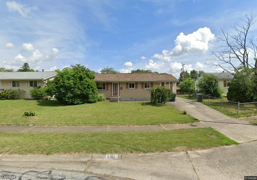
5192 Benham Dr Columbus, OH 43232
East Columbus-White Ash NeighborhoodEstimated Value: $203,000 - $255,000
3
Beds
1
Bath
1,105
Sq Ft
$202/Sq Ft
Est. Value
About This Home
This home is located at 5192 Benham Dr, Columbus, OH 43232 and is currently estimated at $222,852, approximately $201 per square foot. 5192 Benham Dr is a home located in Franklin County with nearby schools including Groveport Madison High School, Eastland Preparatory Academy, and A+ Arts Academy.
Ownership History
Date
Name
Owned For
Owner Type
Purchase Details
Closed on
Feb 10, 2011
Sold by
Household Realty Corporation
Bought by
Nachtrab John G
Current Estimated Value
Home Financials for this Owner
Home Financials are based on the most recent Mortgage that was taken out on this home.
Original Mortgage
$27,675
Interest Rate
5.04%
Mortgage Type
New Conventional
Purchase Details
Closed on
Nov 29, 2010
Sold by
Edstrom Kathy J and Case #09 Cve 07 11182
Bought by
Household Realty Corp
Purchase Details
Closed on
Apr 12, 1989
Bought by
Edstrom Kathy J
Purchase Details
Closed on
Oct 1, 1977
Create a Home Valuation Report for This Property
The Home Valuation Report is an in-depth analysis detailing your home's value as well as a comparison with similar homes in the area
Home Values in the Area
Average Home Value in this Area
Purchase History
| Date | Buyer | Sale Price | Title Company |
|---|---|---|---|
| Nachtrab John G | $36,900 | Attorney | |
| Household Realty Corp | $64,000 | Attorney | |
| Edstrom Kathy J | $53,700 | -- | |
| -- | $29,500 | -- |
Source: Public Records
Mortgage History
| Date | Status | Borrower | Loan Amount |
|---|---|---|---|
| Previous Owner | Nachtrab John G | $27,675 |
Source: Public Records
Tax History
| Year | Tax Paid | Tax Assessment Tax Assessment Total Assessment is a certain percentage of the fair market value that is determined by local assessors to be the total taxable value of land and additions on the property. | Land | Improvement |
|---|---|---|---|---|
| 2025 | $2,902 | $58,630 | $16,560 | $42,070 |
| 2024 | $2,902 | $58,630 | $16,560 | $42,070 |
| 2023 | $2,883 | $58,625 | $16,555 | $42,070 |
| 2022 | $1,845 | $29,750 | $6,440 | $23,310 |
| 2021 | $1,888 | $29,750 | $6,440 | $23,310 |
| 2020 | $2,126 | $33,530 | $6,440 | $27,090 |
| 2019 | $2,107 | $29,230 | $5,600 | $23,630 |
| 2018 | $2,141 | $29,230 | $5,600 | $23,630 |
| 2017 | $2,145 | $29,230 | $5,600 | $23,630 |
| 2016 | $2,159 | $26,880 | $4,620 | $22,260 |
| 2015 | $2,163 | $26,880 | $4,620 | $22,260 |
| 2014 | $1,994 | $26,880 | $4,620 | $22,260 |
| 2013 | $872 | $26,880 | $4,620 | $22,260 |
Source: Public Records
Map
Nearby Homes
- 5143 Rutledge Dr N
- 5323 Sundale Place S
- 3275 Faycrest Rd
- 3246 Latonia Rd
- 3333 Latonia Ct
- 5422 Everson Rd N
- 4878 Amber Crossing Dr
- 2932 Renfro Rd
- 3302 Everson Rd E
- 2908 Renfro Rd
- 5361 Parkline Dr
- 3492 Rodell Rd
- 3455 Tremaine Rd
- 4942 Talbert Dr
- 2998 Osgood Rd E
- 3493 Tremaine Rd
- 5290 Quincy Dr
- 5373 Spire Ln
- 4925 Wymore Dr
- 4995 Talford Ct
Your Personal Tour Guide
Ask me questions while you tour the home.